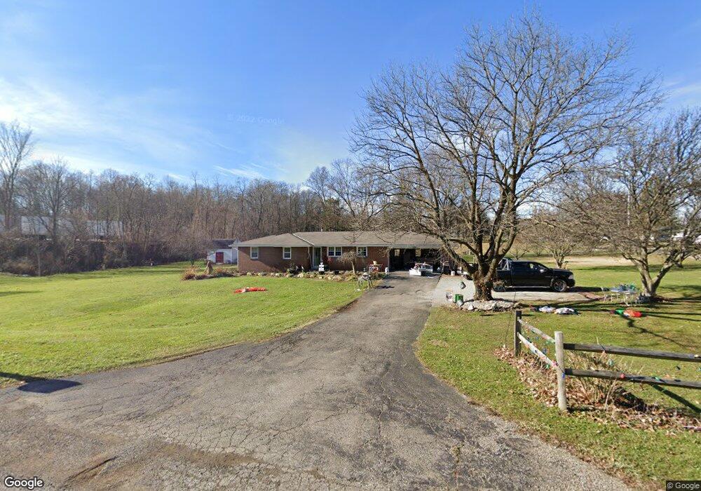
951 Reed Rd Mansfield, OH 44903
Estimated Value: $198,000 - $266,817
3
Beds
2
Baths
1,288
Sq Ft
$184/Sq Ft
Est. Value
About This Home
This home is located at 951 Reed Rd, Mansfield, OH 44903 and is currently estimated at $236,454, approximately $183 per square foot. 951 Reed Rd is a home located in Richland County with nearby schools including Madison High School, St. Mary Catholic School, and Temple-Christian School.
Ownership History
Date
Name
Owned For
Owner Type
Purchase Details
Closed on
May 20, 2011
Sold by
Cabana Eddy R and Cabana Linda J
Bought by
Blankenship Cory L and Blankenship Dana M
Current Estimated Value
Home Financials for this Owner
Home Financials are based on the most recent Mortgage that was taken out on this home.
Original Mortgage
$112,059
Outstanding Balance
$77,408
Interest Rate
4.75%
Mortgage Type
FHA
Estimated Equity
$159,046
Purchase Details
Closed on
Apr 25, 2006
Sold by
Krebs Larry E
Bought by
Cabana Eddy R and Cabana Linda J
Create a Home Valuation Report for This Property
The Home Valuation Report is an in-depth analysis detailing your home's value as well as a comparison with similar homes in the area
Home Values in the Area
Average Home Value in this Area
Purchase History
| Date | Buyer | Sale Price | Title Company |
|---|---|---|---|
| Blankenship Cory L | $115,000 | Chicago Title | |
| Cabana Eddy R | $115,000 | Chicago Title |
Source: Public Records
Mortgage History
| Date | Status | Borrower | Loan Amount |
|---|---|---|---|
| Open | Blankenship Cory L | $112,059 |
Source: Public Records
Tax History Compared to Growth
Tax History
| Year | Tax Paid | Tax Assessment Tax Assessment Total Assessment is a certain percentage of the fair market value that is determined by local assessors to be the total taxable value of land and additions on the property. | Land | Improvement |
|---|---|---|---|---|
| 2024 | $3,379 | $66,870 | $10,180 | $56,690 |
| 2023 | $3,379 | $66,870 | $10,180 | $56,690 |
| 2022 | $2,204 | $40,170 | $8,270 | $31,900 |
| 2021 | $2,203 | $40,170 | $8,270 | $31,900 |
| 2020 | $2,220 | $40,170 | $8,270 | $31,900 |
| 2019 | $2,017 | $34,070 | $7,010 | $27,060 |
| 2018 | $2,000 | $34,070 | $7,010 | $27,060 |
| 2017 | $2,004 | $34,070 | $7,010 | $27,060 |
| 2016 | $2,045 | $34,670 | $6,800 | $27,870 |
| 2015 | $2,045 | $34,670 | $6,800 | $27,870 |
| 2014 | $2,004 | $34,670 | $6,800 | $27,870 |
| 2012 | $946 | $35,750 | $7,010 | $28,740 |
Source: Public Records
Map
Nearby Homes
- 2270 Lakecrest Dr Unit 2272
- 0 Satinwood Dr
- 630 Impala Dr
- 598 Impala Dr
- 1910 Crider Rd
- 640 Running Brook Way
- 1997 Hout Rd
- 1951 Woodmont Rd
- 1806 Richard Dr
- 0 McBride Road Parcel # 1 Unit 9066028
- 2750 Lutz Ave
- 903 Mayflower Ave
- 609 Mcbride Rd
- 2202 Lakewood Dr
- 1628 Park Ave E
- 1106 Keller Dr Unit 1108
- 0 Peterson Rd
- 76 Ford Rd N
- 76 Ford Rd N Unit 20
- 2307 Peterson Rd
- 937 Reed Rd
- 2355 Lakecrest Dr
- 960 Reed Rd
- 983 Reed Rd
- 2345 Lakecrest Dr
- 972 Reed Rd
- 2326 Lakecrest Dr
- 980 Reed Rd
- 2337 Lakecrest Dr
- 2401 Shadowood Ln
- 2401 Shadowwood Ln
- 2401 Shadowood Ln
- 2327 Lakecrest Dr
- 2310 Lakecrest Dr
- 2411 Shadowood Ln
- 2411 Shadowwood Ln
- 2372 Lakecrest Dr
- 2328 Lakecrest Dr
- 1001 Reed Rd
- 1011 Reed Rd