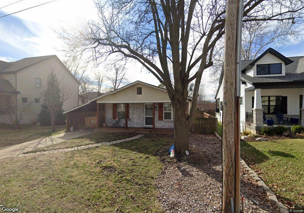
951 Twin Pine Dr Saint Louis, MO 63131
Estimated Value: $344,000 - $392,000
3
Beds
2
Baths
1,040
Sq Ft
$354/Sq Ft
Est. Value
About This Home
This home is located at 951 Twin Pine Dr, Saint Louis, MO 63131 and is currently estimated at $368,674, approximately $354 per square foot. 951 Twin Pine Dr is a home located in St. Louis County with nearby schools including Westchester Elementary School, North Kirkwood Middle School, and Kirkwood Senior High School.
Ownership History
Date
Name
Owned For
Owner Type
Purchase Details
Closed on
Jul 20, 2020
Sold by
Wilder James and Wilder James
Bought by
Wilder James and Wilder Jaime
Current Estimated Value
Purchase Details
Closed on
Feb 23, 2016
Sold by
Wallace R Gates Family Partnership Lp
Bought by
Wilder James and Wilder Elizabeth M
Create a Home Valuation Report for This Property
The Home Valuation Report is an in-depth analysis detailing your home's value as well as a comparison with similar homes in the area
Home Values in the Area
Average Home Value in this Area
Purchase History
| Date | Buyer | Sale Price | Title Company |
|---|---|---|---|
| Wilder James | -- | None Available | |
| Wilder James | $170,000 | Title Partners Agency Llc | |
| The Wallace R Gates Family Partnership L | -- | Title Partners Agency Llc |
Source: Public Records
Tax History Compared to Growth
Tax History
| Year | Tax Paid | Tax Assessment Tax Assessment Total Assessment is a certain percentage of the fair market value that is determined by local assessors to be the total taxable value of land and additions on the property. | Land | Improvement |
|---|---|---|---|---|
| 2025 | $2,914 | $53,490 | $50,770 | $2,720 |
| 2024 | $2,914 | $50,300 | $38,080 | $12,220 |
| 2023 | $2,869 | $50,300 | $38,080 | $12,220 |
| 2022 | $2,650 | $43,270 | $38,080 | $5,190 |
| 2021 | $2,622 | $43,270 | $38,080 | $5,190 |
| 2020 | $2,505 | $39,730 | $38,080 | $1,650 |
| 2019 | $2,517 | $39,730 | $38,080 | $1,650 |
| 2018 | $2,331 | $32,980 | $23,690 | $9,290 |
| 2017 | $2,337 | $32,980 | $23,690 | $9,290 |
| 2016 | $2,108 | $30,100 | $16,910 | $13,190 |
| 2015 | $2,102 | $30,100 | $16,910 | $13,190 |
| 2014 | $1,942 | $27,150 | $8,870 | $18,280 |
Source: Public Records
Map
Nearby Homes
- 1029 Kinstern Dr
- 1090 Kinstern Dr
- 896 Twin Pine Dr
- 918 N Ballas Rd
- 12224 TBB Roger Ln
- 12006 Montour Dr
- 11913 Lillian Ave
- 11909 Lillian Ave
- 1126 Bopp Rd
- 919 Nana Ln
- 1710 Lynkirk Ln
- 2037 Trailcrest Ln Unit 7
- 12213 Brook Springs Ct
- 698 Trailcrest Ct Unit 5
- 2005 Woodland Knoll
- 2017 Woodland Knoll
- 2025 Woodland Knoll
- 2002 Woodland Knoll
- 2033 Woodland Knoll
- 1001 Dovergate Dr
- 945 Twin Pine Dr
- 963 Twin Pine Dr
- 957 Twin Pine Dr
- 954 Blase Ave
- 939 Twin Pine Dr
- 950 Blase Ave
- 1009 Twin Pine Dr
- 954 Twin Pine Dr
- 12075 Alhambra Ave
- 1000 Twin Pine Dr
- 958 Blase Ave
- 946 Blase Ave
- 1011 Twin Pine Dr
- 1008 Twin Pine Dr
- 1004 Twin Pine Dr
- 937 Twin Pine Dr
- 1000 Blase Ave
- 942 Blase Ave
- 1013 Twin Pine Dr
- 942 Twin Pine Dr