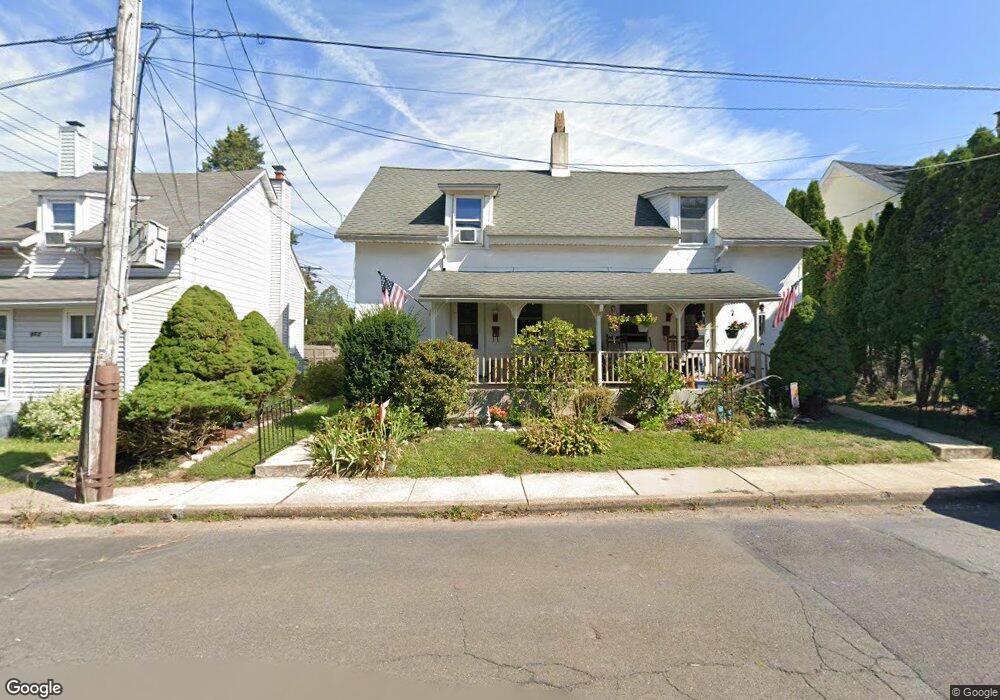
951 W 6th St Unit 18 Lansdale, PA 19446
Estimated Value: $333,000 - $399,000
4
Beds
2
Baths
2,016
Sq Ft
$184/Sq Ft
Est. Value
About This Home
This home is located at 951 W 6th St Unit 18, Lansdale, PA 19446 and is currently estimated at $370,829, approximately $183 per square foot. 951 W 6th St Unit 18 is a home located in Montgomery County with nearby schools including Oak Park El School, Penndale Middle School, and North Penn Senior High School.
Ownership History
Date
Name
Owned For
Owner Type
Purchase Details
Closed on
Jun 30, 2015
Sold by
Nelson Thomas W
Bought by
Nelson Gary E
Current Estimated Value
Home Financials for this Owner
Home Financials are based on the most recent Mortgage that was taken out on this home.
Original Mortgage
$128,205
Interest Rate
4.75%
Mortgage Type
FHA
Purchase Details
Closed on
Nov 24, 1997
Sold by
Nelson Thomas J and Nelson Lewis J
Bought by
Nelson Edward and Nelson Joan M
Create a Home Valuation Report for This Property
The Home Valuation Report is an in-depth analysis detailing your home's value as well as a comparison with similar homes in the area
Home Values in the Area
Average Home Value in this Area
Purchase History
| Date | Buyer | Sale Price | Title Company |
|---|---|---|---|
| Nelson Gary E | $140,000 | None Available | |
| Nelson Edward | $50,000 | -- |
Source: Public Records
Mortgage History
| Date | Status | Borrower | Loan Amount |
|---|---|---|---|
| Closed | Nelson Gary E | $128,205 |
Source: Public Records
Tax History Compared to Growth
Tax History
| Year | Tax Paid | Tax Assessment Tax Assessment Total Assessment is a certain percentage of the fair market value that is determined by local assessors to be the total taxable value of land and additions on the property. | Land | Improvement |
|---|---|---|---|---|
| 2025 | $4,237 | $100,740 | $42,460 | $58,280 |
| 2024 | $4,237 | $100,740 | $42,460 | $58,280 |
| 2023 | $3,964 | $100,740 | $42,460 | $58,280 |
| 2022 | $3,838 | $100,740 | $42,460 | $58,280 |
| 2021 | $3,682 | $100,740 | $42,460 | $58,280 |
| 2020 | $3,571 | $100,740 | $42,460 | $58,280 |
| 2019 | $3,512 | $100,740 | $42,460 | $58,280 |
| 2018 | $941 | $100,740 | $42,460 | $58,280 |
| 2017 | $3,278 | $100,740 | $42,460 | $58,280 |
| 2016 | $3,238 | $100,740 | $42,460 | $58,280 |
| 2015 | $3,006 | $100,740 | $42,460 | $58,280 |
| 2014 | $3,006 | $100,740 | $42,460 | $58,280 |
Source: Public Records
Map
Nearby Homes
- 900 W 8th St
- 1025 Birch St
- 833 W 4th St
- 1035 Forest Ave
- 421 W 7th St
- 1033 Landis Ln
- 831 W Main St
- 21 S Valley Forge Rd Unit 213
- 1200 Moyer Rd
- 941 Wedgewood Dr
- 816 Kenilworth Ave
- 103 Wyndham Woods Way
- 146 Wyndham Woods Way
- 920 Columbia Ave
- 723 Columbia Ave
- 1113 York Ave
- 521 Columbia Ave
- 405 Derstine Ave
- 403 Derstine Ave
- 503 Walnut St
- 945 W 6th St
- 955 W 6th St
- 943 W 6th St
- 957 W 6th St Unit 6
- 602 N Valley Forge Rd
- 604 N Valley Forge Rd
- 606 N Valley Forge Rd
- 518 N Valley Forge Rd
- 516 N Valley Forge Rd
- 514 N Valley Forge Rd
- 512 N Valley Forge Rd
- 510 N Valley Forge Rd
- 600 N Valley Forge Rd
- 608 N Valley Forge Rd
- 520 N Valley Forge Rd
- 610 N Valley Forge Rd
- 612 N Valley Forge Rd
- 506 N Valley Forge Rd
- 614 N Valley Forge Rd
- 504 N Valley Forge Rd