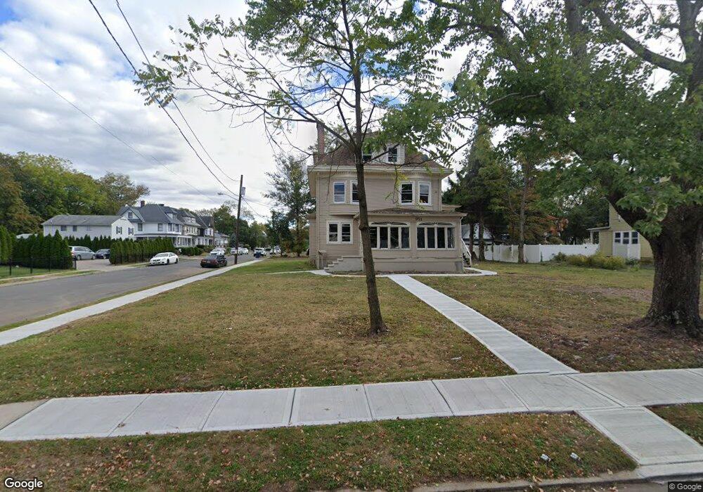
951 W 7th St Unit 59 Plainfield, NJ 07063
Estimated Value: $561,000 - $926,000
--
Bed
--
Bath
4,092
Sq Ft
$177/Sq Ft
Est. Value
About This Home
This home is located at 951 W 7th St Unit 59, Plainfield, NJ 07063 and is currently estimated at $724,060, approximately $176 per square foot. 951 W 7th St Unit 59 is a home located in Union County with nearby schools including Clinton School, Hubbard Middle School, and Plainfield High School.
Ownership History
Date
Name
Owned For
Owner Type
Purchase Details
Closed on
Apr 9, 2025
Sold by
Sheriff Of The County Of Union
Bought by
Community Dream Living
Current Estimated Value
Purchase Details
Closed on
Apr 26, 1995
Sold by
Penn Fsb
Bought by
Dennis June A
Purchase Details
Closed on
Sep 30, 1994
Sold by
Froehlich Ralph
Bought by
Penn Fsb
Create a Home Valuation Report for This Property
The Home Valuation Report is an in-depth analysis detailing your home's value as well as a comparison with similar homes in the area
Home Values in the Area
Average Home Value in this Area
Purchase History
| Date | Buyer | Sale Price | Title Company |
|---|---|---|---|
| Community Dream Living | $62,000 | None Listed On Document | |
| Community Dream Living | $62,000 | None Listed On Document | |
| Dennis June A | $94,000 | -- | |
| Penn Fsb | -- | -- |
Source: Public Records
Tax History Compared to Growth
Tax History
| Year | Tax Paid | Tax Assessment Tax Assessment Total Assessment is a certain percentage of the fair market value that is determined by local assessors to be the total taxable value of land and additions on the property. | Land | Improvement |
|---|---|---|---|---|
| 2025 | $12,050 | $138,000 | $57,700 | $80,300 |
| 2024 | $11,931 | $138,000 | $57,700 | $80,300 |
| 2023 | $11,931 | $138,000 | $57,700 | $80,300 |
| 2022 | $11,673 | $138,000 | $57,700 | $80,300 |
| 2021 | $11,571 | $138,000 | $57,700 | $80,300 |
| 2020 | $11,538 | $138,000 | $57,700 | $80,300 |
| 2019 | $11,538 | $138,000 | $57,700 | $80,300 |
| 2018 | $11,297 | $138,000 | $57,700 | $80,300 |
| 2017 | $11,021 | $138,000 | $57,700 | $80,300 |
| 2016 | $10,796 | $138,000 | $57,700 | $80,300 |
| 2015 | $10,477 | $138,000 | $57,700 | $80,300 |
| 2014 | -- | $138,000 | $57,700 | $80,300 |
Source: Public Records
Map
Nearby Homes
- 950 W 6th St Unit 52
- 962-64 W 6th St
- 905 Stelle Ave Unit 7
- 916 Sherman Ave
- 954 W 4th St
- 901 Sherman Ave Unit 11
- 610 Darrow Ave Unit 16
- 814 Sherman Ave Unit 18
- 338 Manson Place Unit 40
- 312 Monroe Ave Unit 14
- 745 W 4th St Unit 47
- 318-20 Manson Place
- 717 W 7th St
- 1227 W 6th St
- 139 Palmer Ave
- 301 Grant Ave Unit 3
- 355 Bergen St
- 413 W 8th St
- 829 S 2nd St
- 318 Halsey St Unit 20
- 717 Hobert Ave
- 961-67 W 7th St
- 961 W 7th St Unit 67
- 941 W 7th St Unit 45
- 714-20 Hobert Ave
- 720 Hobert Ave
- 714 Hobert Ave Unit 20
- 715 Hobert Ave Unit 17
- 969 W 7th St Unit 75
- 722-30 Hobert Ave
- 722 Hobert Ave Unit 30
- 719 Hobert Ave Unit 21
- 937 W 7th St Unit 39
- 713 Monroe Ave Unit 17
- 717 Monroe Ave
- 958 W 7th St Unit 62
- 719 Monroe Ave Unit 21
- 723 Hobert Ave Unit 25
- 950 W 7th St Unit 56
- 942 W 7th St Unit 44