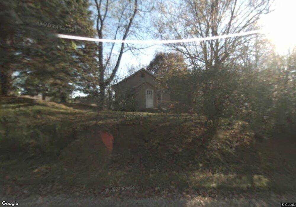
9510 State Rd Haslett, MI 48840
Estimated Value: $178,354 - $237,000
2
Beds
1
Bath
990
Sq Ft
$209/Sq Ft
Est. Value
About This Home
This home is located at 9510 State Rd, Haslett, MI 48840 and is currently estimated at $206,839, approximately $208 per square foot. 9510 State Rd is a home located in Clinton County with nearby schools including Haslett High School.
Ownership History
Date
Name
Owned For
Owner Type
Purchase Details
Closed on
Jul 27, 2023
Sold by
Mccall Roberta
Bought by
Roberta Mccall Revocable Living Trust and Mccall
Current Estimated Value
Purchase Details
Closed on
Jul 5, 2017
Sold by
Meeder David W
Bought by
Mccall Roberta
Purchase Details
Closed on
Jul 10, 2007
Sold by
Eifert Frank and Eifert Charlotte R
Bought by
Meeder David W
Home Financials for this Owner
Home Financials are based on the most recent Mortgage that was taken out on this home.
Original Mortgage
$87,650
Interest Rate
6.42%
Mortgage Type
Purchase Money Mortgage
Create a Home Valuation Report for This Property
The Home Valuation Report is an in-depth analysis detailing your home's value as well as a comparison with similar homes in the area
Home Values in the Area
Average Home Value in this Area
Purchase History
| Date | Buyer | Sale Price | Title Company |
|---|---|---|---|
| Roberta Mccall Revocable Living Trust | -- | None Listed On Document | |
| Mccall Roberta | $125,000 | Transnation Title Agency | |
| Meeder David W | $116,875 | None Available |
Source: Public Records
Mortgage History
| Date | Status | Borrower | Loan Amount |
|---|---|---|---|
| Previous Owner | Meeder David W | $87,650 |
Source: Public Records
Tax History
| Year | Tax Paid | Tax Assessment Tax Assessment Total Assessment is a certain percentage of the fair market value that is determined by local assessors to be the total taxable value of land and additions on the property. | Land | Improvement |
|---|---|---|---|---|
| 2025 | $3,727 | $80,700 | $20,900 | $59,800 |
| 2024 | $22 | $77,200 | $20,900 | $56,300 |
| 2023 | $2,128 | $67,300 | $0 | $0 |
| 2022 | $3,328 | $61,000 | $18,000 | $43,000 |
| 2021 | $3,234 | $60,400 | $18,000 | $42,400 |
| 2020 | $3,153 | $55,300 | $17,500 | $37,800 |
| 2019 | $3,052 | $53,200 | $17,500 | $35,700 |
| 2018 | $2,442 | $51,200 | $17,500 | $33,700 |
| 2017 | $1,827 | $51,800 | $17,500 | $34,300 |
| 2016 | $1,817 | $50,300 | $17,500 | $32,800 |
| 2015 | -- | $49,900 | $0 | $0 |
| 2011 | -- | $50,700 | $0 | $0 |
Source: Public Records
Map
Nearby Homes
- 9595 E State Rd
- 8876 E State Rd
- 16677 Peacock Ln
- The Sebastian Plan at Bonnie Meadows
- The Bristol Plan at Bonnie Meadows
- The Windsor Plan at Bonnie Meadows
- The Balsam Plan at Bonnie Meadows
- The Marley Plan at Bonnie Meadows
- The Wisteria Plan at Bonnie Meadows
- The Rutherford Plan at Bonnie Meadows
- The Hadley Plan at Bonnie Meadows
- The Hearthside Plan at Bonnie Meadows
- The Jamestown Plan at Bonnie Meadows
- The Grayson Plan at Bonnie Meadows
- The Preston Plan at Bonnie Meadows
- The Fitzgerald Plan at Bonnie Meadows
- The Maxwell Plan at Bonnie Meadows
- 16725 Tormiston Rd
- 16685 Tormiston Rd
- 8566 Old State Highway 78
- 16040 Peacock
- 0 Peacock Rd Unit 77074
- 0 Peacock Rd Unit 630000024584
- 0 Peacock Rd Unit 630000256996
- 0 Peacock Rd Unit 630000276838
- 0 Peacock Rd Unit 276838
- 0 Peacock Rd Unit L231362
- 0 Peacock Rd Unit 256996
- 0 Peacock Rd Unit 247972
- 0 Peacock Rd Unit 16387
- 0 Peacock Rd Unit 21941
- 0 Peacock Rd Unit 192804
- 0 Peacock Rd Unit 178104
- 9534 E State Rd
- 0 E State South Peacock Rd Unit 221520
- 0 E State South Peacock Rd Unit 212481
- 16080 Peacock Rd
- 15867 Peacock Rd
- 0 State Peacock Rd Unit 224762
- 9565 State Rd