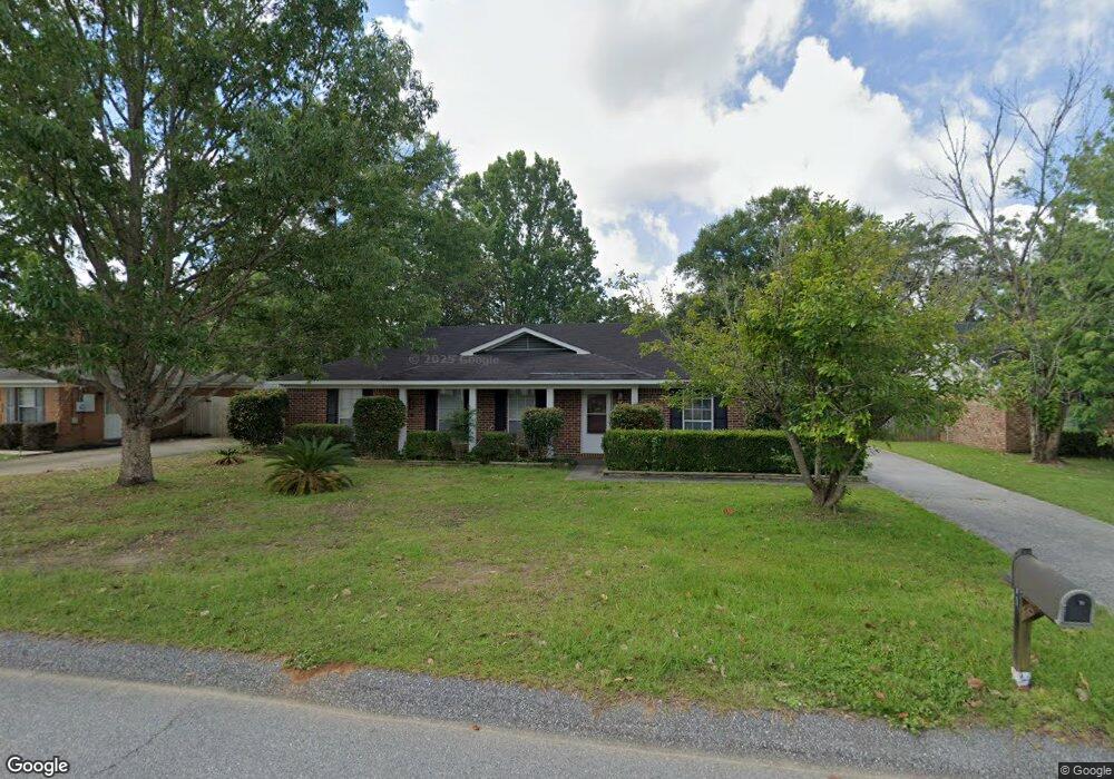
9511 Signal Ct Mobile, AL 36695
Baker NeighborhoodEstimated Value: $206,803 - $237,000
4
Beds
2
Baths
1,664
Sq Ft
$134/Sq Ft
Est. Value
About This Home
This home is located at 9511 Signal Ct, Mobile, AL 36695 and is currently estimated at $222,951, approximately $133 per square foot. 9511 Signal Ct is a home located in Mobile County with nearby schools including Elsie Collier Elementary School, Bernice J Causey Middle School, and Baker High School.
Ownership History
Date
Name
Owned For
Owner Type
Purchase Details
Closed on
Sep 11, 2009
Sold by
Leet Nancy Ann Jackson
Bought by
Mallory John Carleton
Current Estimated Value
Purchase Details
Closed on
Feb 12, 1999
Sold by
Scuffham Leonard E and Scuffham Gwendolyn M
Bought by
Mallory Susan T
Home Financials for this Owner
Home Financials are based on the most recent Mortgage that was taken out on this home.
Original Mortgage
$60,000
Interest Rate
6.79%
Create a Home Valuation Report for This Property
The Home Valuation Report is an in-depth analysis detailing your home's value as well as a comparison with similar homes in the area
Home Values in the Area
Average Home Value in this Area
Purchase History
| Date | Buyer | Sale Price | Title Company |
|---|---|---|---|
| Mallory John Carleton | $15,020 | None Available | |
| Mallory Susan T | -- | -- |
Source: Public Records
Mortgage History
| Date | Status | Borrower | Loan Amount |
|---|---|---|---|
| Previous Owner | Mallory Susan T | $60,000 |
Source: Public Records
Tax History Compared to Growth
Tax History
| Year | Tax Paid | Tax Assessment Tax Assessment Total Assessment is a certain percentage of the fair market value that is determined by local assessors to be the total taxable value of land and additions on the property. | Land | Improvement |
|---|---|---|---|---|
| 2024 | $1,835 | $34,020 | $8,000 | $26,020 |
| 2023 | $1,720 | $31,620 | $8,000 | $23,620 |
| 2022 | $1,387 | $28,600 | $8,000 | $20,600 |
| 2021 | $1,353 | $27,900 | $8,000 | $19,900 |
| 2020 | $1,379 | $28,440 | $8,000 | $20,440 |
| 2019 | $1,352 | $13,940 | $4,000 | $9,940 |
| 2018 | $1,377 | $28,400 | $0 | $0 |
| 2017 | $1,443 | $28,300 | $0 | $0 |
| 2016 | $1,324 | $27,300 | $0 | $0 |
| 2013 | $1,417 | $28,240 | $0 | $0 |
Source: Public Records
Map
Nearby Homes
- 9410 Ashwood Ct
- 9425 Yorktowne Way
- 0 New Neck Rd Unit 387066
- 9556 Bridgeton Ct
- 1111 Valley View Ct
- 860 Trailwood Dr E
- 821 Copperfield Dr W
- 790 Hale Rd
- 791 Copperfield Dr W
- 781 Copperfield Dr W
- 9751 Pine Knoll Rd
- 789 Royal Woods Dr W Unit 7
- 750 Hale Rd
- 11900 Airport Blvd
- 11905 Airport Blvd
- 11905 Airport Blvd Unit 3
- 9721 Royal Woods Dr N
- 9841 Shadow Wood Dr
- 0 Twelve Oaks Dr Unit 7603591
- 1235 Wakefield Dr E
- 9521 Signal Ct
- 9501 Signal Ct
- 1210 Smokerise Dr
- 1220 Smokerise Dr
- 1200 Smokerise Dr
- 9531 Signal Ct
- 9500 Signal Ct
- 9510 Signal Ct
- 1230 Smokerise Dr
- 9480 Signal Ct
- 9520 Signal Ct
- 9541 Signal Ct
- 9540 Signal Ct
- 1221 Smokerise Dr
- 9470 Signal Ct
- 1180 Smokerise Dr
- 9530 Signal Ct
- 1231 Smokerise Dr
- 9550 Bakerfield Ct
- 1211 Smokerise Dr