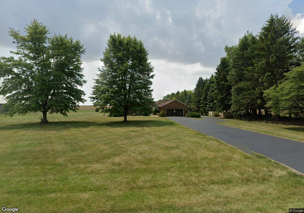
9525 State Route 613 van Buren, OH 45889
Estimated Value: $417,274 - $448,000
4
Beds
3
Baths
2,040
Sq Ft
$216/Sq Ft
Est. Value
About This Home
This home is located at 9525 State Route 613, van Buren, OH 45889 and is currently estimated at $440,069, approximately $215 per square foot. 9525 State Route 613 is a home located in Hancock County with nearby schools including Van Buren Elementary School, Van Buren Middle School, and Van Buren High School.
Ownership History
Date
Name
Owned For
Owner Type
Purchase Details
Closed on
Feb 14, 2012
Sold by
Smith Brian K and Smith Michelle R
Bought by
Smith Brian K and Smith Michelle R
Current Estimated Value
Purchase Details
Closed on
Oct 22, 2001
Sold by
Gutchess Joyce
Bought by
Faust Randall S
Purchase Details
Closed on
Oct 21, 1999
Sold by
Dykema David
Bought by
Gutchess Gerald and Gutchess Joyce
Purchase Details
Closed on
Jan 29, 1996
Sold by
Mowrey Douglas
Bought by
Dykema David and Dykema Danna
Home Financials for this Owner
Home Financials are based on the most recent Mortgage that was taken out on this home.
Original Mortgage
$155,500
Interest Rate
7.19%
Mortgage Type
Balloon
Purchase Details
Closed on
May 15, 1987
Bought by
Mowrey Douglas J and Mowrey Linda S
Create a Home Valuation Report for This Property
The Home Valuation Report is an in-depth analysis detailing your home's value as well as a comparison with similar homes in the area
Home Values in the Area
Average Home Value in this Area
Purchase History
| Date | Buyer | Sale Price | Title Company |
|---|---|---|---|
| Smith Brian K | -- | Attorney | |
| Faust Randall S | $185,000 | -- | |
| Gutchess Gerald | $192,000 | -- | |
| Dykema David | $176,500 | -- | |
| Mowrey Douglas J | $10,000 | -- |
Source: Public Records
Mortgage History
| Date | Status | Borrower | Loan Amount |
|---|---|---|---|
| Previous Owner | Dykema David | $155,500 | |
| Closed | Faust Randall S | -- |
Source: Public Records
Tax History Compared to Growth
Tax History
| Year | Tax Paid | Tax Assessment Tax Assessment Total Assessment is a certain percentage of the fair market value that is determined by local assessors to be the total taxable value of land and additions on the property. | Land | Improvement |
|---|---|---|---|---|
| 2024 | $3,573 | $100,750 | $12,390 | $88,360 |
| 2023 | $3,557 | $100,750 | $12,390 | $88,360 |
| 2022 | $3,597 | $100,750 | $12,390 | $88,360 |
| 2021 | $3,228 | $83,950 | $11,660 | $72,290 |
| 2020 | $3,221 | $83,950 | $11,660 | $72,290 |
| 2019 | $3,321 | $83,950 | $11,660 | $72,290 |
| 2018 | $2,951 | $74,260 | $10,140 | $64,120 |
| 2017 | $1,481 | $74,260 | $10,140 | $64,120 |
| 2016 | $2,722 | $74,260 | $10,140 | $64,120 |
| 2015 | $2,768 | $73,970 | $10,140 | $63,830 |
| 2014 | $2,783 | $73,970 | $10,140 | $63,830 |
| 2012 | $3,027 | $73,970 | $10,140 | $63,830 |
Source: Public Records
Map
Nearby Homes
- 9991 State Route 613
- 10638 Township Road 109
- 11755 State Route 613
- 308 S Main St
- 117 S Main St
- 3361 County Road 220
- 12132 Township Road 108
- 0 Bearcat Way Or Rock Candy Rd Unit Lot 167
- 0 Bushwillow Dr Or Rock Candy Rd Unit Lot 157
- 0 Rock Candy Rd Or Bushwillow Dr Unit Lot 173
- 0 Rock Candy Rd Unit Lot 172 206819
- 0 Rock Candy Rd Unit Lot 171
- 0 Rock Candy Rd Unit Lot 170
- 0 Rock Candy Rd Unit Lot 168
- 0 Rock Candy Rd Unit Lot 162
- 0 Rock Candy Rd Unit Lot 159
- 0 Allen Township 142
- 3815 Forest Trail Dr
- 201 Briar Hill Rd
- 215 Briar Hill Rd
- 9609 Ohio 613
- 9609 State Route 613
- 9540 State Route 613
- 9620 Ohio 613
- 9620 State Route 613
- 9418 Ohio 613
- 9418 State Route 613
- 9660 State Route 613
- 9700 State Route 613
- 9700 Ohio 613
- 9797 State Route 613
- 9780 State Route 613
- 9839 Ohio 613
- 9839 State Route 613
- 9963 State Route 613
- 9963 Ohio 613
- 9991 Ohio 613
- 9584 Township Road 109
- 9043 State Route 613
- 2540 County Road 140