Estimated Value: $848,000 - $900,000
4
Beds
4
Baths
1,728
Sq Ft
$507/Sq Ft
Est. Value
About This Home
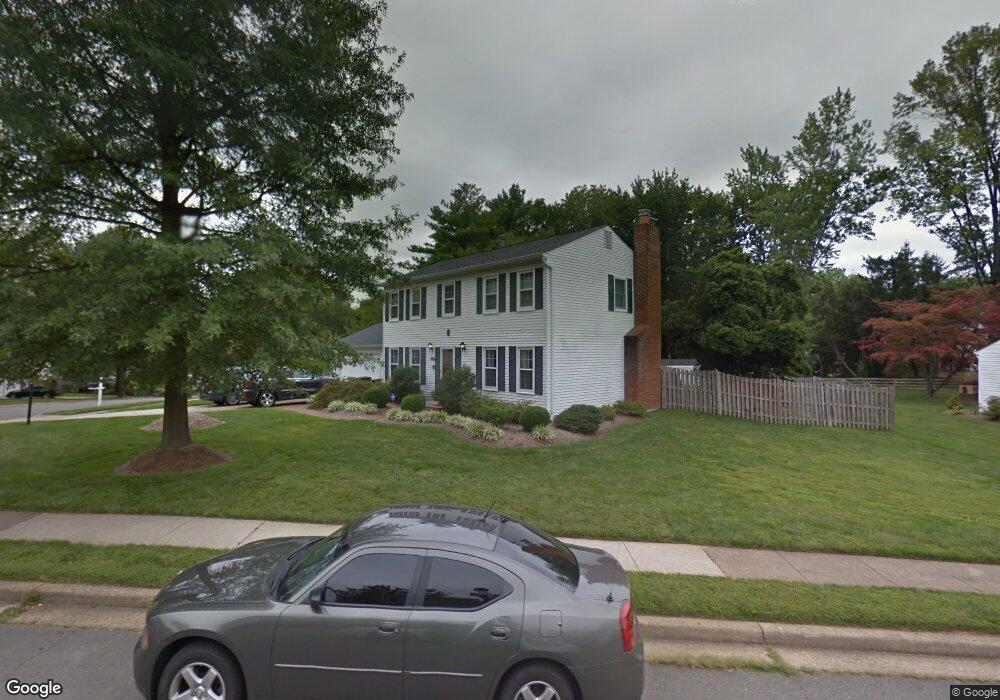
This home is located at 9527 Kirkfield Rd, Burke, VA 22015 and is currently estimated at $876,059, approximately $506 per square foot. 9527 Kirkfield Rd is a home located in Fairfax County with nearby schools including Kings Park Elementary School, Kings Glen Elementary School, and Lake Braddock Secondary School.
Ownership History
Date
Name
Owned For
Owner Type
Purchase Details
Closed on
Apr 12, 2006
Sold by
Stramm William R
Bought by
Verdejo Jason
Current Estimated Value
Home Financials for this Owner
Home Financials are based on the most recent Mortgage that was taken out on this home.
Original Mortgage
$512,000
Outstanding Balance
$292,868
Interest Rate
6.28%
Mortgage Type
New Conventional
Estimated Equity
$583,191
Create a Home Valuation Report for This Property
The Home Valuation Report is an in-depth analysis detailing your home's value as well as a comparison with similar homes in the area
Home Values in the Area
Average Home Value in this Area
Purchase History
| Date | Buyer | Sale Price | Title Company |
|---|---|---|---|
| Verdejo Jason | $640,000 | -- |
Source: Public Records
Mortgage History
| Date | Status | Borrower | Loan Amount |
|---|---|---|---|
| Open | Verdejo Jason | $512,000 |
Source: Public Records
Tax History Compared to Growth
Tax History
| Year | Tax Paid | Tax Assessment Tax Assessment Total Assessment is a certain percentage of the fair market value that is determined by local assessors to be the total taxable value of land and additions on the property. | Land | Improvement |
|---|---|---|---|---|
| 2025 | $8,890 | $841,350 | $332,000 | $509,350 |
| 2024 | $8,890 | $767,380 | $307,000 | $460,380 |
| 2023 | $8,505 | $753,640 | $307,000 | $446,640 |
| 2022 | $7,921 | $692,690 | $282,000 | $410,690 |
| 2021 | $7,410 | $631,460 | $252,000 | $379,460 |
| 2020 | $7,074 | $597,720 | $242,000 | $355,720 |
| 2019 | $6,638 | $560,850 | $237,000 | $323,850 |
| 2018 | $6,450 | $560,850 | $237,000 | $323,850 |
| 2017 | $6,191 | $533,280 | $227,000 | $306,280 |
| 2016 | $5,859 | $505,780 | $212,000 | $293,780 |
| 2015 | $5,848 | $524,000 | $212,000 | $312,000 |
| 2014 | $5,622 | $504,910 | $202,000 | $302,910 |
Source: Public Records
Map
Nearby Homes
- 9710 Ashbourn Dr
- 9513 Burdett Rd
- 9769 High Water Ct
- 9438 Wallingford Dr
- 5307 Richardson Dr
- 5711 Crownleigh Ct
- 9662 Westport Ln
- 5137 Richardson Dr
- 5658 Sutherland Ct
- 5714 Mason Bluff Dr
- 9909 Lakepointe Dr
- 5432 Brixham Ct
- 5502 Saddlebrook Ct
- 9717 Commonwealth Blvd
- 5361 Gainsborough Dr
- 5313 Stonington Dr
- 9883 Becket Ct
- 5006 Lone Oak Place
- 5055 Kenerson Dr
- 5608 Doolittle St
- 9611 Ashbourn Dr
- 5402 Duxford Place
- 5404 Duxford Place
- 9605 Ashbourn Dr
- 9610 Ashbourn Dr
- 9608 Ashbourn Dr
- 9613 Ashbourn Dr
- 5406 Duxford Place
- 9612 Ashbourn Dr
- 9526 Kirkfield Rd
- 5310 Greenough Place
- 5307 Crown Point Rd
- 9603 Ashbourn Dr
- 5408 Duxford Place
- 9615 Ashbourn Dr
- 5401 Duxford Place
- 9524 Kirkfield Rd
- 5308 Greenough Place
- 9530 Barnstable Ct
- 5405 Duxford Place