Estimated Value: $97,000 - $376,000
2
Beds
1
Bath
1,728
Sq Ft
$149/Sq Ft
Est. Value
About This Home
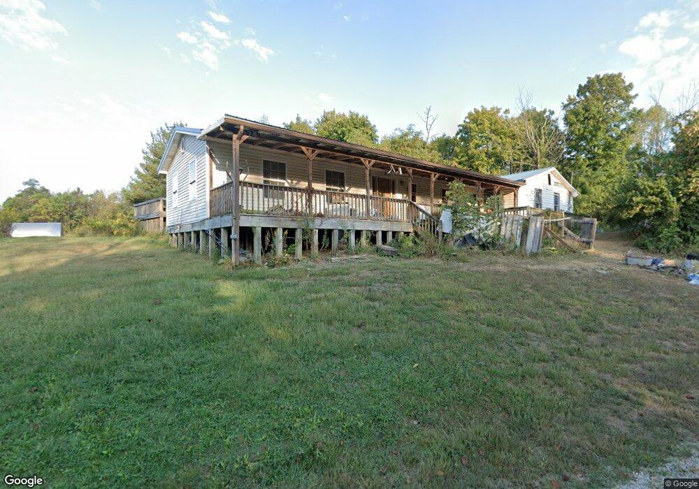
This home is located at 953 Mount Unger Rd, Otway, OH 45657 and is currently estimated at $256,832, approximately $148 per square foot. 953 Mount Unger Rd is a home located in Adams County with nearby schools including West Union Elementary School and West Union High School.
Ownership History
Date
Name
Owned For
Owner Type
Purchase Details
Closed on
Feb 5, 2007
Sold by
Shoemaker Marie and Shoemaker Donnie L
Bought by
Johnson Roy E and Johnson Virginia R
Current Estimated Value
Home Financials for this Owner
Home Financials are based on the most recent Mortgage that was taken out on this home.
Original Mortgage
$50,000
Outstanding Balance
$29,521
Interest Rate
6.27%
Mortgage Type
Future Advance Clause Open End Mortgage
Estimated Equity
$227,311
Purchase Details
Closed on
May 30, 2003
Sold by
Ramey Orville
Bought by
Johnson Virginia
Purchase Details
Closed on
Sep 6, 2002
Bought by
Ramey Orville
Purchase Details
Closed on
Jan 1, 1990
Bought by
Ramey Cynthia Life Estate
Create a Home Valuation Report for This Property
The Home Valuation Report is an in-depth analysis detailing your home's value as well as a comparison with similar homes in the area
Purchase History
| Date | Buyer | Sale Price | Title Company |
|---|---|---|---|
| Johnson Roy E | $22,500 | None Available | |
| Johnson Virginia | -- | -- | |
| Ramey Orville | -- | -- | |
| Ramey Cynthia Life Estate | -- | -- |
Source: Public Records
Mortgage History
| Date | Status | Borrower | Loan Amount |
|---|---|---|---|
| Open | Johnson Roy E | $50,000 |
Source: Public Records
Tax History
| Year | Tax Paid | Tax Assessment Tax Assessment Total Assessment is a certain percentage of the fair market value that is determined by local assessors to be the total taxable value of land and additions on the property. | Land | Improvement |
|---|---|---|---|---|
| 2025 | $935 | $66,400 | $38,890 | $27,510 |
| 2024 | $1,869 | $66,400 | $38,890 | $27,510 |
| 2023 | $3,124 | $66,400 | $38,890 | $27,510 |
| 2022 | $972 | $53,700 | $29,370 | $24,330 |
| 2021 | $1,881 | $53,700 | $29,370 | $24,330 |
| 2020 | $916 | $53,700 | $29,370 | $24,330 |
| 2019 | $1,315 | $53,700 | $29,370 | $24,330 |
| 2018 | $1,157 | $47,850 | $26,710 | $21,140 |
| 2017 | $1,142 | $47,850 | $26,710 | $21,140 |
| 2016 | $1,120 | $47,850 | $26,710 | $21,140 |
| 2015 | $401 | $25,800 | $21,740 | $4,060 |
| 2014 | $401 | $25,800 | $21,740 | $4,060 |
Source: Public Records
Map
Nearby Homes
- 2472 Rocky Fork Rd
- 4345 Mt Unger Rd
- 8.307 Ac Churn Creek Rd
- 0 Blue Creek Rd
- 0 Oppy Hill Rd
- 2603 Cassel Run Rd
- 0 St Rt 348 Unit 1855893
- 3380 Blue Creek Rd
- 2030 Long Lick Rd
- 6421 Big Spruce-Little Bear Rd
- 2800 Beech Fork Rd
- 2314 White Oak Rd
- 1186 Tulip Rd
- 500 Ernie Rd
- 0 Beech Fork Rd Unit 5157055
- 0 Beech Fork Rd Unit 225044315
- Ohio 348
- 2030 Cedar Mills Rd
- 230 Newman Aly
- 357 Enley Rd
- 1141 Mount Unger Rd
- 704 Mount Unger Rd
- 1244 Mount Unger Rd
- 274 Mount Unger Rd
- 0 St Rt 125 Unit 1142246
- 0 St Rt 125 Unit 1253988
- 54.97ac Ohio 125
- 0 St Rt 125 Unit 1691516
- 1524 Mount Unger Rd
- 1539 Mount Unger Rd
- 1690 Mt Unger Rd
- 161 Watson Rd
- 182 Mount Unger Rd
- 186 Mount Unger Rd
- 84 Watson Rd
- 72 Mount Unger Rd
- 357 Allen Rd
- 0 Mt Unger Rd Unit 1804262
- 0 Mt Unger Rd Unit 775080
- 0 Mt Unger Rd Unit 745900
Your Personal Tour Guide
Ask me questions while you tour the home.