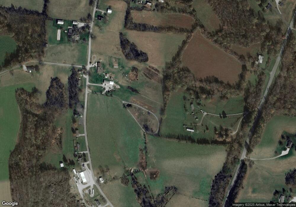
9530 Ky Highway 1247 Waynesburg, KY 40489
Estimated Value: $329,000 - $387,000
4
Beds
2
Baths
--
Sq Ft
2.27
Acres
About This Home
This home is located at 9530 Ky Highway 1247, Waynesburg, KY 40489 and is currently estimated at $367,645. 9530 Ky Highway 1247 is a home located in Lincoln County with nearby schools including Lincoln County High School.
Ownership History
Date
Name
Owned For
Owner Type
Purchase Details
Closed on
May 27, 2025
Sold by
Maclaren Lois W and Maclaren James D
Bought by
Stewart Larry L and Stewart Ruth L
Current Estimated Value
Home Financials for this Owner
Home Financials are based on the most recent Mortgage that was taken out on this home.
Original Mortgage
$337,500
Outstanding Balance
$336,346
Interest Rate
6.83%
Mortgage Type
New Conventional
Estimated Equity
$31,299
Purchase Details
Closed on
Nov 21, 2011
Sold by
Hutchison Don Lee and Hutchison Don Lee
Bought by
Maclaren James D and Maclaren Lois W
Create a Home Valuation Report for This Property
The Home Valuation Report is an in-depth analysis detailing your home's value as well as a comparison with similar homes in the area
Home Values in the Area
Average Home Value in this Area
Purchase History
| Date | Buyer | Sale Price | Title Company |
|---|---|---|---|
| Stewart Larry L | $375,000 | Land Group Title | |
| Stewart Larry L | $375,000 | Land Group Title | |
| Maclaren James D | $34,000 | None Available |
Source: Public Records
Mortgage History
| Date | Status | Borrower | Loan Amount |
|---|---|---|---|
| Open | Stewart Larry L | $337,500 | |
| Closed | Stewart Larry L | $337,500 |
Source: Public Records
Tax History Compared to Growth
Tax History
| Year | Tax Paid | Tax Assessment Tax Assessment Total Assessment is a certain percentage of the fair market value that is determined by local assessors to be the total taxable value of land and additions on the property. | Land | Improvement |
|---|---|---|---|---|
| 2025 | $1,202 | $117,165 | $1,165 | $116,000 |
| 2024 | $1,202 | $117,165 | $117,165 | $0 |
| 2023 | $1,215 | $140,165 | $140,165 | $0 |
| 2022 | $713 | $68,600 | $68,600 | $0 |
| 2021 | $729 | $68,600 | $0 | $0 |
| 2020 | $746 | $68,600 | $0 | $0 |
| 2019 | $753 | $68,600 | $0 | $0 |
| 2018 | $745 | $68,500 | $0 | $0 |
| 2017 | $732 | $68,500 | $0 | $0 |
| 2016 | $732 | $68,500 | $0 | $0 |
| 2015 | $347 | $68,500 | $0 | $0 |
| 2012 | $347 | $34,000 | $6,000 | $28,000 |
Source: Public Records
Map
Nearby Homes
- 8925 Ky Highway 1247
- 1151 Horse Ridge Rd
- 9990 U S 27
- 5225 U S 27
- 565 Ky 3249
- 1570 Highway 3249
- 0 Sam Baughman Rd Unit LotWP001 24575594
- 0 Sam Baughman Rd
- 1091 Trusty Rd
- 995 Trusty Rd
- 1313 Ky Hwy 1778
- 925 Trusty Rd
- 1804 Ky Hwy 1778
- 9999 Martins Trail
- 166 Amber Ct
- 479 N Fishing Creek Rd
- 55 Cardinal Ln
- 162 Howell Ln
- 305 Maywood Rd
- 1007 N Maywood Rd
- 9300 Ky Highway 1247
- 9300 Ky Highway 1247
- 9575 Ky Highway 1247
- 9705 Ky Highway 1247
- 9710 Ky Highway 1247
- 9399 Ky Highway 1247
- 9399 Kentucky 1247
- 2440 Hurricane Ridge Rd
- 9371 Ky Highway 1247
- 9351 Ky Highway 1247
- 9530 Highway 1247
- 115 Red Oak Ln
- 9765 Ky Highway 1247
- 9710 Ky Highway 1247
- 9305 Ky Highway 1247
- 9305 Ky Highway 1247
- 191 Red Oak Ln
- 380 Red Oak Ln
- 368 Red Oak Ln
- 35 Greasy Ridge Rd
