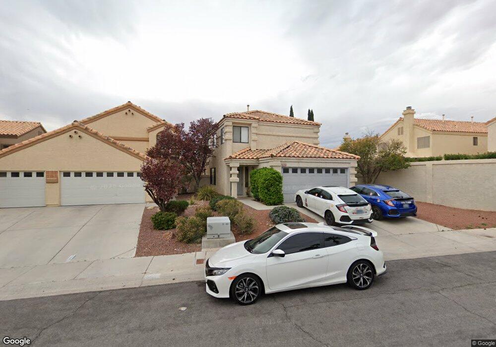
9537 Intercoastal Dr Las Vegas, NV 89117
The Section Seven NeighborhoodEstimated Value: $490,804 - $534,000
4
Beds
3
Baths
2,080
Sq Ft
$247/Sq Ft
Est. Value
About This Home
This home is located at 9537 Intercoastal Dr, Las Vegas, NV 89117 and is currently estimated at $514,451, approximately $247 per square foot. 9537 Intercoastal Dr is a home located in Clark County with nearby schools including M J Christensen Elementary School, Clifford J Lawrence Junior High School, and Bonanza High School.
Ownership History
Date
Name
Owned For
Owner Type
Purchase Details
Closed on
Mar 26, 2012
Sold by
The Bank Of New York Mellon
Bought by
Li Jing Chou and Luo Lucy Xi
Current Estimated Value
Purchase Details
Closed on
Aug 23, 2011
Sold by
Armstrong Richard and Johnson Deedee
Bought by
The Bank Of New York Mellon and The Bank Of New York
Purchase Details
Closed on
Jan 10, 2006
Sold by
Armstrong Richard and Armstrong Dee
Bought by
Armstrong Richard and Armstrong Deedee
Home Financials for this Owner
Home Financials are based on the most recent Mortgage that was taken out on this home.
Original Mortgage
$14,586
Interest Rate
6.32%
Mortgage Type
New Conventional
Purchase Details
Closed on
Jan 10, 2005
Sold by
Crate Daniel D and Crate Susan E
Bought by
Armstrong Richard and Johnson Deedee
Home Financials for this Owner
Home Financials are based on the most recent Mortgage that was taken out on this home.
Original Mortgage
$314,100
Interest Rate
6.99%
Mortgage Type
Unknown
Create a Home Valuation Report for This Property
The Home Valuation Report is an in-depth analysis detailing your home's value as well as a comparison with similar homes in the area
Home Values in the Area
Average Home Value in this Area
Purchase History
| Date | Buyer | Sale Price | Title Company |
|---|---|---|---|
| Li Jing Chou | $144,000 | Fidelity Rainbow | |
| The Bank Of New York Mellon | $130,500 | Accommodation | |
| Armstrong Richard | -- | Nevada Title Company | |
| Armstrong Richard | $349,000 | First Amer Title Co Of Nv |
Source: Public Records
Mortgage History
| Date | Status | Borrower | Loan Amount |
|---|---|---|---|
| Previous Owner | Armstrong Richard | $14,586 | |
| Previous Owner | Armstrong Richard | $314,100 |
Source: Public Records
Tax History Compared to Growth
Tax History
| Year | Tax Paid | Tax Assessment Tax Assessment Total Assessment is a certain percentage of the fair market value that is determined by local assessors to be the total taxable value of land and additions on the property. | Land | Improvement |
|---|---|---|---|---|
| 2025 | $2,735 | $98,274 | $42,000 | $56,274 |
| 2024 | $2,533 | $98,274 | $42,000 | $56,274 |
| 2023 | $2,533 | $90,237 | $36,050 | $54,187 |
| 2022 | $2,345 | $78,147 | $28,350 | $49,797 |
| 2021 | $2,172 | $76,128 | $28,350 | $47,778 |
| 2020 | $2,014 | $73,232 | $25,550 | $47,682 |
| 2019 | $1,887 | $69,002 | $21,700 | $47,302 |
| 2018 | $1,801 | $66,960 | $21,350 | $45,610 |
| 2017 | $2,213 | $67,485 | $21,000 | $46,485 |
| 2016 | $1,686 | $60,950 | $14,000 | $46,950 |
| 2015 | $1,682 | $49,679 | $10,150 | $39,529 |
| 2014 | $1,630 | $50,592 | $7,700 | $42,892 |
Source: Public Records
Map
Nearby Homes
- 9548 Wooden Pier Way
- 9605 Blowing Sand Cir
- 9625 Intercoastal Dr
- 3044 Forest Lake St
- 3009 Periscope Ct
- 9725 Cascade Falls Ave
- 9717 Sierra Mesa Ave
- 3213 Shallow Point Cir
- 9429 Abalone Way
- 3001 Bridge Creek St
- 9404 Low Tide Ct
- 3013 Ocean Port Dr
- 9708 Blazing Star Ct
- 2913 Domino Way
- 3220 Beacon Shores Cir
- 9305 Alameda Harbor Ave
- 2728 Monrovia Dr
- 2724 Monrovia Dr
- 9113 Anchor Cove Ct
- 3220 Ventana Hills Dr
- 9533 Intercoastal Dr
- 3032 Pelican Beach Dr
- 9529 Intercoastal Dr
- 3036 Pelican Beach Dr
- 3028 Pelican Beach Dr
- 9536 Sunken Reef Cir
- 3108 Pelican Beach Dr
- 9540 Sunken Reef Cir
- 9532 Sunken Reef Cir
- 3025 Old Salt Cir
- 3025 Old Salt Cir Unit n/a
- 9528 Sunken Reef Cir
- 3024 Pelican Beach Dr
- 9521 Intercoastal Dr
- 9524 Sunken Reef Cir
- 3021 Old Salt Cir
- 3112 Pelican Beach Dr
- 3020 Pelican Beach Dr
- 9601 Intercoastal Dr