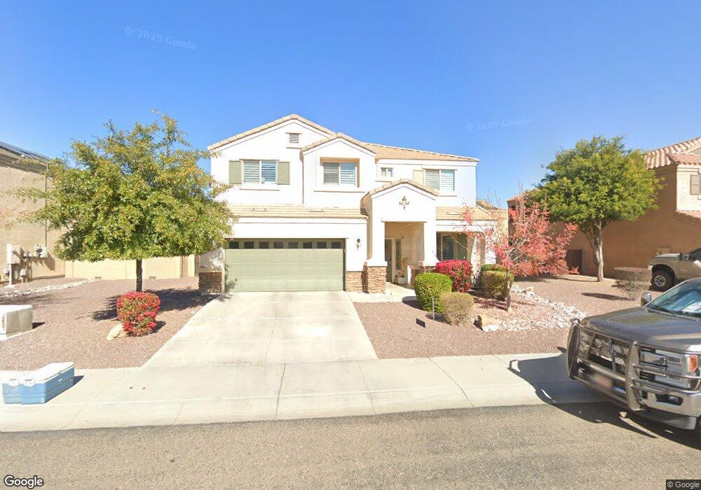
9538 W Harmony Ln Peoria, AZ 85382
Estimated Value: $669,221 - $723,000
--
Bed
1
Bath
3,208
Sq Ft
$216/Sq Ft
Est. Value
About This Home
This home is located at 9538 W Harmony Ln, Peoria, AZ 85382 and is currently estimated at $692,305, approximately $215 per square foot. 9538 W Harmony Ln is a home with nearby schools including Sunset Heights Elementary School and Liberty High School.
Ownership History
Date
Name
Owned For
Owner Type
Purchase Details
Closed on
Sep 18, 2013
Sold by
Continental Homes Inc
Bought by
Wright Michael Timothy
Current Estimated Value
Home Financials for this Owner
Home Financials are based on the most recent Mortgage that was taken out on this home.
Original Mortgage
$215,089
Outstanding Balance
$160,887
Interest Rate
4.46%
Mortgage Type
New Conventional
Estimated Equity
$531,418
Purchase Details
Closed on
Sep 8, 2013
Sold by
Wright Amber
Bought by
Wright Michael Timothy
Home Financials for this Owner
Home Financials are based on the most recent Mortgage that was taken out on this home.
Original Mortgage
$215,089
Outstanding Balance
$160,887
Interest Rate
4.46%
Mortgage Type
New Conventional
Estimated Equity
$531,418
Create a Home Valuation Report for This Property
The Home Valuation Report is an in-depth analysis detailing your home's value as well as a comparison with similar homes in the area
Home Values in the Area
Average Home Value in this Area
Purchase History
| Date | Buyer | Sale Price | Title Company |
|---|---|---|---|
| Wright Michael Timothy | $338,024 | Accommodation | |
| Continental Homes Inc | -- | Accommodation | |
| Wright Michael Timothy | -- | Accommodation |
Source: Public Records
Mortgage History
| Date | Status | Borrower | Loan Amount |
|---|---|---|---|
| Open | Continental Homes Inc | $215,089 | |
| Closed | Wright Michael Timothy | $215,089 |
Source: Public Records
Tax History Compared to Growth
Tax History
| Year | Tax Paid | Tax Assessment Tax Assessment Total Assessment is a certain percentage of the fair market value that is determined by local assessors to be the total taxable value of land and additions on the property. | Land | Improvement |
|---|---|---|---|---|
| 2025 | $3,043 | $38,425 | -- | -- |
| 2024 | $2,991 | $36,596 | -- | -- |
| 2023 | $2,991 | $49,010 | $9,800 | $39,210 |
| 2022 | $2,929 | $37,280 | $7,450 | $29,830 |
| 2021 | $3,131 | $34,910 | $6,980 | $27,930 |
| 2020 | $3,161 | $32,860 | $6,570 | $26,290 |
| 2019 | $3,061 | $32,020 | $6,400 | $25,620 |
| 2018 | $2,934 | $30,730 | $6,140 | $24,590 |
| 2017 | $2,946 | $29,260 | $5,850 | $23,410 |
| 2016 | $2,870 | $28,570 | $5,710 | $22,860 |
| 2015 | $2,825 | $28,080 | $5,610 | $22,470 |
Source: Public Records
Map
Nearby Homes
- 9541 W Frank Ave
- 20961 N 96th Dr
- 9582 W Albert Ln
- 20967 N 96th Ln
- 9574 W Quail Ave
- 9548 W Quail Ave
- 9529 W Runion Dr
- 9446 W Albert Ln
- 9341 W Albert Ln
- 20469 N 95th Dr
- 9729 W Burnett Rd
- 20424 N 96th Ln
- 9426 W Melinda Ln
- 20681 N 93rd Ave
- 9333 W Clara Ln
- 9250 W Runion Dr
- 10001 W Potter Dr
- 9225 W Runion Dr
- 9510 W Menadota Dr
- 9627 W Menadota Dr
- 9542 W Harmony Ln
- 9534 W Harmony Ln
- 21158 N 95th Dr
- 9546 W Harmony Ln
- 9541 W Deanna Dr
- 9535 W Harmony Ln
- 9539 W Harmony Ln
- 9543 W Harmony Ln
- 21180 N 95th Dr
- 9545 W Deanna Dr
- 9550 W Harmony Ln
- 21129 N 95th Dr
- 21147 N 95th Dr
- 9549 W Deanna Dr
- 9551 W Harmony Ln
- 21167 N 95th Dr
- 9554 W Harmony Ln
- 9555 W Harmony Ln
- 9536 W Deanna Dr
- 21187 N 95th Dr