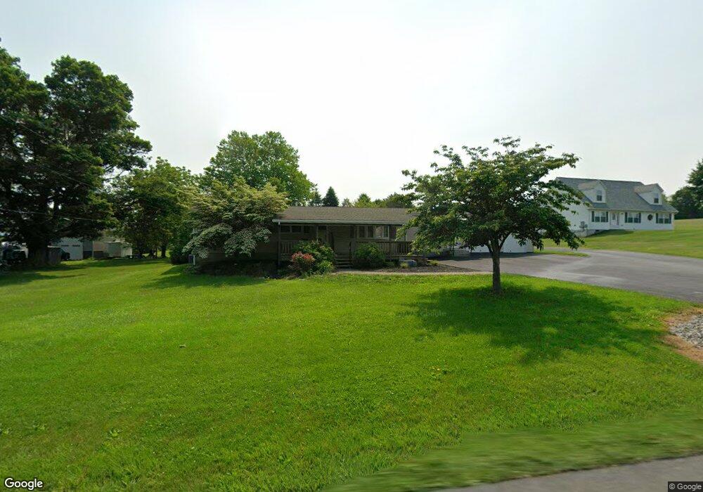
954 Blue Mountain Dr Walnutport, PA 18088
Estimated Value: $325,412 - $404,000
3
Beds
1
Bath
1,440
Sq Ft
$249/Sq Ft
Est. Value
About This Home
This home is located at 954 Blue Mountain Dr, Walnutport, PA 18088 and is currently estimated at $358,853, approximately $249 per square foot. 954 Blue Mountain Dr is a home located in Northampton County with nearby schools including Lehigh Elementary School, Northampton Area Middle School, and Northampton Area High School.
Ownership History
Date
Name
Owned For
Owner Type
Purchase Details
Closed on
Jul 9, 2004
Sold by
Beers Louisa
Bought by
Kane Richard
Current Estimated Value
Home Financials for this Owner
Home Financials are based on the most recent Mortgage that was taken out on this home.
Original Mortgage
$110,000
Outstanding Balance
$55,062
Interest Rate
6.25%
Mortgage Type
New Conventional
Estimated Equity
$303,791
Purchase Details
Closed on
Nov 1, 1983
Bought by
Beers Wilson T and Beers Louisa E
Create a Home Valuation Report for This Property
The Home Valuation Report is an in-depth analysis detailing your home's value as well as a comparison with similar homes in the area
Home Values in the Area
Average Home Value in this Area
Purchase History
| Date | Buyer | Sale Price | Title Company |
|---|---|---|---|
| Kane Richard | $150,000 | -- | |
| Beers Wilson T | $40,900 | -- |
Source: Public Records
Mortgage History
| Date | Status | Borrower | Loan Amount |
|---|---|---|---|
| Open | Kane Richard | $110,000 |
Source: Public Records
Tax History Compared to Growth
Tax History
| Year | Tax Paid | Tax Assessment Tax Assessment Total Assessment is a certain percentage of the fair market value that is determined by local assessors to be the total taxable value of land and additions on the property. | Land | Improvement |
|---|---|---|---|---|
| 2025 | $664 | $61,500 | $19,300 | $42,200 |
| 2024 | $4,521 | $61,500 | $19,300 | $42,200 |
| 2023 | $4,441 | $61,500 | $19,300 | $42,200 |
| 2022 | $4,441 | $61,500 | $19,300 | $42,200 |
| 2021 | $4,452 | $61,500 | $19,300 | $42,200 |
| 2020 | $4,452 | $61,500 | $19,300 | $42,200 |
| 2019 | $4,387 | $61,500 | $19,300 | $42,200 |
| 2018 | $4,322 | $61,500 | $19,300 | $42,200 |
| 2017 | $4,228 | $61,500 | $19,300 | $42,200 |
| 2016 | -- | $61,500 | $19,300 | $42,200 |
| 2015 | -- | $61,500 | $19,300 | $42,200 |
| 2014 | -- | $61,500 | $19,300 | $42,200 |
Source: Public Records
Map
Nearby Homes
- 1015 Honeysuckle Rd
- 723 Fir Dr
- 0 Walnut Dr
- 904 Municipal Rd
- 1150 E Stateside Dr
- 4015 Sycamore Dr
- 0 Olive Rd
- 4196 Independence Ln
- 3829 Dogwood Rd
- 4237 Independence Ln
- 4083 W Mountain View Dr
- 861 Municipal Rd
- 4390 Woodland Cir
- 0 Mountain View Dr Unit 747924
- 137 E Zimmer Dr
- 4405 Lehigh Dr
- 1225 Meyer Dr
- 93 Nashua St
- 95 Nashua St
- 12 E Zimmer Dr
- 958 Blue Mountain Dr
- 946 Blue Mountain Dr
- 945 Blue Mountain Dr
- 936 Blue Mountain Dr
- 967 Blue Mountain Dr
- 12345678 Blue Mountain Dr
- 971 Blue Mountain Dr
- 4007 Wood Dr
- 3995 Wood Dr
- 918 Blue Mountain Dr
- 4015 Wood Dr
- 900 Blue Mountain Dr
- 3979 Wood Dr
- 4023 Wood Dr
- 4055 Wood Dr
- 995 Blue Mountain Dr
- 4031 Wood Dr
- 3971 Wood Dr
- 875 S Dogwood Rd
- 4038 Cedar Dr