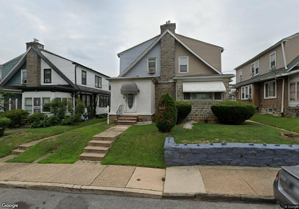
954 Bullock Ave Lansdowne, PA 19050
Estimated Value: $191,000 - $231,000
3
Beds
1
Bath
1,210
Sq Ft
$174/Sq Ft
Est. Value
About This Home
This home is located at 954 Bullock Ave, Lansdowne, PA 19050 and is currently estimated at $210,254, approximately $173 per square foot. 954 Bullock Ave is a home located in Delaware County with nearby schools including Evans Elementary School, Penn Wood Middle School, and Penn Wood High School - Cypress Street Campus.
Ownership History
Date
Name
Owned For
Owner Type
Purchase Details
Closed on
Nov 24, 1995
Sold by
Edwards Dwight E and Brown Lydia L
Bought by
Jones Melvin and Jones Melvin A
Current Estimated Value
Home Financials for this Owner
Home Financials are based on the most recent Mortgage that was taken out on this home.
Original Mortgage
$54,950
Outstanding Balance
$757
Interest Rate
7.44%
Mortgage Type
FHA
Estimated Equity
$209,497
Create a Home Valuation Report for This Property
The Home Valuation Report is an in-depth analysis detailing your home's value as well as a comparison with similar homes in the area
Home Values in the Area
Average Home Value in this Area
Purchase History
| Date | Buyer | Sale Price | Title Company |
|---|---|---|---|
| Jones Melvin | $55,000 | T A Title Insurance Company |
Source: Public Records
Mortgage History
| Date | Status | Borrower | Loan Amount |
|---|---|---|---|
| Open | Jones Melvin | $54,950 |
Source: Public Records
Tax History Compared to Growth
Tax History
| Year | Tax Paid | Tax Assessment Tax Assessment Total Assessment is a certain percentage of the fair market value that is determined by local assessors to be the total taxable value of land and additions on the property. | Land | Improvement |
|---|---|---|---|---|
| 2025 | $4,392 | $102,850 | $32,600 | $70,250 |
| 2024 | $4,392 | $102,850 | $32,600 | $70,250 |
| 2023 | $3,989 | $102,850 | $32,600 | $70,250 |
| 2022 | $3,803 | $102,850 | $32,600 | $70,250 |
| 2021 | $5,751 | $102,850 | $32,600 | $70,250 |
| 2020 | $3,823 | $61,210 | $18,810 | $42,400 |
| 2019 | $3,755 | $61,210 | $18,810 | $42,400 |
| 2018 | $3,703 | $61,210 | $0 | $0 |
| 2017 | $3,625 | $61,210 | $0 | $0 |
| 2016 | $336 | $61,210 | $0 | $0 |
| 2015 | $336 | $61,210 | $0 | $0 |
| 2014 | $336 | $61,210 | $0 | $0 |
Source: Public Records
Map
Nearby Homes
- 939 Serrill Ave
- 921 Serrill Ave
- 908 Yeadon Ave
- 1049 Yeadon Ave
- 923 Bell Ave
- 808 Serrill Ave
- 825 Laurel Rd
- 800 Bullock Ave
- 813 Arbor Rd
- 6718 Cobbs Creek Pkwy
- 6535 Windsor St
- 6835 Chester Ave
- 6951 Chester Ave
- 740 Church Ln
- 1781 S 65th St
- 722 Yeadon Ave
- 6564 Belmar St
- 711 Yeadon Ave Unit 1
- 1824 S 65th St
- 702 Cedar Ave
- 952 Bullock Ave
- 956 Bullock Ave
- 950 Bullock Ave
- 958 Bullock Ave
- 948 Bullock Ave
- 960 Bullock Ave
- 955 Yeadon Ave
- 953 Yeadon Ave
- 946 Bullock Ave
- 957 Yeadon Ave
- 951 Yeadon Ave
- 959 Yeadon Ave
- 949 Yeadon Ave
- 944 Bullock Ave
- 947 Yeadon Ave
- 955 Bullock Ave
- 942 Bullock Ave
- 953 Bullock Ave
- 957 Bullock Ave
- 951 Bullock Ave