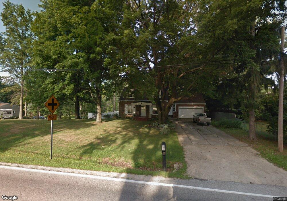
954 S Munroe Rd Tallmadge, OH 44278
Estimated Value: $238,080 - $245,000
2
Beds
2
Baths
1,562
Sq Ft
$155/Sq Ft
Est. Value
About This Home
This home is located at 954 S Munroe Rd, Tallmadge, OH 44278 and is currently estimated at $242,270, approximately $155 per square foot. 954 S Munroe Rd is a home located in Summit County with nearby schools including Tallmadge Middle School, Tallmadge High School, and Cornerstone Community School.
Ownership History
Date
Name
Owned For
Owner Type
Purchase Details
Closed on
Apr 14, 2017
Sold by
Bauhart Jeanne
Bought by
Hora Richard and Hora Kathryn
Current Estimated Value
Purchase Details
Closed on
May 13, 2004
Sold by
Green Tree Servicing Llc
Bought by
Bauhart Jeanne
Home Financials for this Owner
Home Financials are based on the most recent Mortgage that was taken out on this home.
Original Mortgage
$61,200
Interest Rate
6.12%
Mortgage Type
Purchase Money Mortgage
Purchase Details
Closed on
May 5, 2004
Sold by
Thomas Jeannette E and Sackman Jeannette
Bought by
Green Tree Servicing Llc and Conseco Finance Servicing Corp
Home Financials for this Owner
Home Financials are based on the most recent Mortgage that was taken out on this home.
Original Mortgage
$61,200
Interest Rate
6.12%
Mortgage Type
Purchase Money Mortgage
Purchase Details
Closed on
Apr 10, 2000
Sold by
Sackman William
Bought by
Thomas Jeannette E
Create a Home Valuation Report for This Property
The Home Valuation Report is an in-depth analysis detailing your home's value as well as a comparison with similar homes in the area
Home Values in the Area
Average Home Value in this Area
Purchase History
| Date | Buyer | Sale Price | Title Company |
|---|---|---|---|
| Hora Richard | $121,350 | None Available | |
| Bauhart Jeanne | $72,000 | -- | |
| Green Tree Servicing Llc | $80,000 | -- | |
| Thomas Jeannette E | -- | -- |
Source: Public Records
Mortgage History
| Date | Status | Borrower | Loan Amount |
|---|---|---|---|
| Previous Owner | Bauhart Jeanne | $61,200 |
Source: Public Records
Tax History Compared to Growth
Tax History
| Year | Tax Paid | Tax Assessment Tax Assessment Total Assessment is a certain percentage of the fair market value that is determined by local assessors to be the total taxable value of land and additions on the property. | Land | Improvement |
|---|---|---|---|---|
| 2025 | $3,647 | $71,341 | $20,181 | $51,160 |
| 2024 | $3,647 | $71,341 | $20,181 | $51,160 |
| 2023 | $3,647 | $71,341 | $20,181 | $51,160 |
| 2022 | $3,686 | $58,958 | $16,678 | $42,280 |
| 2021 | $3,702 | $58,958 | $16,678 | $42,280 |
| 2020 | $3,673 | $58,960 | $16,680 | $42,280 |
| 2019 | $3,250 | $46,490 | $15,010 | $31,480 |
| 2018 | $2,873 | $46,490 | $15,010 | $31,480 |
| 2017 | $2,725 | $46,490 | $15,010 | $31,480 |
| 2016 | $2,927 | $42,470 | $15,010 | $27,460 |
| 2015 | $2,725 | $42,470 | $15,010 | $27,460 |
| 2014 | $2,708 | $42,470 | $15,010 | $27,460 |
| 2013 | $2,721 | $43,470 | $15,010 | $28,460 |
Source: Public Records
Map
Nearby Homes
- 750 Danner Rd
- 1034 Southeast Ave
- 1165 Broadview Rd
- 128 Byatt Rd
- 498 Eastwood Ave
- 280 Woodside Ln
- 685 Beechview Dr
- 549 S Munroe Rd
- 459 Alaho St
- 523 S Munroe Rd
- 187 Oakview Cir
- 689 Alaho St
- 915 Treat Blvd
- 505 Moody St
- 2354 Savoy Ave
- 2330 Eastwood Ave
- 1075 Amy Trail
- 2360 Newton St
- 2356 Newton St
- 2352 Newton St
- 944 S Munroe Rd
- 972 S Munroe Rd
- 963 S Munroe Rd
- 953 S Munroe Rd
- 943 S Munroe Rd
- 629 Perry Rd
- 975 S Munroe Rd
- 923 S Munroe Rd
- 988 S Munroe Rd
- 670 Perry Rd
- 918 S Munroe Rd
- 1002 S Munroe Rd
- 909 S Munroe Rd
- 985 S Munroe Rd
- 995 S Munroe Rd
- 663 Perry Rd
- 590 Perry Rd
- 680 Perry Rd
- 908 S Munroe Rd
- 671 Perry Rd