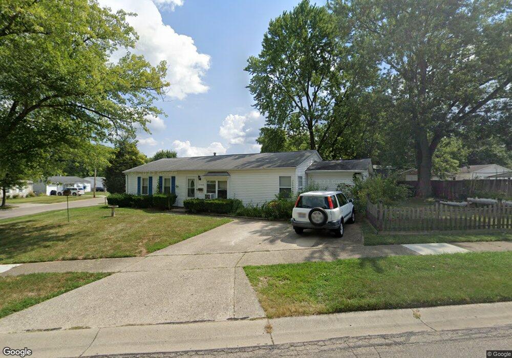
9540 Loralinda Dr Cincinnati, OH 45251
Estimated Value: $163,000 - $204,000
3
Beds
1
Bath
1,272
Sq Ft
$141/Sq Ft
Est. Value
About This Home
This home is located at 9540 Loralinda Dr, Cincinnati, OH 45251 and is currently estimated at $179,446, approximately $141 per square foot. 9540 Loralinda Dr is a home located in Hamilton County with nearby schools including Taylor Elementary School, Pleasant Run Elementary School, and Pleasant Run Middle School.
Ownership History
Date
Name
Owned For
Owner Type
Purchase Details
Closed on
Mar 20, 2015
Sold by
Boyd Francis V
Bought by
Willis Hardrick and Pierson Sandra
Current Estimated Value
Purchase Details
Closed on
Oct 31, 2002
Sold by
Boyd Francis V Tr
Bought by
Boyd Francis
Home Financials for this Owner
Home Financials are based on the most recent Mortgage that was taken out on this home.
Original Mortgage
$44,600
Interest Rate
6.1%
Mortgage Type
Unknown
Purchase Details
Closed on
Mar 23, 1999
Sold by
Frank Boyd and Frank Francis V
Bought by
Boyd Francis
Purchase Details
Closed on
Nov 25, 1996
Sold by
Pittman James W and Pittman Becky Jane
Bought by
Boyd Frank
Home Financials for this Owner
Home Financials are based on the most recent Mortgage that was taken out on this home.
Original Mortgage
$54,900
Interest Rate
7.85%
Create a Home Valuation Report for This Property
The Home Valuation Report is an in-depth analysis detailing your home's value as well as a comparison with similar homes in the area
Home Values in the Area
Average Home Value in this Area
Purchase History
| Date | Buyer | Sale Price | Title Company |
|---|---|---|---|
| Willis Hardrick | -- | Attorney | |
| Boyd Francis | -- | -- | |
| Boyd Francis | -- | -- | |
| Boyd Frank | $61,000 | -- |
Source: Public Records
Mortgage History
| Date | Status | Borrower | Loan Amount |
|---|---|---|---|
| Previous Owner | Boyd Francis | $44,600 | |
| Previous Owner | Boyd Frank | $54,900 |
Source: Public Records
Tax History Compared to Growth
Tax History
| Year | Tax Paid | Tax Assessment Tax Assessment Total Assessment is a certain percentage of the fair market value that is determined by local assessors to be the total taxable value of land and additions on the property. | Land | Improvement |
|---|---|---|---|---|
| 2024 | $2,195 | $40,929 | $9,212 | $31,717 |
| 2023 | $2,208 | $40,929 | $9,212 | $31,717 |
| 2022 | $1,885 | $28,480 | $8,120 | $20,360 |
| 2021 | $1,869 | $28,480 | $8,120 | $20,360 |
| 2020 | $1,888 | $28,480 | $8,120 | $20,360 |
| 2019 | $1,634 | $22,968 | $6,549 | $16,419 |
| 2018 | $1,466 | $22,968 | $6,549 | $16,419 |
| 2017 | $1,390 | $22,968 | $6,549 | $16,419 |
| 2016 | $1,484 | $24,231 | $6,612 | $17,619 |
| 2015 | $1,566 | $24,231 | $6,612 | $17,619 |
| 2014 | $1,571 | $24,231 | $6,612 | $17,619 |
| 2013 | $1,576 | $25,505 | $6,958 | $18,547 |
Source: Public Records
Map
Nearby Homes
- 3151 Birchway Dr Unit 3151
- 9717 Loralinda Dr
- 3246 Ainsworth Dr
- 9302 Loralinda Dr
- 3258 Lillwood Ln
- 9446 Haddington Ct
- 3275 Deshler Dr
- 3276 Deshler Dr
- 9558 Woodstate Dr Unit 13E
- 9562 Trafalgar Ct
- 2908 Libra Ln
- 3205 Donnybrook Ln
- 9568 Woodstate Dr
- 9828 Loralinda Dr
- 3364 Amberway Ct Unit 45
- 9738 Gibralter Dr
- 3464 Sunbury Ln
- 3351 Deshler Dr
- 3463 Amberway Ct
- 3374 Deshler Dr
- 3187 Laverne Dr
- 9510 Loralinda Dr
- 3175 Laverne Dr
- 3186 Hyannis Dr
- 3203 Laverne Dr
- 9525 Loralinda Dr
- 3174 Hyannis Dr
- 3198 Laverne Dr
- 3163 Laverne Dr
- 3186 Laverne Dr
- 9513 Loralinda Dr
- 9561 Loralinda Dr
- 3162 Hyannis Dr
- 3174 Laverne Dr
- 9501 Loralinda Dr
- 3151 Laverne Dr
- 3212 Laverne Dr
- 3162 Laverne Dr
- 9490 Loralinda Dr
- 3150 Hyannis Dr