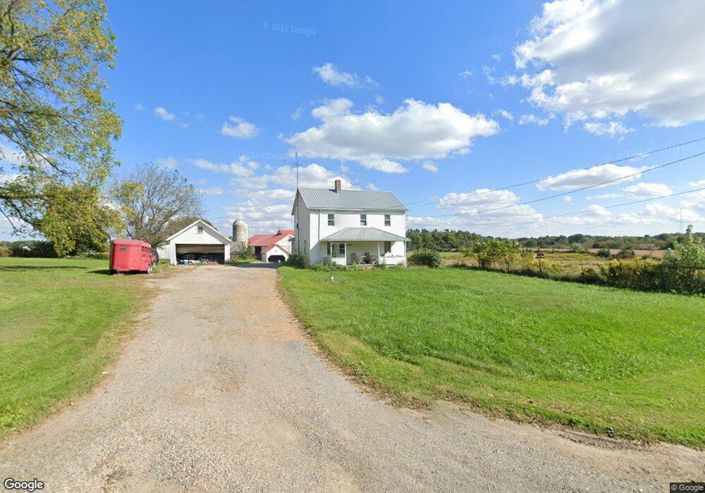
9542 Moulin Ave NE Alliance, OH 44601
Estimated Value: $269,000 - $595,354
8
Beds
2
Baths
3,426
Sq Ft
$128/Sq Ft
Est. Value
About This Home
This home is located at 9542 Moulin Ave NE, Alliance, OH 44601 and is currently estimated at $439,839, approximately $128 per square foot. 9542 Moulin Ave NE is a home located in Stark County with nearby schools including Marlington High School.
Ownership History
Date
Name
Owned For
Owner Type
Purchase Details
Closed on
Dec 23, 2020
Sold by
Moulin Linda A
Bought by
Malcomson James A
Current Estimated Value
Purchase Details
Closed on
Nov 18, 2016
Sold by
Moulin Linda A
Bought by
Moulin Linda A and Malcomson James A
Purchase Details
Closed on
Jul 31, 2007
Sold by
Moulin Linda A
Bought by
Hileman William C
Home Financials for this Owner
Home Financials are based on the most recent Mortgage that was taken out on this home.
Original Mortgage
$79,439
Interest Rate
6.73%
Mortgage Type
Seller Take Back
Purchase Details
Closed on
Aug 6, 2004
Sold by
Moulin Linda A
Bought by
Clunk Dennis R
Purchase Details
Closed on
Feb 21, 2002
Sold by
Moulin Linda A
Bought by
Moulin Wilberta P
Create a Home Valuation Report for This Property
The Home Valuation Report is an in-depth analysis detailing your home's value as well as a comparison with similar homes in the area
Home Values in the Area
Average Home Value in this Area
Purchase History
| Date | Buyer | Sale Price | Title Company |
|---|---|---|---|
| Malcomson James A | -- | None Available | |
| Moulin Linda A | -- | None Available | |
| Hileman William C | $69,700 | Attorney | |
| Clunk Dennis R | $81,100 | -- | |
| Moulin Wilberta P | -- | -- |
Source: Public Records
Mortgage History
| Date | Status | Borrower | Loan Amount |
|---|---|---|---|
| Previous Owner | Hileman William C | $79,439 |
Source: Public Records
Tax History Compared to Growth
Tax History
| Year | Tax Paid | Tax Assessment Tax Assessment Total Assessment is a certain percentage of the fair market value that is determined by local assessors to be the total taxable value of land and additions on the property. | Land | Improvement |
|---|---|---|---|---|
| 2025 | $4,387 | $198,280 | $126,600 | $71,680 |
| 2024 | $2,411 | $198,280 | $126,600 | $71,680 |
| 2023 | $6,348 | $161,915 | $111,545 | $50,370 |
| 2022 | $15,647 | $161,920 | $111,550 | $50,370 |
| 2021 | $2,804 | $78,090 | $27,720 | $50,370 |
| 2020 | $3,146 | $78,090 | $32,520 | $45,570 |
| 2019 | $3,132 | $78,250 | $32,660 | $45,590 |
| 2018 | $3,137 | $78,250 | $32,660 | $45,590 |
| 2017 | $3,414 | $78,830 | $39,800 | $39,030 |
| 2016 | $3,427 | $79,110 | $40,360 | $38,750 |
| 2015 | $3,274 | $79,110 | $40,360 | $38,750 |
| 2014 | $1,048 | $67,260 | $27,130 | $40,130 |
| 2013 | $1,516 | $67,260 | $27,130 | $40,130 |
Source: Public Records
Map
Nearby Homes
- 0 Reeder Ave NE
- 10666 Wilma Ave NE
- 2377 Ansley St Unit 2377
- 2851 Patriots Path Unit 3D
- 2435 Queensbury Rd
- 1430 Westwood Ave
- 2081 Marwood Cir
- 0 Valewood Cir Unit 5006281
- 0 Meadow St NE
- 0 Easton St NE
- 0 W Main St Unit 5090123
- 12355 Edison St NE
- 11960 Freshley Ave NE
- 0 Winchester St
- 0 Winchester St Unit 5162877
- 2220 Western Ave
- 11480 Aebi Ave NE
- 1201 Overlook Dr
- 2195 Blenheim Ave
- 2112 Blenheim Ave
- 9515 Moulin Ave NE
- 9551 Moulin Ave NE
- V/L Moulin Ave
- 9439 Moulin Ave NE
- 9332 Moulin Ave NE
- 9483 Moulin Ave NE
- 9493 Moulin Ave NE
- 9225 Moulin Ave NE
- 9880 Moulin Ave NE
- 9164 Moulin Ave NE
- 9465 Mccallum Ave NE
- 9625 Mccallum Ave NE
- 9139 Moulin Ave NE
- 9110 Moulin Ave NE
- 9279 Mccallum Ave NE
- 9277 Mccallum Ave NE
- 9691 Mccallum Ave NE
- 9107 Moulin Ave NE
- 9737 Mccallum Ave NE
- 9105 Moulin Ave NE