Estimated Value: $238,543 - $304,000
--
Bed
--
Bath
1,262
Sq Ft
$212/Sq Ft
Est. Value
About This Home
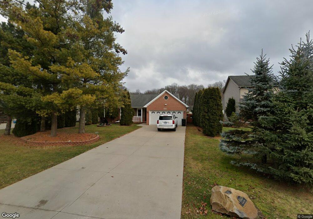
This home is located at 9543 Nook Rd, Clay, MI 48001 and is currently estimated at $267,886, approximately $212 per square foot. 9543 Nook Rd is a home located in St. Clair County with nearby schools including Algonac Junior/Senior High School.
Ownership History
Date
Name
Owned For
Owner Type
Purchase Details
Closed on
Mar 21, 2016
Sold by
Brown Jack
Bought by
Brown David Alan
Current Estimated Value
Purchase Details
Closed on
Jan 28, 2005
Sold by
Brown Jack
Bought by
Brown Jack and Brown David Alan
Home Financials for this Owner
Home Financials are based on the most recent Mortgage that was taken out on this home.
Original Mortgage
$134,400
Outstanding Balance
$67,755
Interest Rate
5.83%
Mortgage Type
New Conventional
Estimated Equity
$200,131
Create a Home Valuation Report for This Property
The Home Valuation Report is an in-depth analysis detailing your home's value as well as a comparison with similar homes in the area
Home Values in the Area
Average Home Value in this Area
Purchase History
| Date | Buyer | Sale Price | Title Company |
|---|---|---|---|
| Brown David Alan | -- | Abstract Title | |
| Brown Jack | -- | Philip F Greco Title Company | |
| Brown Jack | $168,000 | Lawyers Title Insurance Co |
Source: Public Records
Mortgage History
| Date | Status | Borrower | Loan Amount |
|---|---|---|---|
| Open | Brown Jack | $134,400 |
Source: Public Records
Tax History Compared to Growth
Tax History
| Year | Tax Paid | Tax Assessment Tax Assessment Total Assessment is a certain percentage of the fair market value that is determined by local assessors to be the total taxable value of land and additions on the property. | Land | Improvement |
|---|---|---|---|---|
| 2025 | $2,526 | $114,400 | $0 | $0 |
| 2024 | $2,292 | $117,400 | $0 | $0 |
| 2023 | $2,129 | $96,400 | $0 | $0 |
| 2022 | $2,248 | $86,500 | $0 | $0 |
| 2021 | $2,153 | $93,600 | $0 | $0 |
| 2020 | $2,158 | $89,700 | $15,000 | $74,700 |
| 2019 | $2,130 | $76,500 | $0 | $0 |
| 2018 | $2,093 | $70,000 | $0 | $0 |
| 2017 | $1,972 | $63,600 | $0 | $0 |
| 2016 | $1,823 | $63,600 | $0 | $0 |
| 2015 | -- | $64,000 | $15,000 | $49,000 |
| 2014 | -- | $52,400 | $15,000 | $37,400 |
| 2013 | -- | $47,600 | $0 | $0 |
Source: Public Records
Map
Nearby Homes
- 503 Fassett St
- 00 Dickinson Island
- 0 Russell Dr Unit 50179629
- 1003 Smith St
- 1600 N Channel Dr
- 140 Kenyon Rd Unit 40
- 685 Townsend Ct
- 632 Pleasant St
- 9188 Marsh Rd
- 328 Heritage Way
- 326 Heritage Way
- 00000 N Channel Dr
- 407-425 N Channel Dr
- 00 N Channel Dr
- 618 Green St
- 408 Conley St
- 24 Vacant Lots Land
- 2090 N Channel Dr
- 488 Lathrop St
- 0000 Lee St