Estimated Value: $215,000 - $268,382
About This Home
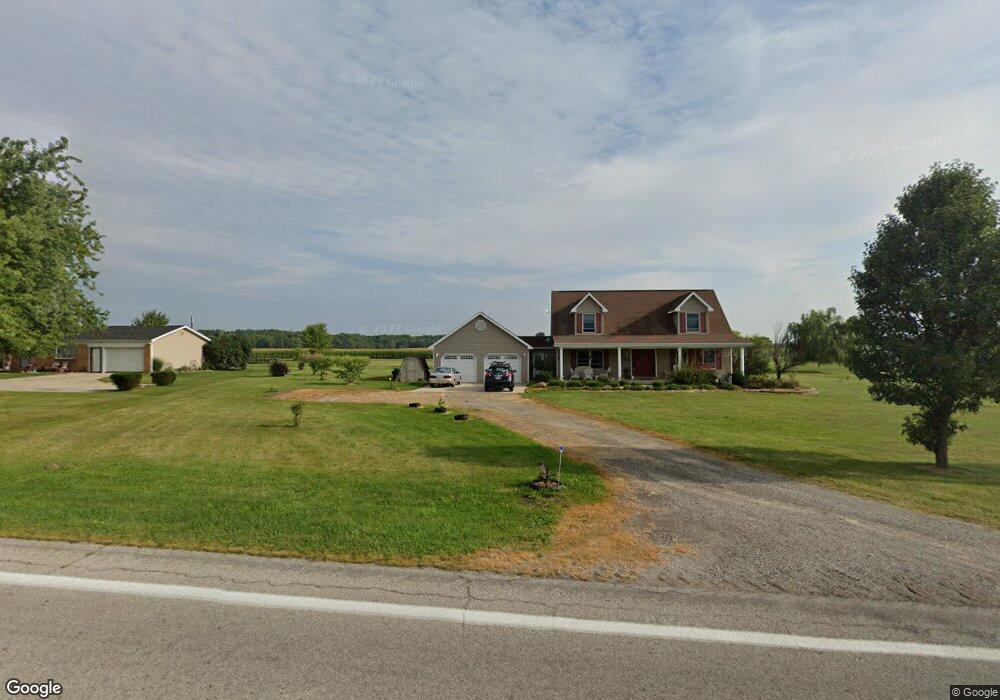
This home is located at 9547 State Route 34, Bryan, OH 43506 and is currently estimated at $244,846, approximately $140 per square foot. 9547 State Route 34 is a home located in Williams County with nearby schools including Bryan Elementary PK-5, Washington Elementary School, and Bryan Middle School/High School.
Ownership History
We collect this data history from publicly available records. To have your information removed, we recommend requesting removal directly through your county’s website.
Purchase Details
Home Financials for this Owner
Home Financials are based on the most recent Mortgage that was taken out on this home.Purchase Details
Home Financials for this Owner
Home Financials are based on the most recent Mortgage that was taken out on this home.Purchase Details
Home Financials for this Owner
Home Financials are based on the most recent Mortgage that was taken out on this home.Purchase Details
Purchase Details
Purchase History
We collect this data history from publicly available records. To have your information removed, we recommend requesting removal directly through your county’s website.
| Date | Buyer | Sale Price | Title Company |
|---|---|---|---|
| $230,000 | None Listed On Document | ||
| $230,000 | None Listed On Document | ||
| -- | Meyer Carl J | ||
| -- | None Listed On Document | ||
| $130,000 | None Available | ||
| $14,500 | -- | ||
| -- | -- |
Mortgage History
We collect this data history from publicly available records. To have your information removed, we recommend requesting removal directly through your county’s website.
| Date | Status | Borrower | Loan Amount |
|---|---|---|---|
| Open | $223,100 | ||
| Closed | $223,100 | ||
| Previous Owner | $152,523 | ||
| Previous Owner | $104,000 |
Tax History
We collect this data history from publicly available records. To have your information removed, we recommend requesting removal directly through your county’s website.
| Year | Tax Paid | Tax Assessment Tax Assessment Total Assessment is a certain percentage of the fair market value that is determined by local assessors to be the total taxable value of land and additions on the property. | Land | Improvement |
|---|---|---|---|---|
| 2025 | $3,155 | $70,080 | $8,510 | $61,570 |
| 2024 | $3,139 | $70,080 | $8,510 | $61,570 |
| 2023 | $3,155 | $55,550 | $7,950 | $47,600 |
| 2022 | $2,780 | $55,550 | $7,950 | $47,600 |
| 2021 | $2,781 | $55,550 | $7,950 | $47,600 |
| 2020 | $2,485 | $48,240 | $6,830 | $41,410 |
| 2019 | $2,479 | $48,240 | $6,830 | $41,410 |
| 2018 | $2,280 | $48,240 | $6,830 | $41,410 |
| 2017 | $2,187 | $42,670 | $6,650 | $36,020 |
| 2016 | $2,075 | $42,670 | $6,650 | $36,020 |
| 2015 | $2,137 | $42,670 | $6,650 | $36,020 |
| 2014 | $2,137 | $41,930 | $6,650 | $35,280 |
| 2013 | $2,154 | $41,930 | $6,650 | $35,280 |
Map
- 0 Saint Andrews Dr
- 7634 County Road 9
- 00 Troon Ct
- 125 Turnberry Dr
- 202 Belfast Ln
- 322 Dublin Ln
- 324 Dublin Ln
- 314 Dublin Ln
- 5966 County Road 12
- 1319 Ohio Dr
- 110 Norlick Dr
- 7303 Williams County C
- 12107 Williams County C
- 418 Connin St
- 320 Newdale Dr
- 13673 County Rd E Unit 10
- 930 W High St
- 6695 Ohio 15 Unit 16
- 6695 Ohio 15 Unit 11
- 903 Greystone Dr
- 9547 Ohio 34
- 9505 State Route 34
- 9574 Ohio 34
- 9585 State Route 34
- 9585 State Route 34
- 9606 County Road F
- 9446 State Route 34
- 9446 State Route 34
- 9675 County Road F
- 9675 C R F
- - 2 5 Acres On Co Rd F - West of Bryan
- 9710 Cr F
- 9721 State Route 34
- 9721 State Route 34
- : 2 5 Acres On Co Rd F - West of Bryan
- 9710 County Road F
- 9359 County Road F
- - 7 41 Acres On St Rt 34 - West of Bryan
- 09359 County Road F
- 00 County Road F
Ask me questions while you tour the home.