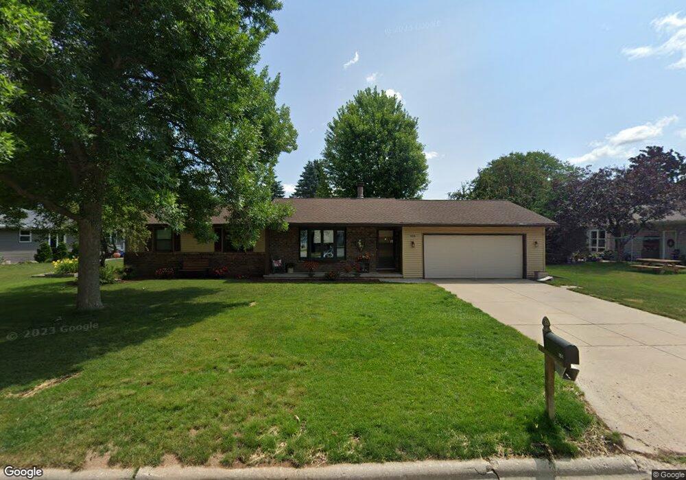
955 Amberly Trail Green Bay, WI 54311
Wilder Park NeighborhoodEstimated Value: $284,000 - $309,726
3
Beds
1
Bath
1,196
Sq Ft
$251/Sq Ft
Est. Value
About This Home
This home is located at 955 Amberly Trail, Green Bay, WI 54311 and is currently estimated at $299,682, approximately $250 per square foot. 955 Amberly Trail is a home located in Brown County with nearby schools including Wilder Elementary School, Edison Middle School, and Preble High School.
Ownership History
Date
Name
Owned For
Owner Type
Purchase Details
Closed on
Jul 2, 2025
Sold by
Karnopp Brian P and Karnopp Laurie A
Bought by
Karnopp Brian P and Karnopp Laurie A
Current Estimated Value
Purchase Details
Closed on
Oct 30, 2002
Sold by
Shaw David N and Shaw Kathy A
Bought by
Karnopp Brian P and Karnopp Laurie A
Home Financials for this Owner
Home Financials are based on the most recent Mortgage that was taken out on this home.
Original Mortgage
$100,000
Interest Rate
5.5%
Create a Home Valuation Report for This Property
The Home Valuation Report is an in-depth analysis detailing your home's value as well as a comparison with similar homes in the area
Home Values in the Area
Average Home Value in this Area
Purchase History
| Date | Buyer | Sale Price | Title Company |
|---|---|---|---|
| Karnopp Brian P | -- | -- | |
| Karnopp Brian P | $129,900 | Bay Title & Abstract |
Source: Public Records
Mortgage History
| Date | Status | Borrower | Loan Amount |
|---|---|---|---|
| Previous Owner | Karnopp Brian P | $100,000 |
Source: Public Records
Tax History Compared to Growth
Tax History
| Year | Tax Paid | Tax Assessment Tax Assessment Total Assessment is a certain percentage of the fair market value that is determined by local assessors to be the total taxable value of land and additions on the property. | Land | Improvement |
|---|---|---|---|---|
| 2024 | $3,396 | $185,200 | $41,200 | $144,000 |
| 2023 | $3,230 | $185,200 | $41,200 | $144,000 |
| 2022 | $3,169 | $185,200 | $41,200 | $144,000 |
| 2021 | $3,085 | $136,800 | $30,900 | $105,900 |
| 2020 | $3,129 | $136,800 | $30,900 | $105,900 |
| 2019 | $3,026 | $136,800 | $30,900 | $105,900 |
| 2018 | $2,959 | $136,800 | $30,900 | $105,900 |
| 2017 | $2,928 | $136,800 | $30,900 | $105,900 |
| 2016 | $2,881 | $136,800 | $30,900 | $105,900 |
| 2015 | $2,983 | $136,800 | $30,900 | $105,900 |
| 2014 | $3,062 | $136,800 | $30,900 | $105,900 |
| 2013 | $3,062 | $136,800 | $30,900 | $105,900 |
Source: Public Records
Map
Nearby Homes
- 856 Alpine Dr
- 2679 Radinz Rd
- 1015 Aphrodite Rd
- 2722 Finger Rd
- 2648 Pecan St
- 2615 Finger Rd Unit 2617
- 537 Edward Dr
- 537 Alpine Dr
- 0 Lowell Dr
- 2856 Sleepy Hollow Dr
- 2400 Ruffed Ct
- 2570 Edgewood Ln
- 448 Harvest Rd
- 442 Robert Ln
- 3060 Gilbert Dr
- 3069 Gilbert Dr
- 3076 Gilbert Dr
- 2730 Castaway Ct
- 3129 Finger Rd
- 650 Calvin Ct
- 2738 Woodstock Ct
- 2741 Hillsborough Ct
- 2747 Hillsborough Ct
- 2748 Woodstock Ct
- 2751 Hillsborough Ct
- 2752 Woodstock Ct
- 956 Amberly Trail
- 946 Amberly Trail
- 1009 Amberly Trail
- 2739 Woodstock Ct
- 1000 Amberly Trail Unit 1002
- 2746 Hillsborough Ct
- 2747 Woodstock Ct
- 2757 Hillsborough Ct
- 2760 Woodstock Ct
- 932 Amberly Trail
- 2750 Hillsborough Ct
- 1025 Amberly Trail
- 2751 Woodstock Ct
- 919 Amberly Trail