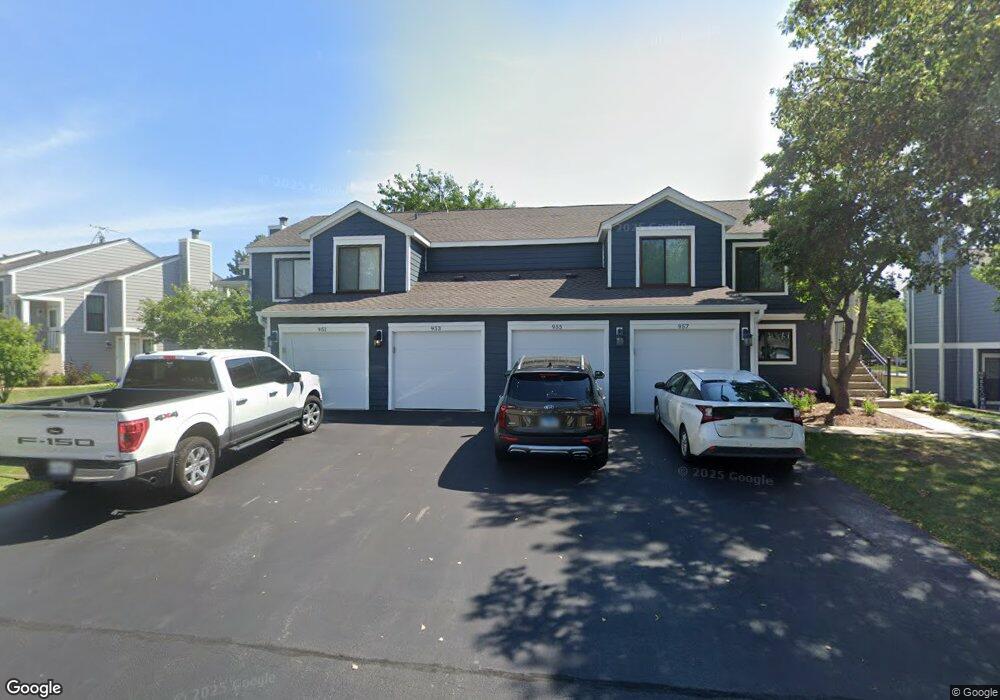
955 Brunswick Cir Unit 312B Schaumburg, IL 60193
South Schaumburg NeighborhoodEstimated Value: $267,000 - $297,000
2
Beds
--
Bath
1,200
Sq Ft
$236/Sq Ft
Est. Value
About This Home
This home is located at 955 Brunswick Cir Unit 312B, Schaumburg, IL 60193 and is currently estimated at $282,609, approximately $235 per square foot. 955 Brunswick Cir Unit 312B is a home located in Cook County with nearby schools including Michael Collins Elementary School, Robert Frost Junior High School, and J B Conant High School.
Ownership History
Date
Name
Owned For
Owner Type
Purchase Details
Closed on
Jun 27, 2016
Sold by
Jurkonis Karl and Jurkonis Ellen
Bought by
Jurkonis Karl P and Jurkonis Ellen A
Current Estimated Value
Purchase Details
Closed on
Dec 14, 2001
Sold by
Augustyn Michele
Bought by
Jurkonis Karl and Jurkonis Ellen
Purchase Details
Closed on
May 21, 1998
Sold by
Bigger Melissa M
Bought by
Augustyn Michele
Home Financials for this Owner
Home Financials are based on the most recent Mortgage that was taken out on this home.
Original Mortgage
$96,000
Interest Rate
7.22%
Create a Home Valuation Report for This Property
The Home Valuation Report is an in-depth analysis detailing your home's value as well as a comparison with similar homes in the area
Home Values in the Area
Average Home Value in this Area
Purchase History
| Date | Buyer | Sale Price | Title Company |
|---|---|---|---|
| Jurkonis Karl P | -- | Attorney | |
| Jurkonis Karl | $151,000 | -- | |
| Augustyn Michele | $113,000 | Professional National Title |
Source: Public Records
Mortgage History
| Date | Status | Borrower | Loan Amount |
|---|---|---|---|
| Previous Owner | Augustyn Michele | $96,000 |
Source: Public Records
Tax History Compared to Growth
Tax History
| Year | Tax Paid | Tax Assessment Tax Assessment Total Assessment is a certain percentage of the fair market value that is determined by local assessors to be the total taxable value of land and additions on the property. | Land | Improvement |
|---|---|---|---|---|
| 2024 | $5,574 | $19,900 | $4,663 | $15,237 |
| 2023 | $5,405 | $19,900 | $4,663 | $15,237 |
| 2022 | $5,405 | $19,900 | $4,663 | $15,237 |
| 2021 | $4,858 | $16,029 | $2,543 | $13,486 |
| 2020 | $4,775 | $16,029 | $2,543 | $13,486 |
| 2019 | $4,774 | $17,810 | $2,543 | $15,267 |
| 2018 | $3,713 | $12,371 | $2,119 | $10,252 |
| 2017 | $3,654 | $12,371 | $2,119 | $10,252 |
| 2016 | $3,417 | $12,371 | $2,119 | $10,252 |
| 2015 | $3,290 | $10,998 | $1,907 | $9,091 |
| 2014 | $3,254 | $10,998 | $1,907 | $9,091 |
| 2013 | $3,171 | $10,998 | $1,907 | $9,091 |
Source: Public Records
Map
Nearby Homes
- 916 Manchester Cir Unit 91A
- 126 Manchester Ct Unit 61B
- 1100 Boston Harbor Unit 7004
- 205 Nantucket Harbor Unit 104
- 421 E Wise Rd
- 426 E Niagara Ave
- 36 Shore Dr
- 124 E Monterey Ave
- 718 N Point Dr
- 620 S Point Dr
- 733 Limerick Ln Unit 7333D
- 711 Tipperary Ct Unit 2D
- 712 Tipperary Ct Unit 1C
- 727 Killarney Ct Unit 1C
- 722 Merlin Dr Unit 16
- 631 Derry Ct Unit 3C
- 421 Summit Dr
- 826 Thornton Ct Unit 2AL
- 635 Limerick Ln Unit 2B
- 614 Tralee Ct Unit 2-C
- 957 Brunswick Cir Unit 311B
- 957 Brunswick Cir Unit U31-1B
- 951 Brunswick Cir Unit 311A
- 953 Brunswick Cir Unit 312A
- 947 Brunswick Cir Unit 301B
- 961 Brunswick Cir Unit 321A
- 961 Brunswick Cir Unit 1A
- 941 Brunswick Cir Unit 301A
- 945 Brunswick Cir Unit 302B
- 967 Brunswick Cir Unit 321B
- 943 Brunswick Cir Unit 302A
- 965 Brunswick Cir Unit 322B
- 963 Brunswick Cir Unit 322A
- 952 Brunswick Cir Unit 242B
- 950 Brunswick Cir Unit 241B
- 956 Brunswick Cir Unit 241A
- 946 Brunswick Cir Unit 251A
- 944 Brunswick Cir Unit 252A
- 954 Brunswick Cir Unit 242A
- 954 Brunswick Cir Unit 954