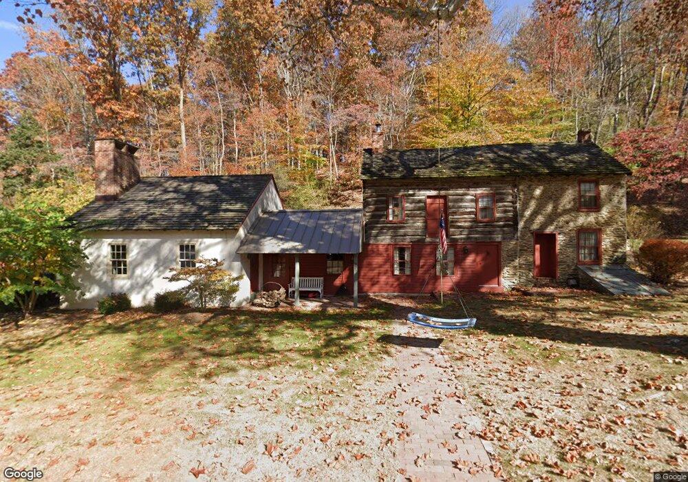
955 Connor Rd West Chester, PA 19380
Estimated Value: $714,000 - $797,000
5
Beds
4
Baths
3,184
Sq Ft
$239/Sq Ft
Est. Value
About This Home
This home is located at 955 Connor Rd, West Chester, PA 19380 and is currently estimated at $761,320, approximately $239 per square foot. 955 Connor Rd is a home located in Chester County with nearby schools including East Bradford Elementary School, E.N. Peirce Middle School, and Henderson High School.
Ownership History
Date
Name
Owned For
Owner Type
Purchase Details
Closed on
Oct 7, 1998
Sold by
Lockwood Michael J and Lockwood Dale E
Bought by
Lockwood Michael J and Lockwood Dale E
Current Estimated Value
Create a Home Valuation Report for This Property
The Home Valuation Report is an in-depth analysis detailing your home's value as well as a comparison with similar homes in the area
Home Values in the Area
Average Home Value in this Area
Purchase History
| Date | Buyer | Sale Price | Title Company |
|---|---|---|---|
| Lockwood Michael J | -- | -- |
Source: Public Records
Tax History Compared to Growth
Tax History
| Year | Tax Paid | Tax Assessment Tax Assessment Total Assessment is a certain percentage of the fair market value that is determined by local assessors to be the total taxable value of land and additions on the property. | Land | Improvement |
|---|---|---|---|---|
| 2025 | $6,985 | $240,970 | $46,330 | $194,640 |
| 2024 | $6,985 | $240,970 | $46,330 | $194,640 |
| 2023 | $6,925 | $240,970 | $46,330 | $194,640 |
| 2022 | $6,834 | $240,970 | $46,330 | $194,640 |
| 2021 | $6,678 | $240,970 | $46,330 | $194,640 |
| 2020 | $6,634 | $240,970 | $46,330 | $194,640 |
| 2019 | $6,420 | $240,970 | $46,330 | $194,640 |
| 2018 | $6,278 | $240,970 | $46,330 | $194,640 |
| 2017 | $6,137 | $240,970 | $46,330 | $194,640 |
| 2016 | $5,258 | $240,970 | $46,330 | $194,640 |
| 2015 | $5,258 | $240,970 | $46,330 | $194,640 |
| 2014 | $5,258 | $240,970 | $46,330 | $194,640 |
Source: Public Records
Map
Nearby Homes
- 4 Amanda Ln
- 1280 Cardinal Ave
- Lot 1 Susan Dr
- 1179 Harmony Hill Rd
- 530 Legion Dr
- 806 Downingtown Pike
- 1223 Hall Rd
- 1252 Memory Ln
- 950 Sugars Bridge Rd
- 141 Four Leaf Dr
- 479 Douglas Dr
- 81 Four Leaf Dr
- 1236 Shadyside Rd
- 1020 Boot Rd
- 510 Pine Needle Dr
- 370 Highland Rd
- 1430 Grove Ave
- 1432 Grove Ave
- 34 May Apple Dr Unit 18
- 112 Crosspointe Dr