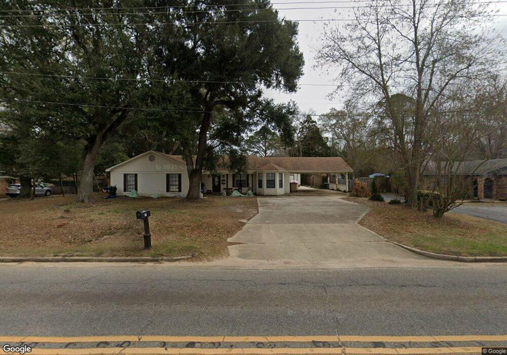
955 Dawes Rd Mobile, AL 36695
Kimberline NeighborhoodEstimated Value: $219,000 - $232,000
3
Beds
2
Baths
2,062
Sq Ft
$109/Sq Ft
Est. Value
About This Home
This home is located at 955 Dawes Rd, Mobile, AL 36695 and is currently estimated at $225,022, approximately $109 per square foot. 955 Dawes Rd is a home located in Mobile County with nearby schools including O'rourke Elementary School, Bernice J Causey Middle School, and Baker High School.
Ownership History
Date
Name
Owned For
Owner Type
Purchase Details
Closed on
Oct 18, 2022
Sold by
Crawford Raymond and Crawford Hannah
Bought by
Grimes Walter Stephen
Current Estimated Value
Home Financials for this Owner
Home Financials are based on the most recent Mortgage that was taken out on this home.
Original Mortgage
$196,377
Outstanding Balance
$188,059
Interest Rate
5.89%
Mortgage Type
FHA
Estimated Equity
$36,963
Purchase Details
Closed on
Aug 21, 2020
Sold by
Rhf Investments Llc
Bought by
Crawford Raymond and Crawford Hannah
Home Financials for this Owner
Home Financials are based on the most recent Mortgage that was taken out on this home.
Original Mortgage
$170,940
Interest Rate
2.9%
Mortgage Type
VA
Purchase Details
Closed on
Mar 24, 2020
Sold by
Casselberry Carolyn Z and Lancaster Richard E
Bought by
Rhf Investments Llc
Create a Home Valuation Report for This Property
The Home Valuation Report is an in-depth analysis detailing your home's value as well as a comparison with similar homes in the area
Home Values in the Area
Average Home Value in this Area
Purchase History
| Date | Buyer | Sale Price | Title Company |
|---|---|---|---|
| Grimes Walter Stephen | $200,000 | -- | |
| Crawford Raymond | $165,000 | First American Mortgage Sln | |
| Rhf Investments Llc | $65,000 | None Available |
Source: Public Records
Mortgage History
| Date | Status | Borrower | Loan Amount |
|---|---|---|---|
| Open | Grimes Walter Stephen | $196,377 | |
| Previous Owner | Crawford Raymond | $170,940 |
Source: Public Records
Tax History
| Year | Tax Paid | Tax Assessment Tax Assessment Total Assessment is a certain percentage of the fair market value that is determined by local assessors to be the total taxable value of land and additions on the property. | Land | Improvement |
|---|---|---|---|---|
| 2025 | $910 | $19,930 | $2,400 | $17,530 |
| 2024 | $910 | $20,340 | $2,400 | $17,940 |
| 2023 | $930 | $18,110 | $2,400 | $15,710 |
| 2022 | $770 | $17,250 | $2,400 | $14,850 |
| 2021 | $796 | $16,400 | $2,400 | $14,000 |
| 2020 | $0 | $27,440 | $4,800 | $22,640 |
| 2019 | $0 | $13,020 | $2,450 | $10,570 |
| 2018 | $0 | $13,040 | $0 | $0 |
| 2017 | $0 | $13,380 | $0 | $0 |
| 2016 | -- | $13,640 | $0 | $0 |
| 2013 | -- | $13,480 | $0 | $0 |
Source: Public Records
Map
Nearby Homes
- 8053 Stacey Rd Unit 36
- 8051 Bonanza Dr
- 8051 Kimberlin Dr S
- 740 Abbey Way Unit 13
- 758 Abbey Way Unit 15
- 741 Abbey Way Unit 42
- 1350 A Schillinger Rd S
- 1350 Schillinger Rd S
- 0 Three Dean Way Unit 7712046
- 8621 Grelot Rd
- 1030 Hamilton Bridges Dr E
- 0 Air Terminal Dr Unit 7717451
- 8710 Londonderry Ct Unit 2
- 8391 Jeff Hamilton Road Extension
- 8391 Jeff Hamilton Road Extension
- 8601 Grelot Rd
- 0 Airport Blvd Unit 7368583
- 0 Airport Blvd Unit 7368582
- 8050 Saint Jude Cir N
- 7693 Pembroke Cir
- 971 Dawes Rd
- 981 Dawes Rd
- 951 Dawes Rd
- 8201 Kimberlin Dr S
- 963 Dawes Rd
- 8191 Kimberlin Dr S
- 8181 Kimberlin Dr S
- 1040 Cruisair Cir
- 1001 Leroy Stevens Rd
- 1050 Cruisair Cir
- 8210 Kimberlin Dr S
- 8013 Kimberlin Dr S
- 1011 Leroy Stevens Rd
- 8200 Kimberlin Dr S
- 990 Dawes Rd
- 950 Debonair Dr
- 8171 Cruisair Cir
- 8161 Cruisair Cir
- 973 Debonair Dr
- 1021 Leroy Stevens Rd
Your Personal Tour Guide
Ask me questions while you tour the home.