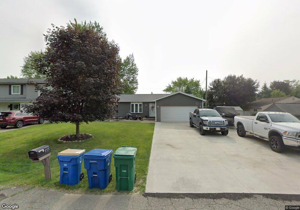
955 Ledyard St Waterford, MI 48328
Waterford Township NeighborhoodEstimated Value: $246,000 - $276,000
3
Beds
2
Baths
1,097
Sq Ft
$242/Sq Ft
Est. Value
About This Home
This home is located at 955 Ledyard St, Waterford, MI 48328 and is currently estimated at $265,867, approximately $242 per square foot. 955 Ledyard St is a home located in Oakland County with nearby schools including Donelson Hills Elementary School, Mason Middle School, and Waterford Mott High School.
Ownership History
Date
Name
Owned For
Owner Type
Purchase Details
Closed on
Jan 8, 2008
Sold by
Chapwanya Webster and Chapwanya Sylvia
Bought by
Wells Fargo Bank Na and Option One Mortgage Loan Trust 2005-4 As
Current Estimated Value
Purchase Details
Closed on
May 30, 2003
Sold by
Dailey Dayton and Ducklow Sandra
Bought by
Chapwanya Webster and Chapwanya Sylvia
Purchase Details
Closed on
May 5, 2003
Sold by
Kuehn Jacob F and Kuehn Florence
Bought by
Ducklow Sandra and Dailey Dayton
Purchase Details
Closed on
Jun 16, 2000
Sold by
Ducklow Dale L
Bought by
Ducklow Sandra L
Create a Home Valuation Report for This Property
The Home Valuation Report is an in-depth analysis detailing your home's value as well as a comparison with similar homes in the area
Home Values in the Area
Average Home Value in this Area
Purchase History
| Date | Buyer | Sale Price | Title Company |
|---|---|---|---|
| Wells Fargo Bank Na | $116,450 | None Available | |
| Chapwanya Webster | $169,000 | Metropolitan Title Company | |
| Ducklow Sandra | -- | Metropolitan Title Company | |
| Ducklow Sandra L | -- | -- |
Source: Public Records
Tax History Compared to Growth
Tax History
| Year | Tax Paid | Tax Assessment Tax Assessment Total Assessment is a certain percentage of the fair market value that is determined by local assessors to be the total taxable value of land and additions on the property. | Land | Improvement |
|---|---|---|---|---|
| 2024 | $1,337 | $121,730 | $0 | $0 |
| 2023 | $1,275 | $113,610 | $0 | $0 |
| 2022 | $1,401 | $92,500 | $0 | $0 |
| 2021 | $1,326 | $82,760 | $0 | $0 |
| 2020 | $797 | $79,800 | $0 | $0 |
| 2019 | $1,295 | $75,320 | $0 | $0 |
| 2018 | $1,285 | $62,150 | $0 | $0 |
| 2017 | $1,189 | $62,150 | $0 | $0 |
| 2016 | $1,179 | $56,530 | $0 | $0 |
| 2015 | -- | $52,800 | $0 | $0 |
| 2014 | -- | $45,120 | $0 | $0 |
| 2011 | -- | $43,480 | $0 | $0 |
Source: Public Records
Map
Nearby Homes
- 715 Woodingham Ave
- 3553 Port Cove Dr Unit 39
- 3559 Port Cove Dr Unit 25
- 3559 Port Cove Dr Unit 17
- 3891 Oak Knoll Rd
- 603 Woodingham Ave
- 3313 Harbours Blvd
- 3932 Oak Knoll Rd
- 000 Cass Lake Rd
- 3964 Oak Knoll Rd
- 540 Lake Village Ave
- 581 S Winding Dr
- 433 Hogarth St
- 425 Hogarth St
- 424 Hogarth St
- The Dover Plan at Hogarth
- The Dawson Plan at Hogarth
- The Concord Plan at Hogarth
- The Everest Plan at Hogarth
- 3860 Lawley Ave
- 951 Ledyard St Unit Bldg-Unit
- 951 Ledyard St
- 3580 Cass Elizabeth Rd
- 3590 Cass Elizabeth Rd
- 945 Ledyard St
- 954 Hogarth Ave
- 950 Hogarth Ave
- 3610 Cass Elizabeth Rd
- 941 Ledyard St
- 3560 Cass Elizabeth Rd
- 946 Hogarth Ave
- 976 Ledyard St
- 3620 Cass Elizabeth Rd
- 960 Ledyard St
- 920 Ledyard St
- 942 Hogarth Ave
- 3550 Cass Elizabeth Rd
- 3630 Cass Elizabeth Rd
- 937 Ledyard St
- 900 Ledyard St