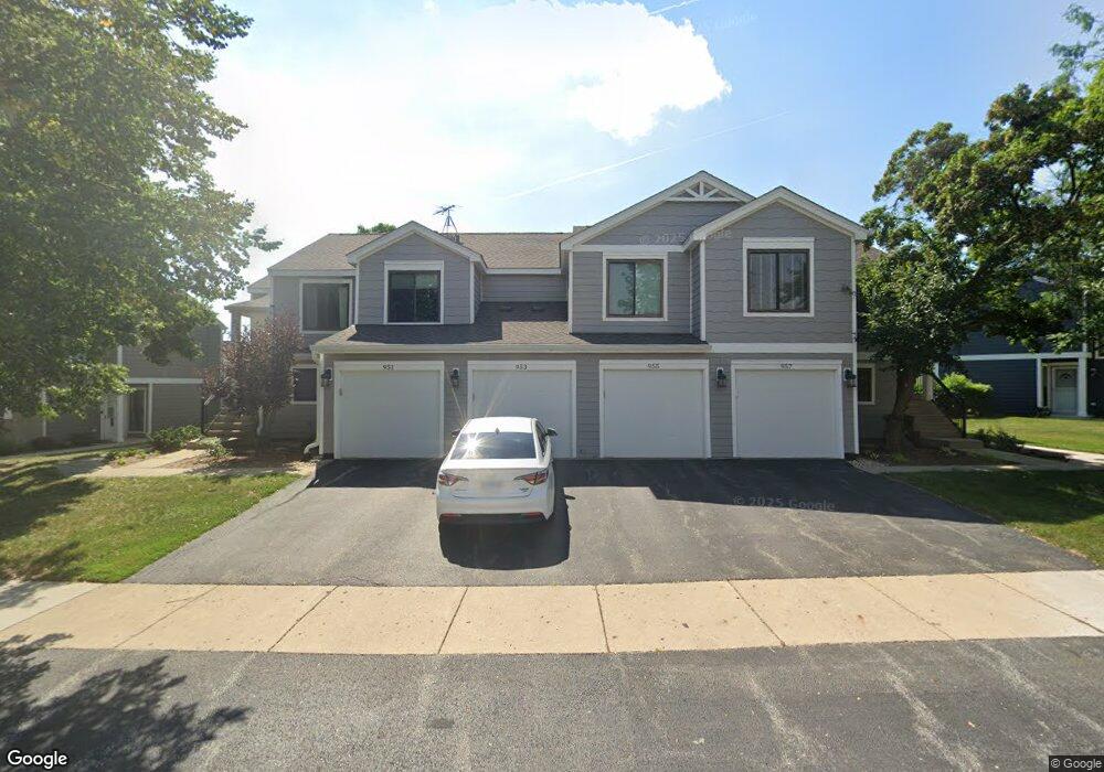
955 Manchester Cir Unit 152B Schaumburg, IL 60193
South Schaumburg NeighborhoodEstimated Value: $276,634 - $301,000
2
Beds
--
Bath
1,200
Sq Ft
$243/Sq Ft
Est. Value
About This Home
This home is located at 955 Manchester Cir Unit 152B, Schaumburg, IL 60193 and is currently estimated at $291,909, approximately $243 per square foot. 955 Manchester Cir Unit 152B is a home located in Cook County with nearby schools including Michael Collins Elementary School, Robert Frost Junior High School, and J B Conant High School.
Ownership History
Date
Name
Owned For
Owner Type
Purchase Details
Closed on
Dec 6, 2017
Sold by
Ringquist Karen S
Bought by
The Karen S Ringquist Living Trust Dated
Current Estimated Value
Purchase Details
Closed on
Nov 2, 2016
Sold by
Matthew Walsh
Bought by
Stresino Peter
Home Financials for this Owner
Home Financials are based on the most recent Mortgage that was taken out on this home.
Original Mortgage
$139,500
Outstanding Balance
$112,171
Interest Rate
3.47%
Estimated Equity
$179,738
Purchase Details
Closed on
Jul 31, 1997
Sold by
Winter Janice L and Dickinson Warren P
Bought by
Ringquist Karen S
Home Financials for this Owner
Home Financials are based on the most recent Mortgage that was taken out on this home.
Original Mortgage
$118,750
Interest Rate
7.55%
Create a Home Valuation Report for This Property
The Home Valuation Report is an in-depth analysis detailing your home's value as well as a comparison with similar homes in the area
Home Values in the Area
Average Home Value in this Area
Purchase History
| Date | Buyer | Sale Price | Title Company |
|---|---|---|---|
| The Karen S Ringquist Living Trust Dated | -- | Chicago Title Insurance Comp | |
| Stresino Peter | -- | -- | |
| Ringquist Karen S | $83,333 | Attorneys Natl Title Network |
Source: Public Records
Mortgage History
| Date | Status | Borrower | Loan Amount |
|---|---|---|---|
| Open | Stresino Peter | $139,500 | |
| Closed | Stresino Peter | -- | |
| Previous Owner | Ringquist Karen S | $118,750 |
Source: Public Records
Tax History Compared to Growth
Tax History
| Year | Tax Paid | Tax Assessment Tax Assessment Total Assessment is a certain percentage of the fair market value that is determined by local assessors to be the total taxable value of land and additions on the property. | Land | Improvement |
|---|---|---|---|---|
| 2024 | $4,645 | $19,900 | $4,663 | $15,237 |
| 2023 | $4,476 | $19,900 | $4,663 | $15,237 |
| 2022 | $4,476 | $19,900 | $4,663 | $15,237 |
| 2021 | $3,849 | $16,029 | $2,543 | $13,486 |
| 2020 | $3,851 | $16,029 | $2,543 | $13,486 |
| 2019 | $3,855 | $17,810 | $2,543 | $15,267 |
| 2018 | $2,682 | $12,371 | $2,119 | $10,252 |
| 2017 | $2,657 | $12,371 | $2,119 | $10,252 |
| 2016 | $2,727 | $12,371 | $2,119 | $10,252 |
| 2015 | $2,505 | $10,998 | $1,907 | $9,091 |
| 2014 | $2,494 | $10,998 | $1,907 | $9,091 |
| 2013 | $2,413 | $10,998 | $1,907 | $9,091 |
Source: Public Records
Map
Nearby Homes
- 126 Manchester Ct Unit 61B
- 916 Manchester Cir Unit 91A
- 205 Nantucket Harbor Unit 104
- 1100 Boston Harbor Unit 7004
- 36 Shore Dr
- 421 E Wise Rd
- 426 E Niagara Ave
- 124 E Monterey Ave
- 733 Limerick Ln Unit 7333D
- 711 Tipperary Ct Unit 2D
- 712 Tipperary Ct Unit 1C
- 727 Killarney Ct Unit 1C
- 620 S Point Dr
- 718 N Point Dr
- 631 Derry Ct Unit 3C
- 635 Limerick Ln Unit 2B
- 614 Tralee Ct Unit 2-C
- 553 Stone Gate Cir
- 421 Summit Dr
- 722 Merlin Dr Unit 16
- 951 Manchester Cir Unit 151A
- 957 Manchester Cir Unit 151B
- 953 Manchester Cir Unit 152A
- 953 Manchester Cir Unit 953
- 945 Manchester Cir Unit 142B
- 947 Manchester Cir Unit 141B
- 947 Manchester Cir Unit 947
- 941 Manchester Cir Unit 141A
- 963 Manchester Cir Unit 162A
- 943 Manchester Cir Unit 142A
- 137 Manchester Ct
- 137 Manchester Ct Unit 21A
- 134 Manchester Ct Unit 72B
- 961 Manchester Cir Unit 161A
- 136 Manchester Ct Unit 71B
- 135 Manchester Ct Unit 22A
- 131 Manchester Ct Unit 21B
- 965 Manchester Cir Unit 162B
- 965 Manchester Cir Unit 965
- 222 E Hartford Dr Unit 172A