Estimated Value: $199,478
2
Beds
1
Bath
1,348
Sq Ft
$148/Sq Ft
Est. Value
About This Home
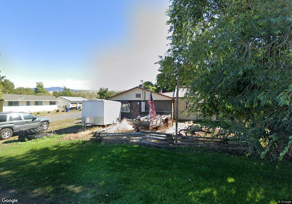
This home is located at 955 N Benson St, Union, OR 97883 and is currently estimated at $199,478, approximately $147 per square foot. 955 N Benson St is a home with nearby schools including Union Elementary School and Union High School.
Ownership History
Date
Name
Owned For
Owner Type
Purchase Details
Closed on
Oct 22, 2014
Sold by
Hull Tod M
Bought by
Hull Tod M and Hull Angel
Current Estimated Value
Home Financials for this Owner
Home Financials are based on the most recent Mortgage that was taken out on this home.
Original Mortgage
$54,100
Outstanding Balance
$17,206
Interest Rate
4.2%
Mortgage Type
New Conventional
Estimated Equity
$182,272
Create a Home Valuation Report for This Property
The Home Valuation Report is an in-depth analysis detailing your home's value as well as a comparison with similar homes in the area
Purchase History
| Date | Buyer | Sale Price | Title Company |
|---|---|---|---|
| Hull Tod M | -- | None Available |
Source: Public Records
Mortgage History
| Date | Status | Borrower | Loan Amount |
|---|---|---|---|
| Open | Hull Tod M | $54,100 |
Source: Public Records
Tax History
| Year | Tax Paid | Tax Assessment Tax Assessment Total Assessment is a certain percentage of the fair market value that is determined by local assessors to be the total taxable value of land and additions on the property. | Land | Improvement |
|---|---|---|---|---|
| 2025 | $990 | $69,670 | $31,790 | $37,880 |
| 2024 | $879 | $67,650 | $30,870 | $36,780 |
| 2023 | $851 | $65,680 | $29,970 | $35,710 |
| 2022 | $846 | $63,769 | $29,098 | $34,671 |
| 2021 | $823 | $61,912 | $28,219 | $33,693 |
| 2020 | $797 | $60,109 | $27,335 | $32,774 |
| 2019 | $720 | $58,359 | $30,815 | $27,544 |
| 2018 | $701 | $56,660 | $29,970 | $26,690 |
| 2017 | $618 | $55,010 | $29,251 | $25,759 |
| 2016 | $624 | $53,408 | $28,400 | $25,008 |
| 2015 | $600 | $51,853 | $28,883 | $22,970 |
| 2014 | $584 | $50,343 | $28,091 | $22,252 |
| 2013 | -- | $48,877 | $25,615 | $23,262 |
Source: Public Records
Map
Nearby Homes
- 141 E Bryan Ave
- 320 W Delta St
- 527 S Dewey St
- 558 E Fulton St
- 216 E Fulton St
- 845 W Arch St
- 0 E Fulton St Unit 170916477
- 370 Heritage Ln
- 320 Heritage Ln
- 1020 S 2nd St
- 240 Heritage Ln
- 61615 High Valley Rd
- 59926 Comstock Rd
- 0 Rose Ridge Rd Unit 3
- 0 Rose Ridge Rd Unit 1
- 0 Rose Ridge Rd Unit 22290306
- 0 Rose Ridge Rd Unit 2
- 606 2nd St
- 0 Conklin Ln Unit 232609065
- 69431 Antles Ln Unit 1
- 1029 N Benson St
- 1089 N Benson St
- 760 E Hickory St
- 871 N Benson St
- 1058 N Benson St
- 802 W Hickory St Union Or St
- 911 N Cove St
- 670 E Fir St
- 815 N Benson St
- 1063 N Cove St
- 833 N Cove St
- 1133 N Benson St
- 940 N Cove St
- 675 E Elm St
- 1010 N Cove St
- 539 E Fir St Unit 41
- 610 E Elm St
- 568 E Hickory St
- 762 E Bryan St
- 800 E Bryan St
Your Personal Tour Guide
Ask me questions while you tour the home.