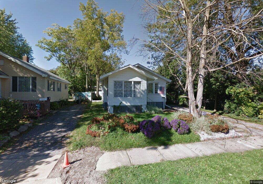
955 S Stone St Decatur, IL 62521
Saint Mary's NeighborhoodEstimated Value: $38,000 - $48,000
1
Bed
1
Bath
1,568
Sq Ft
$27/Sq Ft
Est. Value
About This Home
This home is located at 955 S Stone St, Decatur, IL 62521 and is currently estimated at $41,781, approximately $26 per square foot. 955 S Stone St is a home located in Macon County with nearby schools including South Shores Elementary School, Stephen Decatur Middle School, and St. Patrick School.
Ownership History
Date
Name
Owned For
Owner Type
Purchase Details
Closed on
May 5, 2016
Sold by
Lecrandc Dustin
Bought by
Judd Bourne Enterprises Llc
Current Estimated Value
Purchase Details
Closed on
Dec 7, 2015
Sold by
Schneider Thomas
Bought by
Bayview Loan Servicing Llc
Purchase Details
Closed on
Jul 1, 2005
Sold by
Fishel David D
Bought by
Renn Robert B and Renn Sarah J
Home Financials for this Owner
Home Financials are based on the most recent Mortgage that was taken out on this home.
Original Mortgage
$25,882
Interest Rate
6.18%
Mortgage Type
FHA
Purchase Details
Closed on
Jan 1, 2001
Create a Home Valuation Report for This Property
The Home Valuation Report is an in-depth analysis detailing your home's value as well as a comparison with similar homes in the area
Home Values in the Area
Average Home Value in this Area
Purchase History
| Date | Buyer | Sale Price | Title Company |
|---|---|---|---|
| Judd Bourne Enterprises Llc | $5,000 | None Available | |
| Bayview Loan Servicing Llc | -- | None Available | |
| Renn Robert B | $20,000 | None Available | |
| -- | $12,500 | -- |
Source: Public Records
Mortgage History
| Date | Status | Borrower | Loan Amount |
|---|---|---|---|
| Previous Owner | Renn Robert B | $25,882 |
Source: Public Records
Tax History Compared to Growth
Tax History
| Year | Tax Paid | Tax Assessment Tax Assessment Total Assessment is a certain percentage of the fair market value that is determined by local assessors to be the total taxable value of land and additions on the property. | Land | Improvement |
|---|---|---|---|---|
| 2024 | $850 | $8,779 | $1,141 | $7,638 |
| 2023 | $843 | $8,469 | $1,101 | $7,368 |
| 2022 | $812 | $7,940 | $1,019 | $6,921 |
| 2021 | $763 | $7,415 | $951 | $6,464 |
| 2020 | $752 | $7,071 | $907 | $6,164 |
| 2019 | $752 | $7,071 | $907 | $6,164 |
| 2018 | $847 | $8,065 | $614 | $7,451 |
| 2017 | $867 | $8,280 | $630 | $7,650 |
| 2016 | $884 | $8,364 | $636 | $7,728 |
| 2015 | $375 | $8,216 | $625 | $7,591 |
| 2014 | $351 | $8,135 | $619 | $7,516 |
| 2013 | $159 | $8,440 | $642 | $7,798 |
Source: Public Records
Map
Nearby Homes
- 1263 E Dickinson Ave
- 1104 E Moore St
- 1232 S Silas St
- 1283 S Illinois St
- 1408 E Buena Vista Ave
- 632 S 17th St
- 1347 S Maffit St
- 409 Southmoreland Place
- 1952 Florida Ct
- 1155 S 20th St
- 1232 E Johns Ave
- 1127 S 21st St
- 22 Eastmoreland Ln
- 1605 E Clay St
- 1136 S 21st St
- 2039 E Whitmer St
- 1764 E Johns Ave
- 1753 E Clay St
- 1645 E Wood St
- 2104 E Whitmer St
- 965 S Stone St
- 1261 Bon Air Ct
- 927 S Stone St
- 1251 Bon Air Ct
- 1251 E Bon Air Ct
- 923 S Stone St
- 1241 Bon Air Ct
- 1266 E Dickinson Ave
- 952 S Stone St
- 1264 E Dickinson Ave
- 1256 E Dickinson Ave
- 1272 E Dickinson Ave
- 895 S Stone St
- 1248 Bon Air Ct
- 1244 E Dickinson Ave
- 1231 E Bon Air Ct
- 958 S Stone St
- 1274 E Dickinson Ave
- 966 S Stone St
- 1238 Bon Air Ct