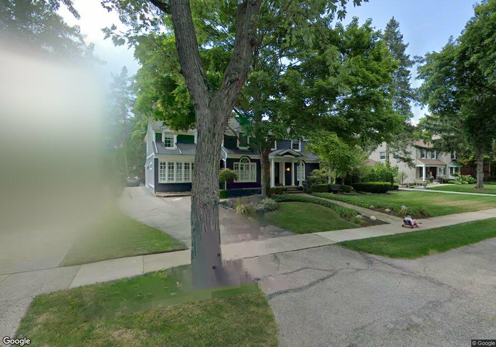
955 Suffield Ave Birmingham, MI 48009
Estimated Value: $1,652,617 - $1,965,000
4
Beds
5
Baths
3,408
Sq Ft
$529/Sq Ft
Est. Value
About This Home
This home is located at 955 Suffield Ave, Birmingham, MI 48009 and is currently estimated at $1,803,404, approximately $529 per square foot. 955 Suffield Ave is a home located in Oakland County with nearby schools including Quarton Elementary, Derby Middle School, and Ernest W. Seaholm High School.
Ownership History
Date
Name
Owned For
Owner Type
Purchase Details
Closed on
Jun 22, 2011
Sold by
Simon Paul J and Simon Sara J
Bought by
Vohra Taher T and Vohra Alifya
Current Estimated Value
Home Financials for this Owner
Home Financials are based on the most recent Mortgage that was taken out on this home.
Original Mortgage
$404,800
Outstanding Balance
$18,539
Interest Rate
4.67%
Mortgage Type
Purchase Money Mortgage
Estimated Equity
$1,784,865
Purchase Details
Closed on
May 12, 2001
Sold by
Peyton Thomas J
Bought by
Simon Paul J
Create a Home Valuation Report for This Property
The Home Valuation Report is an in-depth analysis detailing your home's value as well as a comparison with similar homes in the area
Home Values in the Area
Average Home Value in this Area
Purchase History
| Date | Buyer | Sale Price | Title Company |
|---|---|---|---|
| Vohra Taher T | $506,000 | Complete Title Services Of S | |
| Simon Paul J | -- | -- |
Source: Public Records
Mortgage History
| Date | Status | Borrower | Loan Amount |
|---|---|---|---|
| Open | Vohra Taher T | $404,800 |
Source: Public Records
Tax History
| Year | Tax Paid | Tax Assessment Tax Assessment Total Assessment is a certain percentage of the fair market value that is determined by local assessors to be the total taxable value of land and additions on the property. | Land | Improvement |
|---|---|---|---|---|
| 2025 | $18,255 | $741,790 | $0 | $0 |
| 2024 | $16,115 | $703,040 | $0 | $0 |
| 2023 | $15,442 | $668,770 | $0 | $0 |
| 2022 | $16,557 | $639,110 | $0 | $0 |
| 2021 | $16,704 | $640,460 | $0 | $0 |
| 2020 | $11,646 | $540,680 | $0 | $0 |
| 2019 | $13,180 | $529,330 | $0 | $0 |
| 2018 | $13,079 | $509,130 | $0 | $0 |
| 2017 | $13,056 | $497,580 | $0 | $0 |
| 2016 | $13,081 | $477,780 | $0 | $0 |
| 2015 | -- | $389,580 | $0 | $0 |
| 2014 | -- | $362,450 | $0 | $0 |
| 2011 | -- | $284,650 | $0 | $0 |
Source: Public Records
Map
Nearby Homes
- 1094 Suffield Ave
- 1183 Puritan Ave
- 1120 Lyonhurst St
- 1882 Melbourne St
- 1444 Fairfax St
- 592 Lakeside Dr
- 1295 Lakeside Dr
- 750 Hazelwood St
- 1115 N Old Woodward Ave Unit 52
- 1115 N Old Woodward Ave Unit 61
- 1551 Lakeside Dr
- 1115 N Old Woodward #76 Ave
- 1115 N Old Woodward Ave
- 1111 N Old Woodward Ave Unit 4
- 1111 N Old Woodward Ave Unit 23
- 667 Oak Ave
- 670 Oak Ave
- 395 Greenwood St
- 488 Vinewood Ave
- 601 Dewey St
- 933 Suffield Ave
- 993 Suffield Ave
- 948 Fairfax St
- 921 Suffield Ave
- 932 Fairfax St
- 990 Fairfax St
- 1009 Suffield Ave
- 976 Suffield Ave
- 954 Suffield Ave
- 910 Fairfax St
- 998 Suffield Ave
- 916 Suffield Ave
- 1027 Suffield Ave
- 1010 Fairfax St
- 1000 Suffield Ave
- 889 Suffield Ave Unit Bldg-Unit
- 889 Suffield Ave
- 1028 Suffield Ave
- 1033 Suffield Ave
- 878 Fairfax St
Your Personal Tour Guide
Ask me questions while you tour the home.