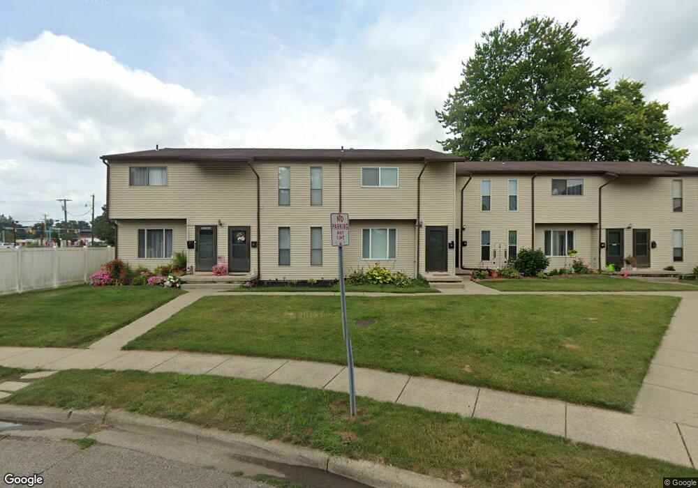
955 Welsh View Dr Newark, OH 43055
Estimated Value: $384,000
--
Bed
--
Bath
7,072
Sq Ft
$54/Sq Ft
Est. Value
About This Home
This home is located at 955 Welsh View Dr, Newark, OH 43055 and is currently estimated at $384,000, approximately $54 per square foot. 955 Welsh View Dr is a home located in Licking County with nearby schools including John Clem Elementary School, Liberty Middle School, and Newark High School.
Ownership History
Date
Name
Owned For
Owner Type
Purchase Details
Closed on
Jul 1, 2019
Sold by
Guanciale Family Limited Partnership
Bought by
Pag Properties Iv Ltd
Current Estimated Value
Home Financials for this Owner
Home Financials are based on the most recent Mortgage that was taken out on this home.
Original Mortgage
$1,324,875
Outstanding Balance
$873,893
Interest Rate
4%
Mortgage Type
Future Advance Clause Open End Mortgage
Estimated Equity
-$489,893
Create a Home Valuation Report for This Property
The Home Valuation Report is an in-depth analysis detailing your home's value as well as a comparison with similar homes in the area
Home Values in the Area
Average Home Value in this Area
Purchase History
| Date | Buyer | Sale Price | Title Company |
|---|---|---|---|
| Pag Properties Iv Ltd | $1,766,500 | None Available |
Source: Public Records
Mortgage History
| Date | Status | Borrower | Loan Amount |
|---|---|---|---|
| Open | Pag Properties Iv Ltd | $1,324,875 |
Source: Public Records
Tax History Compared to Growth
Tax History
| Year | Tax Paid | Tax Assessment Tax Assessment Total Assessment is a certain percentage of the fair market value that is determined by local assessors to be the total taxable value of land and additions on the property. | Land | Improvement |
|---|---|---|---|---|
| 2024 | $8,482 | $205,800 | $34,300 | $171,500 |
| 2023 | $8,464 | $205,800 | $34,300 | $171,500 |
| 2022 | $5,750 | $120,750 | $17,150 | $103,600 |
| 2021 | $6,058 | $120,750 | $17,150 | $103,600 |
| 2020 | $6,168 | $120,750 | $17,150 | $103,600 |
| 2019 | $6,205 | $120,750 | $17,150 | $103,600 |
| 2018 | $6,254 | $0 | $0 | $0 |
| 2017 | $5,935 | $0 | $0 | $0 |
| 2016 | $6,039 | $0 | $0 | $0 |
| 2015 | $6,183 | $0 | $0 | $0 |
| 2014 | $7,093 | $0 | $0 | $0 |
| 2013 | $5,952 | $0 | $0 | $0 |
Source: Public Records
Map
Nearby Homes
- 473 Meadowbrook Dr
- 440 Reverie Place
- 913 Roosevelt Ct
- 584 Moull St Unit A
- 1006 Kingsbury Ct Unit 1006
- 712 Stone Ridge Way
- 188 Meadow Dr
- 184 Meadow Dr
- 709 Meadow Dr
- 245 Rugg Ave
- 711 Sherwick Rd
- 855 E Village Dr
- 189 N Quentin Rd
- 632 Granville Rd
- 181 S Quentin Rd
- 425 N 11th St
- 565 Granville St
- 376 Woods Ave
- 408 Granville St
- 988 Mount Vernon Rd
- 357 Alford Dr
- 350 Welsh View Dr
- 964 N 21st St
- 360 Alford Dr
- 627 Kennedy St
- 365 Alford Dr
- 340 W Trinity Way
- 635 Kennedy St
- 945 Welsh View Dr
- 502 Meadowbrook Dr
- 371 Alford Dr
- 0 N 21st St
- 641 Kennedy St
- 494 Meadowbrook Dr
- 945 Welsh Dr
- 379 Alford Dr
- 380 Alford Dr
- 491 Catalina Dr Unit F6
- 491 Catalina Dr
- 491 Catalina Dr Unit F-5