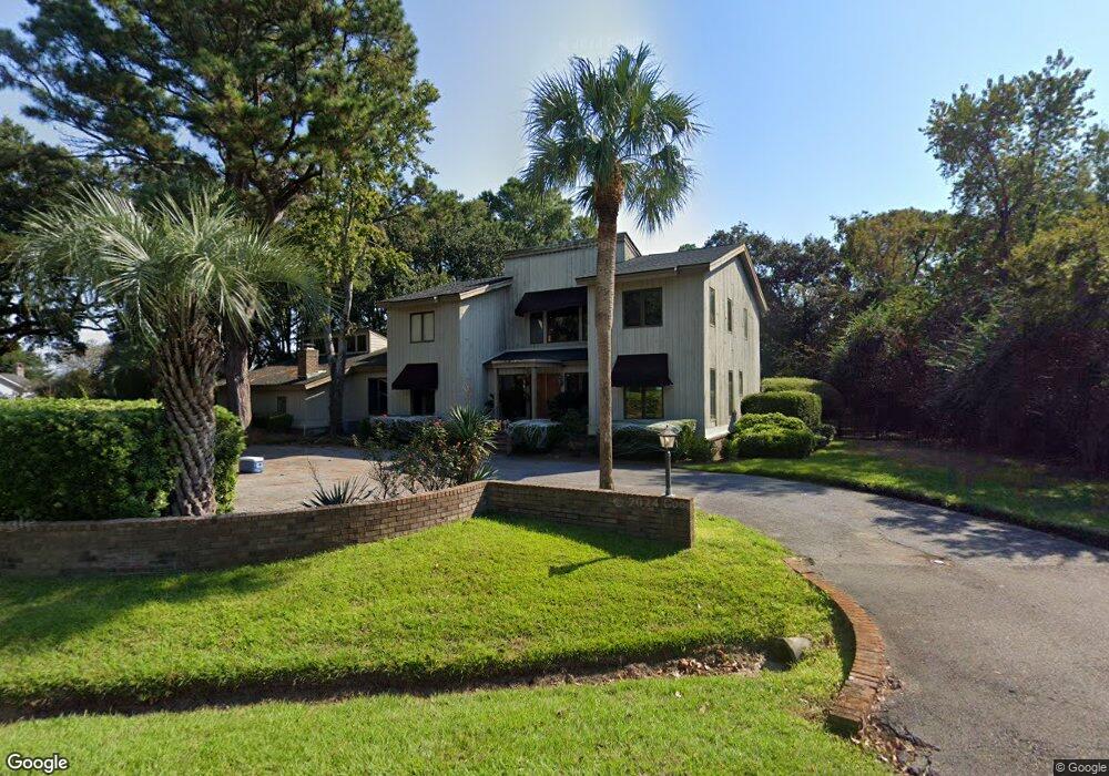
955 White Point Blvd Charleston, SC 29412
James Island NeighborhoodEstimated Value: $1,130,000 - $1,754,085
4
Beds
5
Baths
4,133
Sq Ft
$362/Sq Ft
Est. Value
About This Home
This home is located at 955 White Point Blvd, Charleston, SC 29412 and is currently estimated at $1,494,521, approximately $361 per square foot. 955 White Point Blvd is a home located in Charleston County with nearby schools including Harbor View Elementary School, Camp Road Middle, and James Island Charter High School.
Ownership History
Date
Name
Owned For
Owner Type
Purchase Details
Closed on
Jul 13, 2010
Sold by
Mcspadden Margaret S and Mcspadden Earle F
Bought by
Huffman Lauren T
Current Estimated Value
Home Financials for this Owner
Home Financials are based on the most recent Mortgage that was taken out on this home.
Original Mortgage
$417,000
Outstanding Balance
$278,070
Interest Rate
4.79%
Mortgage Type
New Conventional
Estimated Equity
$1,216,451
Create a Home Valuation Report for This Property
The Home Valuation Report is an in-depth analysis detailing your home's value as well as a comparison with similar homes in the area
Home Values in the Area
Average Home Value in this Area
Purchase History
| Date | Buyer | Sale Price | Title Company |
|---|---|---|---|
| Huffman Lauren T | $470,000 | -- |
Source: Public Records
Mortgage History
| Date | Status | Borrower | Loan Amount |
|---|---|---|---|
| Open | Huffman Lauren T | $417,000 |
Source: Public Records
Tax History Compared to Growth
Tax History
| Year | Tax Paid | Tax Assessment Tax Assessment Total Assessment is a certain percentage of the fair market value that is determined by local assessors to be the total taxable value of land and additions on the property. | Land | Improvement |
|---|---|---|---|---|
| 2024 | $3,059 | $23,570 | $0 | $0 |
| 2023 | $3,059 | $23,570 | $0 | $0 |
| 2022 | $2,860 | $23,570 | $0 | $0 |
| 2021 | $3,002 | $23,570 | $0 | $0 |
| 2020 | $3,114 | $23,570 | $0 | $0 |
| 2019 | $2,766 | $20,490 | $0 | $0 |
| 2017 | $2,668 | $20,490 | $0 | $0 |
| 2016 | $2,556 | $20,490 | $0 | $0 |
| 2015 | $2,643 | $20,490 | $0 | $0 |
| 2014 | $2,377 | $0 | $0 | $0 |
| 2011 | -- | $0 | $0 | $0 |
Source: Public Records
Map
Nearby Homes
- 924 White Point Blvd
- 881 Kushiwah Creek Dr
- 897 Kushiwah Creek Ct
- 1026 Fort Sumter Dr
- 825 Shutes Folly Dr
- 793 Shell Sand Rd
- 713 Lake Frances Dr
- 525 Yellow Tower Terrace
- 777 Lake Frances Dr
- 969 Harbor View Rd
- 975 Harbor View Rd
- 1077 Harbor View Rd
- 1110 Darwin St
- 620 N Shore Dr
- 679 Edmonds Dr
- 3009 Allison Cove Dr
- 683 Edmonds Dr
- 816 Porcari St
- 804 Porcari St
- 643 N Shore Dr
- 951 White Point Blvd
- 947 White Point Ct
- 940 White Point Blvd
- 961 White Point Blvd
- 944 White Point Blvd
- 945 White Point Ct
- 960 Paul Revere Dr
- 943 White Point Ct
- 936 White Point Blvd
- 948 White Point Blvd
- 963 White Point Blvd
- 952 White Point Blvd
- 957 Paul Revere Dr
- 929 Paul Revere Ct
- 932 White Point Blvd
- 939 Paul Revere Ct
- 967 White Point Blvd
- 935 White Point Blvd
- 965 White Point Blvd
- 938 Paul Revere Ct