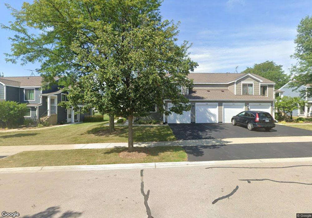
956 Brunswick Cir Unit 241A Schaumburg, IL 60193
South Schaumburg NeighborhoodEstimated Value: $255,000 - $271,000
2
Beds
--
Bath
1,200
Sq Ft
$219/Sq Ft
Est. Value
About This Home
This home is located at 956 Brunswick Cir Unit 241A, Schaumburg, IL 60193 and is currently estimated at $262,322, approximately $218 per square foot. 956 Brunswick Cir Unit 241A is a home located in Cook County with nearby schools including Michael Collins Elementary School, Robert Frost Junior High School, and J B Conant High School.
Ownership History
Date
Name
Owned For
Owner Type
Purchase Details
Closed on
Oct 29, 2004
Sold by
Wolnik Deborah A
Bought by
Dreyer Lucy R
Current Estimated Value
Home Financials for this Owner
Home Financials are based on the most recent Mortgage that was taken out on this home.
Original Mortgage
$156,700
Outstanding Balance
$70,766
Interest Rate
4.37%
Mortgage Type
Unknown
Estimated Equity
$191,556
Create a Home Valuation Report for This Property
The Home Valuation Report is an in-depth analysis detailing your home's value as well as a comparison with similar homes in the area
Home Values in the Area
Average Home Value in this Area
Purchase History
| Date | Buyer | Sale Price | Title Company |
|---|---|---|---|
| Dreyer Lucy R | $165,000 | First American Title Ins Co |
Source: Public Records
Mortgage History
| Date | Status | Borrower | Loan Amount |
|---|---|---|---|
| Open | Dreyer Lucy R | $156,700 |
Source: Public Records
Tax History Compared to Growth
Tax History
| Year | Tax Paid | Tax Assessment Tax Assessment Total Assessment is a certain percentage of the fair market value that is determined by local assessors to be the total taxable value of land and additions on the property. | Land | Improvement |
|---|---|---|---|---|
| 2024 | $735 | $17,570 | $4,117 | $13,453 |
| 2023 | $735 | $17,570 | $4,117 | $13,453 |
| 2022 | $735 | $17,570 | $4,117 | $13,453 |
| 2021 | $799 | $14,152 | $2,245 | $11,907 |
| 2020 | $731 | $14,152 | $2,245 | $11,907 |
| 2019 | $727 | $15,725 | $2,245 | $13,480 |
| 2018 | $816 | $10,922 | $1,871 | $9,051 |
| 2017 | $789 | $10,922 | $1,871 | $9,051 |
| 2016 | $1,371 | $10,922 | $1,871 | $9,051 |
| 2015 | $2,120 | $9,711 | $1,684 | $8,027 |
| 2014 | $2,113 | $9,711 | $1,684 | $8,027 |
| 2013 | $2,042 | $9,711 | $1,684 | $8,027 |
Source: Public Records
Map
Nearby Homes
- 916 Manchester Cir Unit 91A
- 126 Manchester Ct Unit 61B
- 1100 Boston Harbor Unit 7004
- 205 Nantucket Harbor Unit 104
- 421 E Wise Rd
- 36 Shore Dr
- 426 E Niagara Ave
- 124 E Monterey Ave
- 733 Limerick Ln Unit 7333D
- 711 Tipperary Ct Unit 2D
- 712 Tipperary Ct Unit 1C
- 718 N Point Dr
- 620 S Point Dr
- 727 Killarney Ct Unit 1C
- 631 Derry Ct Unit 3C
- 635 Limerick Ln Unit 2B
- 614 Tralee Ct Unit 2-C
- 421 Summit Dr
- 722 Merlin Dr Unit 16
- 553 Stone Gate Cir
- 954 Brunswick Cir Unit 242A
- 954 Brunswick Cir Unit 954
- 952 Brunswick Cir Unit 242B
- 950 Brunswick Cir Unit 241B
- 946 Brunswick Cir Unit 251A
- 960 Brunswick Cir Unit 231B
- 944 Brunswick Cir Unit 252A
- 955 Glouchester Cir Unit 212B
- 962 Brunswick Cir Unit 232B
- 964 Brunswick Cir Unit 232A
- 953 Glouchester Cir Unit 212A
- 966 Brunswick Cir Unit 231A
- 957 Glouchester Cir Unit 212B
- 951 Glouchester Cir Unit 211A
- 942 Brunswick Cir Unit 252B
- 940 Brunswick Cir Unit 1B
- 940 Brunswick Cir Unit 251B
- 953 Brunswick Cir Unit 312A
- 963 Glouchester Cir Unit 222A
- 947 Brunswick Cir Unit 301B