Estimated Value: $238,823 - $259,000
Studio
--
Bath
--
Sq Ft
0.54
Acres
About This Home
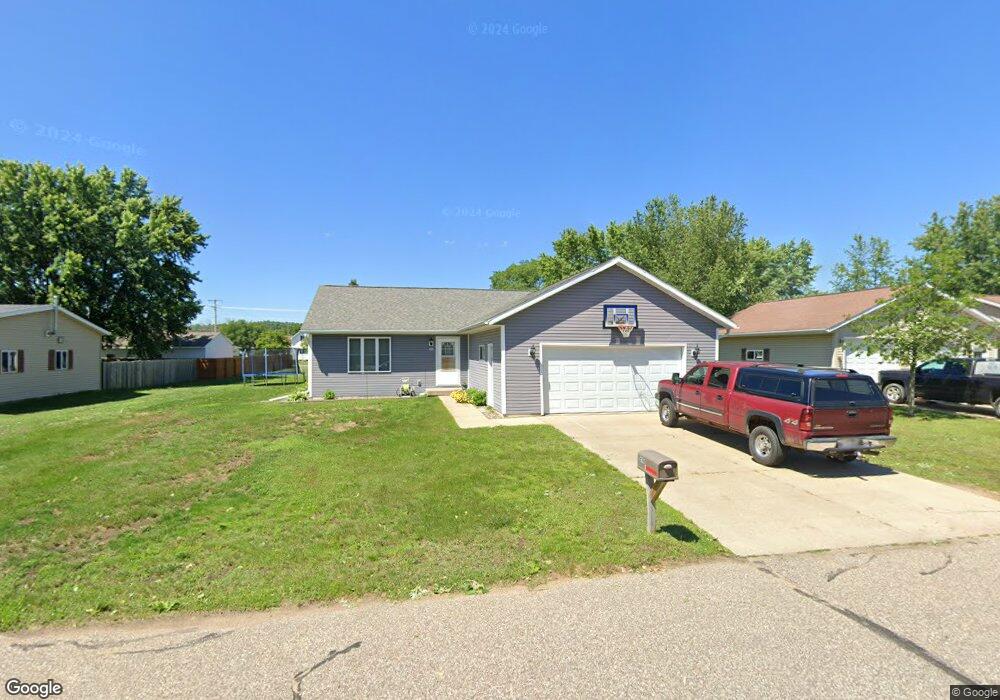
This home is located at 956 E Taft St, Blair, WI 54616 and is currently estimated at $251,456. 956 E Taft St is a home located in Trempealeau County with nearby schools including Blair-Taylor Elementary School, Blair-Taylor Middle/High School, and Pinehill Amish School.
Ownership History
Date
Name
Owned For
Owner Type
Purchase Details
Closed on
May 23, 2007
Sold by
Frederixon Dwight
Bought by
Flury Rock G and Flury Cynthia D
Current Estimated Value
Home Financials for this Owner
Home Financials are based on the most recent Mortgage that was taken out on this home.
Original Mortgage
$120,000
Outstanding Balance
$71,672
Interest Rate
6.2%
Mortgage Type
Future Advance Clause Open End Mortgage
Estimated Equity
$179,784
Create a Home Valuation Report for This Property
The Home Valuation Report is an in-depth analysis detailing your home's value as well as a comparison with similar homes in the area
Purchase History
| Date | Buyer | Sale Price | Title Company |
|---|---|---|---|
| Flury Rock G | $10,000 | None Available |
Source: Public Records
Mortgage History
| Date | Status | Borrower | Loan Amount |
|---|---|---|---|
| Open | Flury Rock G | $120,000 |
Source: Public Records
Tax History
| Year | Tax Paid | Tax Assessment Tax Assessment Total Assessment is a certain percentage of the fair market value that is determined by local assessors to be the total taxable value of land and additions on the property. | Land | Improvement |
|---|---|---|---|---|
| 2025 | $3,657 | $227,000 | $18,600 | $208,400 |
| 2024 | $3,668 | $227,000 | $18,600 | $208,400 |
| 2023 | $3,471 | $130,200 | $21,300 | $108,900 |
| 2022 | $3,301 | $130,200 | $21,300 | $108,900 |
| 2021 | $2,798 | $119,500 | $10,600 | $108,900 |
| 2020 | $2,522 | $21,490 | $10,600 | $10,890 |
| 2019 | $2,644 | $119,500 | $10,600 | $108,900 |
| 2018 | $2,302 | $119,500 | $10,600 | $108,900 |
| 2017 | $2,409 | $119,500 | $10,600 | $108,900 |
| 2016 | $2,213 | $119,500 | $10,600 | $108,900 |
| 2015 | $2,643 | $119,500 | $10,600 | $108,900 |
| 2014 | $2,450 | $119,500 | $10,600 | $108,900 |
| 2011 | $2,944 | $127,000 | $10,600 | $116,400 |
Source: Public Records
Map
Nearby Homes
- 128 E Broadway St
- 127 E Broadway St
- XX Vold Rd
- N34855 County Rd S
- N28190 Brekke Ridge Rd
- 0 Joe Coulee Rd
- 00 Joe Coulee Rd
- 211 2nd St
- W15971 Cedar Rd
- 21 Hanson St
- 21 Pearl St
- 06 Lot 6 Elm Ln
- 011 Lot 11 Elm Ln
- 05 Lot 5 Elm Ln
- 010 Lot 10 Elm Ln
- 37508 Haug Rd
- 18191 Hopkins St
- 36180 Main St Unit 1 & 2
- 36015 Main St
- 36180 Main St
- 954 E Taft St
- 911 E Broadway St
- 907 E Broadway St
- 957 E Taft St
- 952 E Taft St
- 955 E Taft St
- 959 E Taft St
- 844 E Broadway St
- 854 E Broadway St
- 913 E Broadway St
- 953 E Taft St
- 961 E Taft St
- 950 E Taft St
- 842 E Broadway St
- 904 E Olson St
- 115 S Birch St
- 105 S Birch St
- 105 S Birch St
- 910 E Broadway St
- 840 E Broadway St
Your Personal Tour Guide
Ask me questions while you tour the home.