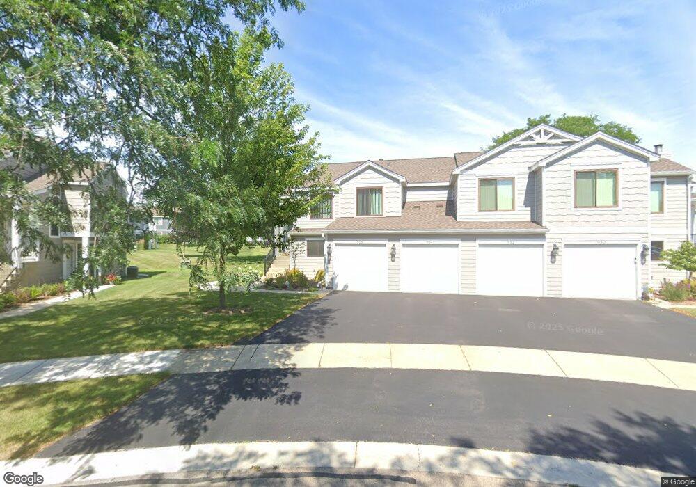
956 Glouchester Cir Unit 191A Schaumburg, IL 60193
South Schaumburg NeighborhoodEstimated Value: $265,829 - $281,000
2
Beds
--
Bath
1,200
Sq Ft
$229/Sq Ft
Est. Value
About This Home
This home is located at 956 Glouchester Cir Unit 191A, Schaumburg, IL 60193 and is currently estimated at $274,457, approximately $228 per square foot. 956 Glouchester Cir Unit 191A is a home located in Cook County with nearby schools including Michael Collins Elementary School, Robert Frost Junior High School, and J B Conant High School.
Ownership History
Date
Name
Owned For
Owner Type
Purchase Details
Closed on
Mar 29, 2021
Sold by
Dierbech Richard C
Bought by
Dierbech Richard C and Richard C Dierbech Trust
Current Estimated Value
Purchase Details
Closed on
Jun 1, 2005
Sold by
Eddy Susan R
Bought by
Dierbach Richard C
Home Financials for this Owner
Home Financials are based on the most recent Mortgage that was taken out on this home.
Original Mortgage
$165,000
Outstanding Balance
$86,970
Interest Rate
5.91%
Mortgage Type
Fannie Mae Freddie Mac
Estimated Equity
$187,487
Purchase Details
Closed on
Apr 26, 1995
Sold by
Hutchison Thomas A
Bought by
Eddy Susan R
Home Financials for this Owner
Home Financials are based on the most recent Mortgage that was taken out on this home.
Original Mortgage
$89,750
Interest Rate
8.42%
Create a Home Valuation Report for This Property
The Home Valuation Report is an in-depth analysis detailing your home's value as well as a comparison with similar homes in the area
Home Values in the Area
Average Home Value in this Area
Purchase History
| Date | Buyer | Sale Price | Title Company |
|---|---|---|---|
| Dierbech Richard C | -- | Attorney | |
| Dierbach Richard C | $175,000 | Git | |
| Eddy Susan R | $94,500 | -- |
Source: Public Records
Mortgage History
| Date | Status | Borrower | Loan Amount |
|---|---|---|---|
| Open | Dierbach Richard C | $165,000 | |
| Previous Owner | Eddy Susan R | $89,750 |
Source: Public Records
Tax History Compared to Growth
Tax History
| Year | Tax Paid | Tax Assessment Tax Assessment Total Assessment is a certain percentage of the fair market value that is determined by local assessors to be the total taxable value of land and additions on the property. | Land | Improvement |
|---|---|---|---|---|
| 2024 | $3,993 | $17,570 | $4,117 | $13,453 |
| 2023 | $3,843 | $17,570 | $4,117 | $13,453 |
| 2022 | $3,843 | $17,570 | $4,117 | $13,453 |
| 2021 | $3,280 | $14,152 | $2,245 | $11,907 |
| 2020 | $3,291 | $14,152 | $2,245 | $11,907 |
| 2019 | $3,296 | $15,725 | $2,245 | $13,480 |
| 2018 | $2,247 | $10,922 | $1,871 | $9,051 |
| 2017 | $2,229 | $10,922 | $1,871 | $9,051 |
| 2016 | $2,327 | $10,922 | $1,871 | $9,051 |
| 2015 | $2,120 | $9,711 | $1,684 | $8,027 |
| 2014 | $2,113 | $9,711 | $1,684 | $8,027 |
| 2013 | $2,042 | $9,711 | $1,684 | $8,027 |
Source: Public Records
Map
Nearby Homes
- 126 Manchester Ct Unit 61B
- 916 Manchester Cir Unit 91A
- 205 Nantucket Harbor Unit 104
- 1100 Boston Harbor Unit 7004
- 36 Shore Dr
- 421 E Wise Rd
- 426 E Niagara Ave
- 124 E Monterey Ave
- 733 Limerick Ln Unit 7333D
- 711 Tipperary Ct Unit 2D
- 712 Tipperary Ct Unit 1C
- 727 Killarney Ct Unit 1C
- 620 S Point Dr
- 718 N Point Dr
- 631 Derry Ct Unit 3C
- 635 Limerick Ln Unit 2B
- 614 Tralee Ct Unit 2-C
- 553 Stone Gate Cir
- 421 Summit Dr
- 722 Merlin Dr Unit 16
- 950 Glouchester Cir Unit 191B
- 954 Glouchester Cir Unit 192A
- 952 Glouchester Cir Unit 192B
- 962 Glouchester Cir Unit 182B
- 960 Glouchester Cir Unit 181B
- 943 Glouchester Cir Unit 202A
- 966 Glouchester Cir Unit 181A
- 941 Glouchester Cir Unit 201A
- 964 Glouchester Cir Unit 182A
- 943 Manchester Cir Unit 142A
- 945 Glouchester Cir Unit 202B
- 947 Manchester Cir Unit 141B
- 947 Manchester Cir Unit 947
- 220 E Hartford Dr Unit 171A
- 226 E Hartford Dr Unit 171B
- 953 Manchester Cir Unit 152A
- 953 Manchester Cir Unit 953
- 222 E Hartford Dr Unit 172A
- 224 E Hartford Dr Unit 172B
- 935 Manchester Cir Unit 132B