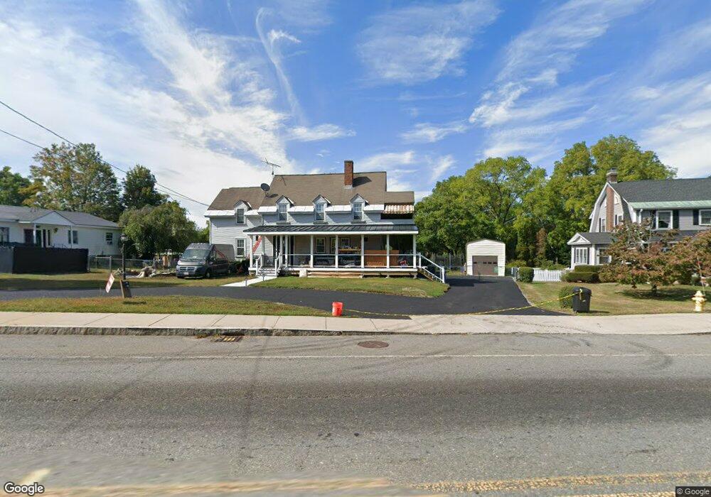
956 Main St Leominster, MA 01453
Estimated Value: $481,000 - $548,000
3
Beds
2
Baths
2,088
Sq Ft
$246/Sq Ft
Est. Value
About This Home
This home is located at 956 Main St, Leominster, MA 01453 and is currently estimated at $513,313, approximately $245 per square foot. 956 Main St is a home located in Worcester County with nearby schools including Leominster High School, St. Leo School, and St Bernards Elementary School.
Ownership History
Date
Name
Owned For
Owner Type
Purchase Details
Closed on
Nov 26, 1991
Sold by
956 Rt and Leclerc Richard
Bought by
Wilkey Burton and Wilkey Gloria
Current Estimated Value
Create a Home Valuation Report for This Property
The Home Valuation Report is an in-depth analysis detailing your home's value as well as a comparison with similar homes in the area
Home Values in the Area
Average Home Value in this Area
Purchase History
| Date | Buyer | Sale Price | Title Company |
|---|---|---|---|
| Wilkey Burton | $110,000 | -- |
Source: Public Records
Mortgage History
| Date | Status | Borrower | Loan Amount |
|---|---|---|---|
| Open | Wilkey Burton | $40,000 | |
| Open | Wilkey Burton | $120,000 | |
| Closed | Wilkey Burton | $25,937 | |
| Closed | Wilkey Burton | $102,850 |
Source: Public Records
Tax History Compared to Growth
Tax History
| Year | Tax Paid | Tax Assessment Tax Assessment Total Assessment is a certain percentage of the fair market value that is determined by local assessors to be the total taxable value of land and additions on the property. | Land | Improvement |
|---|---|---|---|---|
| 2025 | $5,858 | $417,500 | $142,600 | $274,900 |
| 2024 | $5,781 | $398,400 | $135,800 | $262,600 |
| 2023 | $5,546 | $356,900 | $118,200 | $238,700 |
| 2022 | $5,266 | $318,000 | $102,800 | $215,200 |
| 2021 | $5,011 | $276,400 | $80,100 | $196,300 |
| 2020 | $4,797 | $266,800 | $80,100 | $186,700 |
| 2019 | $4,650 | $250,800 | $76,300 | $174,500 |
| 2018 | $4,608 | $238,400 | $74,100 | $164,300 |
| 2017 | $4,309 | $218,400 | $69,200 | $149,200 |
| 2016 | $4,018 | $205,200 | $69,200 | $136,000 |
| 2015 | $3,843 | $197,700 | $69,200 | $128,500 |
| 2014 | $3,432 | $181,700 | $73,300 | $108,400 |
Source: Public Records
Map
Nearby Homes
- 32 Fox Meadow Rd Unit E
- 55 Fox Meadow Rd Unit H
- 17 Fernwood Dr Unit G
- 36 Fox Meadow Rd Unit A
- 17 Fernwood Dr Unit D
- 51 Fox Meadow Rd Unit C
- 48 Fox Meadow Rd Unit G
- 1084 Main St
- 291 Joslin St
- 40 Flaggler Rd
- 24 Causeway Terrace
- 11 Dale Ave
- 75 Dale Ave
- 313 Lincoln St
- 24 North St
- 29 Crawford St
- 4 Lincoln St
- 57 Liberty St Unit 2
- 66 Hamilton St Unit 3
- 593 Main St Unit SL4