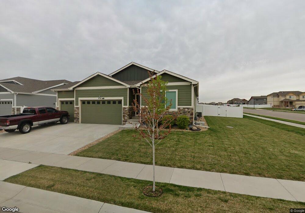
956 Mt Andrew Dr Severance, CO 80550
Estimated Value: $513,257 - $565,000
4
Beds
3
Baths
1,457
Sq Ft
$370/Sq Ft
Est. Value
About This Home
This home is located at 956 Mt Andrew Dr, Severance, CO 80550 and is currently estimated at $538,564, approximately $369 per square foot. 956 Mt Andrew Dr is a home with nearby schools including Range View Elementary School, Severance Middle School, and Lopez Continuation High School.
Ownership History
Date
Name
Owned For
Owner Type
Purchase Details
Closed on
Jun 24, 2019
Sold by
Aspen View Homes Llc
Bought by
Perkins Charlene N and Perkins Mark R
Current Estimated Value
Home Financials for this Owner
Home Financials are based on the most recent Mortgage that was taken out on this home.
Original Mortgage
$366,837
Outstanding Balance
$322,539
Interest Rate
4.1%
Mortgage Type
New Conventional
Estimated Equity
$216,025
Purchase Details
Closed on
Jan 18, 2019
Sold by
Avh Lot Holdings Llc
Bought by
Aspen View Homes Llc
Create a Home Valuation Report for This Property
The Home Valuation Report is an in-depth analysis detailing your home's value as well as a comparison with similar homes in the area
Home Values in the Area
Average Home Value in this Area
Purchase History
| Date | Buyer | Sale Price | Title Company |
|---|---|---|---|
| Perkins Charlene N | $386,145 | Unified Title Company | |
| Aspen View Homes Llc | $82,400 | Unified Title Co |
Source: Public Records
Mortgage History
| Date | Status | Borrower | Loan Amount |
|---|---|---|---|
| Open | Perkins Charlene N | $366,837 |
Source: Public Records
Tax History Compared to Growth
Tax History
| Year | Tax Paid | Tax Assessment Tax Assessment Total Assessment is a certain percentage of the fair market value that is determined by local assessors to be the total taxable value of land and additions on the property. | Land | Improvement |
|---|---|---|---|---|
| 2025 | $5,521 | $30,440 | $6,380 | $24,060 |
| 2024 | $5,521 | $30,440 | $6,380 | $24,060 |
| 2023 | $5,269 | $36,130 | $7,100 | $29,030 |
| 2022 | $4,260 | $25,540 | $5,700 | $19,840 |
| 2021 | $4,082 | $26,270 | $5,860 | $20,410 |
| 2020 | $3,810 | $24,790 | $5,010 | $19,780 |
| 2019 | $2,589 | $16,930 | $16,930 | $0 |
| 2018 | $258 | $1,640 | $1,640 | $0 |
| 2017 | $14 | $0 | $0 | $0 |
Source: Public Records
Map
Nearby Homes
- The Monarch Plan at Hidden Valley Farm
- The Twin Peaks Plan at Hidden Valley Farm
- The Pagosa Plan at Hidden Valley Farm
- 851 Forest Canyon Rd
- The Chatfield Plan at Hidden Valley Farm
- The Dillon Plan at Hidden Valley Farm
- 727 Elk Mountain Dr
- 963 Milner Pass Rd
- 719 Elk Mountain Dr
- 381 Mt Bross Ave
- 952 Cascade Falls St
- 971 Ouzel Falls Rd
- 1057 Mt Oxford Ave
- 368 Mt Bross Ave
- Pike Plan at Hidden Valley Farm
- Arapaho Plan at Hidden Valley Farm
- Roosevelt Plan at Hidden Valley Farm
- Chatfield Plan at Hidden Valley Farm
- San Juan Plan at Hidden Valley Farm
- 960 Cascade Falls St
- 958 Mt Andrew Dr
- 855 Sunlight Peak Dr
- 960 Mt Andrew Dr
- 957 Mt Andrew Dr
- 948 Mt Andrew Dr
- 857 Sunlight Peak Dr
- 859 Sunlight Peak Dr
- 959 Mt Andrew Dr
- 853 Sunlight Peak Dr
- 961 Mt Andrew Dr
- 946 Mt Andrew Dr
- 856 Sunlight Peak Dr
- 851 Sunlight Peak Dr
- 858 Sunlight Peak Dr
- 963 Mt Andrew Dr
- 1071 Mt Columbia Dr
- 860 Sunlight Peak Dr
- 964 Mt Andrew Dr
- 944 Mt Andrew Dr
- 854 Sunlight Peak Dr