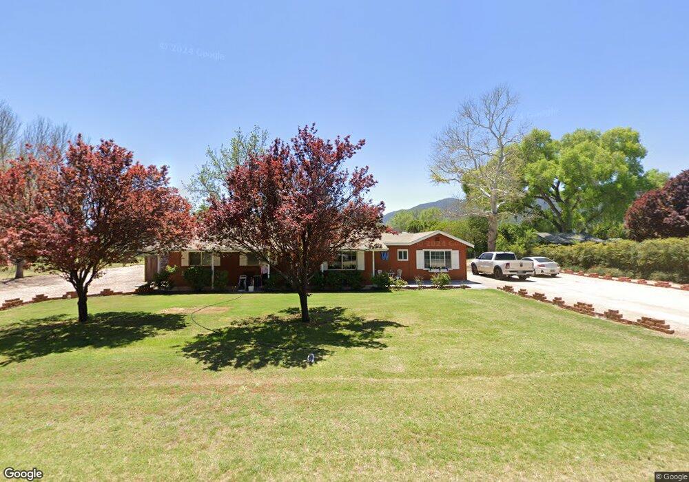
957 E Mahala Dr Camp Verde, AZ 86322
Estimated Value: $421,623 - $541,000
Studio
--
Bath
1,643
Sq Ft
$300/Sq Ft
Est. Value
About This Home
This home is located at 957 E Mahala Dr, Camp Verde, AZ 86322 and is currently estimated at $492,406, approximately $299 per square foot. 957 E Mahala Dr is a home located in Yavapai County with nearby schools including Camp Verde Elementary School, Camp Verde Middle School, and Camp Verde High School.
Ownership History
Date
Name
Owned For
Owner Type
Purchase Details
Closed on
Oct 31, 2006
Sold by
Bullard James Brian and Bullard Heather L
Bought by
Bullard James Brian and Bullard Heather L
Current Estimated Value
Purchase Details
Closed on
Aug 28, 2006
Sold by
Bullard James Brain
Bought by
Bullard James Brian and Bullard Heather
Home Financials for this Owner
Home Financials are based on the most recent Mortgage that was taken out on this home.
Original Mortgage
$289,000
Interest Rate
6.87%
Mortgage Type
New Conventional
Purchase Details
Closed on
Dec 9, 2005
Sold by
Bullard Heather L
Bought by
Bullard James Brian
Purchase Details
Closed on
Nov 8, 2000
Sold by
Whitker Maryann
Bought by
Starr Frances Anna
Create a Home Valuation Report for This Property
The Home Valuation Report is an in-depth analysis detailing your home's value as well as a comparison with similar homes in the area
Purchase History
| Date | Buyer | Sale Price | Title Company |
|---|---|---|---|
| Bullard James Brian | -- | None Available | |
| Bullard James Brian | -- | Grand Canyon Title Agency | |
| Bullard James Brian | -- | Yavapai Title Agency Inc | |
| Bullard James Brian | $250,000 | Yavapai Title Agency Inc | |
| Starr Frances Anna | -- | Chicago Title Insurance Co |
Source: Public Records
Mortgage History
| Date | Status | Borrower | Loan Amount |
|---|---|---|---|
| Previous Owner | Bullard James Brian | $289,000 |
Source: Public Records
Tax History
| Year | Tax Paid | Tax Assessment Tax Assessment Total Assessment is a certain percentage of the fair market value that is determined by local assessors to be the total taxable value of land and additions on the property. | Land | Improvement |
|---|---|---|---|---|
| 2026 | $1,614 | $30,248 | -- | -- |
| 2024 | $1,561 | $29,829 | -- | -- |
| 2023 | $1,561 | $24,760 | $0 | $0 |
| 2022 | $1,471 | $19,823 | $3,320 | $16,503 |
| 2021 | $1,529 | $18,974 | $3,887 | $15,087 |
| 2020 | $1,475 | $0 | $0 | $0 |
| 2019 | $1,444 | $0 | $0 | $0 |
| 2018 | $1,394 | $0 | $0 | $0 |
| 2017 | $1,321 | $0 | $0 | $0 |
| 2016 | $1,270 | $0 | $0 | $0 |
| 2015 | $1,252 | $0 | $0 | $0 |
| 2014 | $1,189 | $0 | $0 | $0 |
Source: Public Records
Map
Nearby Homes
- 2854 S Diamond Rd S
- 3355 S Silver Rd
- 3405 S Silver Rd
- 791 E Quarterhorse Ln
- 707 E Quarterhorse Ln
- 726 E River Glen Dr
- 2833 S Old Church Rd
- 750 E Cole Blvd Unit 23
- 722 S Cole Blvd Unit 22
- 674 E Cole Blvd Unit 21
- 646 E Cole Blvd Unit 20
- 2444 S Kynlee Dr Unit 2
- 2332 S Diamond Creek Ln
- 618 E Cole Blvd Unit 19
- 2400 S Kynlee Dr Unit 3
- 327 E Quarterhorse Ln
- 590 E Cole Blvd Unit 18
- 405 E Cole Blvd Unit 8
- 437 E Cole Blvd Unit 7
- 356 E Cole Blvd Unit 15
Your Personal Tour Guide
Ask me questions while you tour the home.