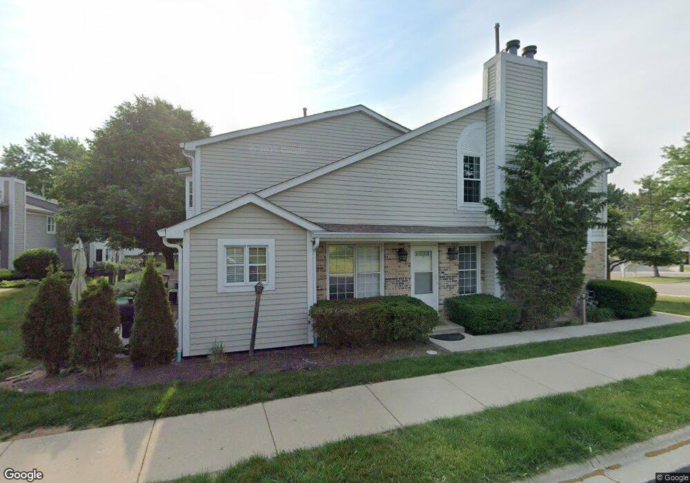
957 N Cove Dr Unit 957F Palatine, IL 60067
Baldwin NeighborhoodEstimated Value: $270,399 - $356,000
2
Beds
--
Bath
1,258
Sq Ft
$242/Sq Ft
Est. Value
About This Home
This home is located at 957 N Cove Dr Unit 957F, Palatine, IL 60067 and is currently estimated at $304,850, approximately $242 per square foot. 957 N Cove Dr Unit 957F is a home located in Cook County with nearby schools including Gray M Sanborn Elementary School, Walter R. Sundling Junior High School, and Palatine High School.
Ownership History
Date
Name
Owned For
Owner Type
Purchase Details
Closed on
Jun 27, 2003
Sold by
First Bank & Trust Co
Bought by
Marinelli Kathleen K
Current Estimated Value
Purchase Details
Closed on
Nov 13, 1998
Sold by
Kula Lombardo Constance A
Bought by
First Bank & Trust Company and Trust #10-1708
Home Financials for this Owner
Home Financials are based on the most recent Mortgage that was taken out on this home.
Original Mortgage
$55,250
Interest Rate
6.72%
Purchase Details
Closed on
Oct 7, 1998
Sold by
First Bank & Trust Company Of Illinois
Bought by
Lombardo Constance Kula
Home Financials for this Owner
Home Financials are based on the most recent Mortgage that was taken out on this home.
Original Mortgage
$55,250
Interest Rate
6.72%
Create a Home Valuation Report for This Property
The Home Valuation Report is an in-depth analysis detailing your home's value as well as a comparison with similar homes in the area
Home Values in the Area
Average Home Value in this Area
Purchase History
| Date | Buyer | Sale Price | Title Company |
|---|---|---|---|
| Marinelli Kathleen K | $228,500 | -- | |
| First Bank & Trust Company | -- | -- | |
| Lombardo Constance Kula | -- | -- |
Source: Public Records
Mortgage History
| Date | Status | Borrower | Loan Amount |
|---|---|---|---|
| Previous Owner | Lombardo Constance Kula | $55,250 |
Source: Public Records
Tax History Compared to Growth
Tax History
| Year | Tax Paid | Tax Assessment Tax Assessment Total Assessment is a certain percentage of the fair market value that is determined by local assessors to be the total taxable value of land and additions on the property. | Land | Improvement |
|---|---|---|---|---|
| 2024 | $3,875 | $19,058 | $2,157 | $16,901 |
| 2023 | $3,695 | $19,058 | $2,157 | $16,901 |
| 2022 | $3,695 | $19,058 | $2,157 | $16,901 |
| 2021 | $2,610 | $15,971 | $1,258 | $14,713 |
| 2020 | $2,395 | $15,971 | $1,258 | $14,713 |
| 2019 | $2,373 | $17,780 | $1,258 | $16,522 |
| 2018 | $2,576 | $16,759 | $1,168 | $15,591 |
| 2017 | $2,484 | $16,759 | $1,168 | $15,591 |
| 2016 | $2,846 | $16,759 | $1,168 | $15,591 |
| 2015 | $3,239 | $15,789 | $1,078 | $14,711 |
| 2014 | $3,233 | $15,789 | $1,078 | $14,711 |
| 2013 | $4,638 | $19,062 | $1,078 | $17,984 |
Source: Public Records
Map
Nearby Homes
- 1068 N Coolidge Ave
- 1020 W Sutton Ct Unit 30
- 1049 W Sutton Ct Unit 13
- 842 N Maple Ave Unit 44
- 1022 N Knollwood Dr
- 1213 W Northwest Hwy
- 1102 N Knollwood Dr
- 667 N Morrison Ave
- 1124 W Colfax St
- 1230 W Claridge Ct
- 882 N Franklin Ave
- 870 N Quentin Rd
- 884 N Quentin Rd
- 805 W Poplar St
- 552 N Quentin Rd
- 1255 N Sterling Ave Unit 208
- 1295 N Sterling Ave Unit 212
- 1048 N Palos Ave
- 580 N Quentin Rd
- 550 N Quentin Rd
- 953 N Cove Dr Unit 953D
- 961 N Cove Dr Unit 961E
- 949 N Cove Dr Unit 949C
- 949 N Cove Dr Unit C
- 945 N Cove Dr Unit 945B
- 945 N Cove Dr Unit B
- 965 N Cove Dr Unit 965B
- 973 N Cove Dr Unit 973C
- 941 N Cove Dr Unit 947
- 941 N Cove Dr Unit 941A
- 977 N Cove Dr Unit 977D
- 981 N Cove Dr Unit 981E
- 915 N Sterling Ave Unit 107
- 915 N Sterling Ave Unit 108
- 915 N Sterling Ave Unit 214
- 915 N Sterling Ave Unit 202
- 915 N Sterling Ave Unit 102
- 915 N Sterling Ave Unit 103
- 985 N Cove Dr Unit 985F
- 937 N Cove Dr Unit 937E