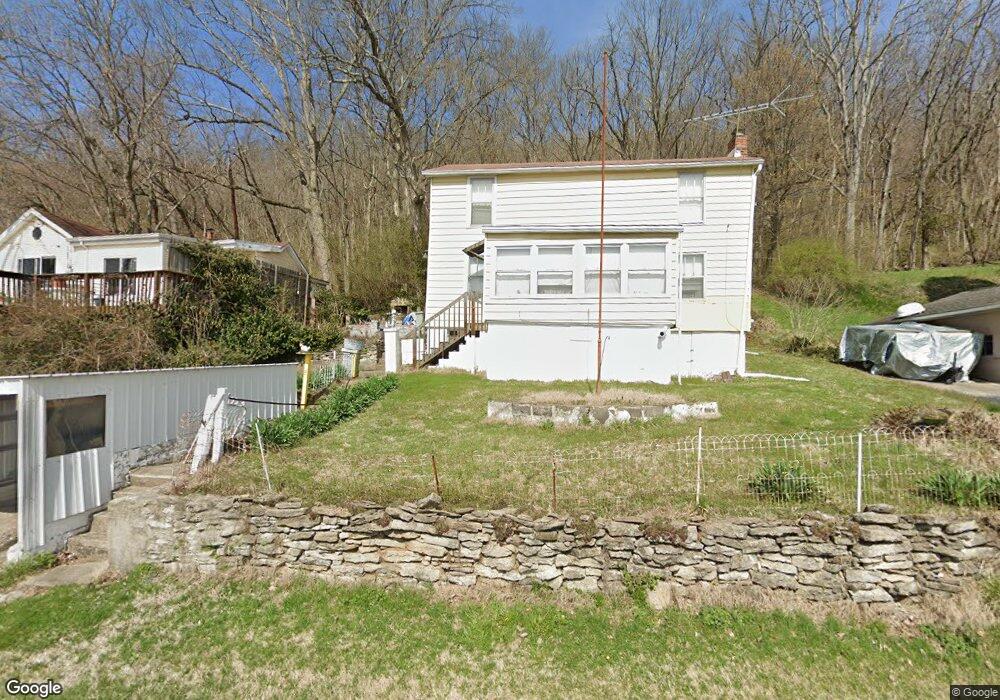
9576 Brower Rd North Bend, OH 45052
Estimated Value: $83,000 - $200,000
3
Beds
1
Bath
1,160
Sq Ft
$128/Sq Ft
Est. Value
About This Home
This home is located at 9576 Brower Rd, North Bend, OH 45052 and is currently estimated at $147,937, approximately $127 per square foot. 9576 Brower Rd is a home located in Hamilton County with nearby schools including Charles T. Young Elementary School, Taylor Middle School, and Taylor High School.
Ownership History
Date
Name
Owned For
Owner Type
Purchase Details
Closed on
May 18, 2015
Sold by
Thompson Lawrence T
Bought by
Thompson Lawrence T and Thompson Anthony W
Current Estimated Value
Purchase Details
Closed on
Jan 28, 2010
Sold by
Thompson Lawrence T
Bought by
Thompson Lawrence T and Thompson Mary B
Purchase Details
Closed on
Nov 9, 2009
Sold by
Thompson Mary B
Bought by
Thompson Lawrence T
Purchase Details
Closed on
Sep 28, 2000
Sold by
Thompson Mary B and Thompson Lawrence T
Bought by
Thompson Lawrence T and Thompson Mary B
Create a Home Valuation Report for This Property
The Home Valuation Report is an in-depth analysis detailing your home's value as well as a comparison with similar homes in the area
Home Values in the Area
Average Home Value in this Area
Purchase History
| Date | Buyer | Sale Price | Title Company |
|---|---|---|---|
| Thompson Lawrence T | -- | Attorney | |
| Thompson Lawrence T | -- | None Available | |
| Thompson Lawrence T | -- | Attorney | |
| Thompson Lawrence T | -- | -- |
Source: Public Records
Tax History Compared to Growth
Tax History
| Year | Tax Paid | Tax Assessment Tax Assessment Total Assessment is a certain percentage of the fair market value that is determined by local assessors to be the total taxable value of land and additions on the property. | Land | Improvement |
|---|---|---|---|---|
| 2024 | $748 | $15,813 | $6,125 | $9,688 |
| 2023 | $748 | $15,813 | $6,125 | $9,688 |
| 2022 | $1,018 | $16,920 | $6,073 | $10,847 |
| 2021 | $989 | $16,920 | $6,073 | $10,847 |
| 2020 | $998 | $16,920 | $6,073 | $10,847 |
| 2019 | $906 | $14,217 | $5,103 | $9,114 |
| 2018 | $872 | $14,217 | $5,103 | $9,114 |
| 2017 | $819 | $14,217 | $5,103 | $9,114 |
| 2016 | $745 | $13,293 | $5,460 | $7,833 |
| 2015 | $752 | $13,293 | $5,460 | $7,833 |
| 2014 | $760 | $13,293 | $5,460 | $7,833 |
| 2013 | $696 | $12,425 | $5,103 | $7,322 |
Source: Public Records
Map
Nearby Homes
- 2700 Rittenhouse Rd
- 36 Timberline Ct
- 7284 W Harrison Ave
- 143 Mount Nebo Rd
- 118 Mount Nebo Rd
- 100 Mount Nebo Rd
- 21 Wamsley Ave
- 9807 Miamiview Rd
- 42 Edinburgh Place Unit 42
- 101 E State Rd
- 110 Elliott St
- 0 Saint Annes Unit 1826785
- 9750 Hooven Ave
- 301 N Miami Ave
- 540 Aston View Ln
- 10451 Dugan Gap Rd
- The Jefferson Plan at North Pointe
- The Bristol Plan at North Pointe
- The Austin Plan at North Pointe
- The Rosewood Plan at North Pointe