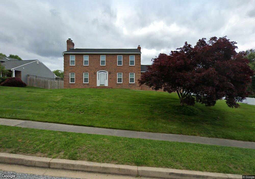
959 E Ring Factory Rd Bel Air, MD 21014
Estimated Value: $549,000 - $698,000
About This Home
This home is located at 959 E Ring Factory Rd, Bel Air, MD 21014 and is currently estimated at $612,723, approximately $224 per square foot. 959 E Ring Factory Rd is a home located in Harford County with nearby schools including Homestead-Wakefield Elementary School, Bel Air Middle School, and Bel Air High School.
Ownership History
We collect this data history from publicly available records. To have your information removed, we recommend requesting removal directly through your county’s website.
Purchase Details
Purchase Details
Home Values in the Area
Average Home Value in this Area
Purchase History
We collect this data history from publicly available records. To have your information removed, we recommend requesting removal directly through your county’s website.
| Date | Buyer | Sale Price | Title Company |
|---|---|---|---|
| $191,000 | -- | ||
| $153,600 | -- |
Mortgage History
We collect this data history from publicly available records. To have your information removed, we recommend requesting removal directly through your county’s website.
| Date | Status | Borrower | Loan Amount |
|---|---|---|---|
| Closed | $142,000 |
Tax History
We collect this data history from publicly available records. To have your information removed, we recommend requesting removal directly through your county’s website.
| Year | Tax Paid | Tax Assessment Tax Assessment Total Assessment is a certain percentage of the fair market value that is determined by local assessors to be the total taxable value of land and additions on the property. | Land | Improvement |
|---|---|---|---|---|
| 2025 | $5,404 | $516,600 | $114,000 | $402,600 |
| 2024 | $4,950 | $495,800 | $0 | $0 |
| 2023 | $4,950 | $475,000 | $0 | $0 |
| 2022 | $4,950 | $454,200 | $114,000 | $340,200 |
| 2020 | $4,792 | $415,267 | $0 | $0 |
| 2019 | $4,568 | $395,800 | $120,800 | $275,000 |
| 2018 | $4,487 | $392,333 | $0 | $0 |
| 2017 | $4,447 | $395,800 | $0 | $0 |
| 2016 | -- | $385,400 | $0 | $0 |
| 2015 | $4,156 | $380,733 | $0 | $0 |
| 2014 | $4,156 | $376,067 | $0 | $0 |
Map
- 919 Jackson Blvd
- 900 Macphail Woods Crossing Unit 3A
- 902 Macphail Woods Crossing Unit 1E
- 902 Macphail Woods Crossing Unit 4J
- 814 N Pine Ridge Ct
- 717 Clifton Terrace Dr
- 1813 Selvin Dr Unit 303
- 1421 Saratoga Dr
- 1314G Scottsdale Dr Unit 269
- 1818 Selvin Dr Unit 301
- 1310 Scottsdale Dr Unit C
- 1604 Martha Ct Unit 201
- 1309 Sheridan Place Unit 99
- 600 E Macphail Rd
- 1310 Sheridan Place Unit 27
- Lot 2 Carolina Ave
- 1438 Moonshadow Rd
- 906 Whispering Ridge Ln
- 619 Kildonan Ct
- 1445 Fountain Glen Dr
- 957 E Ring Factory Rd
- 955 E Macphail Rd
- 963 E Ring Factory Rd
- 912 Hedgerow Ct
- 955 E Ring Factory Rd
- 915 Meadow Ridge Ct
- 959 E Macphail Rd
- 957 E Macphail Rd
- 967 E Ring Factory Rd
- 953 E Ring Factory Rd
- 951 E Macphail Rd
- 911 Hedgerow Ct
- 910 Hedgerow Ct
- 965 E Ring Factory Rd
- 913 Meadow Ridge Ct
- 969 E Ring Factory Rd
- 914 Meadow Ridge Ct
- 908 Hedgerow Ct
- 951 E Ring Factory Rd
- 909 Hedgerow Ct
Ask me questions while you tour the home.