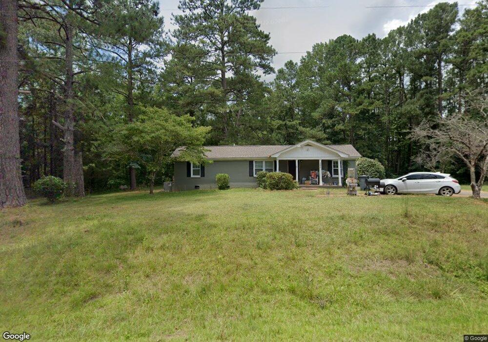
9590 Cove Rd Manchester, GA 31816
Estimated Value: $154,000 - $201,000
3
Beds
2
Baths
1,300
Sq Ft
$144/Sq Ft
Est. Value
About This Home
This home is located at 9590 Cove Rd, Manchester, GA 31816 and is currently estimated at $187,284, approximately $144 per square foot. 9590 Cove Rd is a home located in Meriwether County with nearby schools including Mountain View Elementary School, Manchester Middle School, and Manchester High School.
Ownership History
Date
Name
Owned For
Owner Type
Purchase Details
Closed on
Mar 22, 2018
Sold by
Bishop Jason Scott
Bought by
Foster Peal Estate Properties
Current Estimated Value
Home Financials for this Owner
Home Financials are based on the most recent Mortgage that was taken out on this home.
Original Mortgage
$52,483
Interest Rate
4.4%
Mortgage Type
New Conventional
Purchase Details
Closed on
Sep 30, 2013
Sold by
Bishop James Anthony
Bought by
Bishop Jason Scott
Purchase Details
Closed on
Jun 17, 2009
Sold by
Crawford Jane Underwood
Bought by
Bishop Jason Scott
Purchase Details
Closed on
Jan 1, 1993
Sold by
Meriwether County
Bought by
Underwood Ruth Mrs
Purchase Details
Closed on
Jan 1, 1965
Bought by
Meriwether County
Create a Home Valuation Report for This Property
The Home Valuation Report is an in-depth analysis detailing your home's value as well as a comparison with similar homes in the area
Home Values in the Area
Average Home Value in this Area
Purchase History
| Date | Buyer | Sale Price | Title Company |
|---|---|---|---|
| Foster Peal Estate Properties | $35,000 | -- | |
| Bishop Jason Scott | -- | -- | |
| Bishop Jason Scott | $65,000 | -- | |
| Bishop Jason Scott | $65,000 | -- | |
| Underwood Ruth Mrs | -- | -- | |
| Meriwether County | -- | -- |
Source: Public Records
Mortgage History
| Date | Status | Borrower | Loan Amount |
|---|---|---|---|
| Closed | Foster Peal Estate Properties | $52,483 |
Source: Public Records
Tax History Compared to Growth
Tax History
| Year | Tax Paid | Tax Assessment Tax Assessment Total Assessment is a certain percentage of the fair market value that is determined by local assessors to be the total taxable value of land and additions on the property. | Land | Improvement |
|---|---|---|---|---|
| 2024 | $2,118 | $63,760 | $11,480 | $52,280 |
| 2023 | $1,624 | $47,040 | $11,480 | $35,560 |
| 2022 | $1,624 | $47,040 | $11,480 | $35,560 |
| 2021 | $1,649 | $47,040 | $11,480 | $35,560 |
| 2020 | $1,662 | $47,040 | $11,480 | $35,560 |
| 2019 | $1,667 | $47,040 | $11,480 | $35,560 |
| 2018 | $617 | $17,240 | $5,720 | $11,520 |
| 2017 | $691 | $19,104 | $5,720 | $13,384 |
| 2016 | $629 | $19,104 | $5,720 | $13,384 |
| 2015 | $630 | $19,104 | $5,720 | $13,384 |
| 2014 | $630 | $19,104 | $5,720 | $13,384 |
| 2013 | -- | $19,104 | $5,720 | $13,384 |
Source: Public Records
Map
Nearby Homes
- 3494 Georgia 85
- 3494 Ga Highway 85 E
- 77 Cordwood St
- 16 North St
- 5 Jay St
- 1772 Grant Ave
- 434 Phil Howe Rd
- 1600 Grant Ave
- 286 Starling Rd
- 12 Truitt St
- 305 Holy Hill Place
- 380 Elm St
- 802 Jd Parham Dr
- 701 Jd Parham Dr
- 200 Hunt Cir
- 36 E 2nd St
- 312 2nd Ave
- 408 Broad St
- 522 4th St
- 3.26 ACRES Mountain Ridge Dr
- 9556 Cove Rd
- 9541 Cove Rd
- 277 Amberwood Ln
- 447 Terry Creek Cir
- 9705 Cove Rd
- 9707 Cove Rd
- 9420 Cove Rd
- 380 Terry Creek Cir
- 315 Terry Creek Cir
- 9751 Cove Rd
- 60 Tiny Ln
- 3530 Ga Highway 85 E
- 3530 Ga Highway 85 E
- 3530 Ga Highway 85 E
- 3530 Ga Highway 85 E
- 3590 Ga Highway 85 E
- 3492 Ga Highway 85 E
- 8 Tiny Ln
- 3482 Georgia 85
- 3482 Ga Highway 85 E