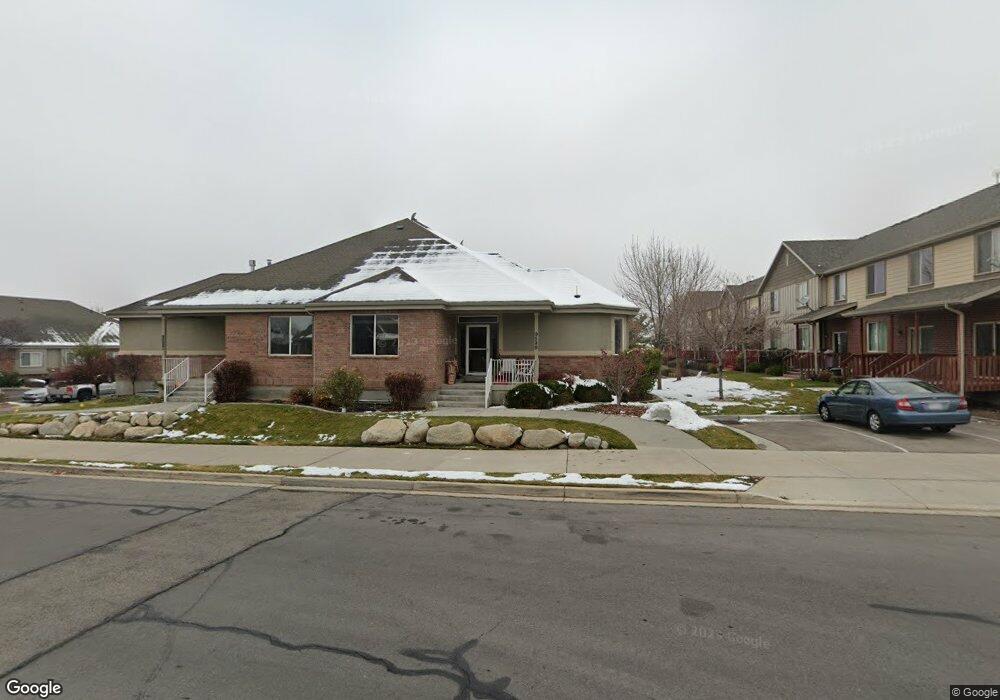
9591 N 4500 W Unit 19 Pleasant Grove, UT 84062
Estimated Value: $459,000 - $535,262
3
Beds
2
Baths
2,341
Sq Ft
$213/Sq Ft
Est. Value
About This Home
This home is located at 9591 N 4500 W Unit 19, Pleasant Grove, UT 84062 and is currently estimated at $499,316, approximately $213 per square foot. 9591 N 4500 W Unit 19 is a home located in Utah County with nearby schools including Deerfield Elementary School, Mountain Ridge Junior High School, and Lone Peak High School.
Ownership History
Date
Name
Owned For
Owner Type
Purchase Details
Closed on
Apr 13, 2022
Sold by
Novoa David
Bought by
Sylvester Charles David and Sylvester Kai
Current Estimated Value
Home Financials for this Owner
Home Financials are based on the most recent Mortgage that was taken out on this home.
Original Mortgage
$384,000
Outstanding Balance
$358,783
Interest Rate
3.76%
Mortgage Type
New Conventional
Estimated Equity
$140,533
Purchase Details
Closed on
May 25, 2021
Sold by
Hayes Rex B and Hayes Patricia B
Bought by
Novoa David
Purchase Details
Closed on
Feb 7, 2012
Sold by
Hayes Rex B and Hayes Patricia B
Bought by
Hayes Rex B and Hayes Patricia B
Purchase Details
Closed on
Feb 9, 2005
Sold by
Foothill Development Inc
Bought by
Hayes Rex B and Hayes Patricia B
Home Financials for this Owner
Home Financials are based on the most recent Mortgage that was taken out on this home.
Original Mortgage
$170,800
Interest Rate
5.73%
Mortgage Type
New Conventional
Create a Home Valuation Report for This Property
The Home Valuation Report is an in-depth analysis detailing your home's value as well as a comparison with similar homes in the area
Home Values in the Area
Average Home Value in this Area
Purchase History
| Date | Buyer | Sale Price | Title Company |
|---|---|---|---|
| Sylvester Charles David | -- | None Listed On Document | |
| Novoa David | -- | Utah First Title Ins Agency | |
| Hayes Rex B | -- | None Available | |
| Hayes Rex B | -- | Sundance Title Insurance Ag |
Source: Public Records
Mortgage History
| Date | Status | Borrower | Loan Amount |
|---|---|---|---|
| Open | Sylvester Charles David | $384,000 | |
| Previous Owner | Hayes Rex B | $170,800 |
Source: Public Records
Tax History Compared to Growth
Tax History
| Year | Tax Paid | Tax Assessment Tax Assessment Total Assessment is a certain percentage of the fair market value that is determined by local assessors to be the total taxable value of land and additions on the property. | Land | Improvement |
|---|---|---|---|---|
| 2025 | $2,133 | $259,325 | $69,300 | $402,200 |
| 2024 | $2,133 | $252,615 | $0 | $0 |
| 2023 | $1,990 | $253,275 | $0 | $0 |
| 2022 | $1,924 | $239,085 | $0 | $0 |
| 2021 | $1,796 | $332,500 | $49,900 | $282,600 |
| 2020 | $1,651 | $298,200 | $44,700 | $253,500 |
| 2019 | $1,520 | $285,100 | $42,800 | $242,300 |
| 2018 | $1,103 | $195,000 | $35,000 | $160,000 |
| 2017 | $1,135 | $107,250 | $0 | $0 |
| 2016 | $1,220 | $107,250 | $0 | $0 |
| 2015 | $1,289 | $107,250 | $0 | $0 |
| 2014 | $1,185 | $97,900 | $0 | $0 |
Source: Public Records
Map
Nearby Homes
- 9587 N 4500 W
- 248 N Deerfield Ln
- 4441 W Bridgestone Dr
- 1172 Murdock Dr
- 9681 N Peach Ct
- 4631 W Harvey Blvd
- 1243 N 1270 E
- 1162 E 1180 N
- 9900 N Meadow Dr
- 1228 E 1030 N
- 9506 N 4000 W
- 1089 N 950 E
- 4696 W Camellia Ln
- 10052 N Marigold Ln
- 1058 N 930 E Unit 64
- 9748 N Caldwell Place
- 9857 N Featherstone Dr
- 1059 N 930 E
- 4947 Evergreen Ln
- 9757 N Caldwell Place
- 9591 N 4500 W
- 9593 N 4500 W
- 9589 N 4500 W
- 9598 N 4500 W
- 9579 N 4500 W
- 9579 N 4500 W Unit 44
- 9579 N 4500 W Unit 14
- 9615 N 4500 W Unit 213
- 9611 N 4500 W Unit 214
- 9611 N 4500 W
- 9619 N 4500 W
- 9607 N 4500 W Unit 215
- 9623 N 4500 W Unit 211
- 9581 N 4500 W
- 9581 N 4500 W Unit 15
- 9603 N 4500 W Unit 216
- 9603 N 4500 W
- 9577 N 4500 W
- 9577 N 4500 W Unit 13
- 9631 N 4500 W