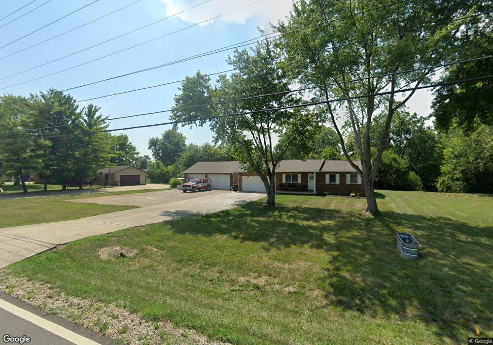
9599 State Route 104 Orient, OH 43146
Estimated Value: $242,000 - $277,000
3
Beds
1
Bath
988
Sq Ft
$258/Sq Ft
Est. Value
About This Home
This home is located at 9599 State Route 104, Orient, OH 43146 and is currently estimated at $254,949, approximately $258 per square foot. 9599 State Route 104 is a home located in Pickaway County.
Ownership History
Date
Name
Owned For
Owner Type
Purchase Details
Closed on
Jun 30, 2022
Sold by
Charles R Lang Sr Trust
Bought by
Nester Kelsey
Current Estimated Value
Home Financials for this Owner
Home Financials are based on the most recent Mortgage that was taken out on this home.
Original Mortgage
$211,105
Outstanding Balance
$199,345
Interest Rate
5.23%
Mortgage Type
FHA
Estimated Equity
$55,604
Purchase Details
Closed on
Oct 31, 2011
Sold by
Lang Charles R
Bought by
Lang Charles R and The Trust Of Charles R Lang Sr
Purchase Details
Closed on
Dec 10, 2007
Sold by
Lang Charles R
Bought by
Lang Charles R and Lang Bessie A
Purchase Details
Closed on
Jun 1, 1987
Purchase Details
Closed on
Nov 1, 1986
Create a Home Valuation Report for This Property
The Home Valuation Report is an in-depth analysis detailing your home's value as well as a comparison with similar homes in the area
Home Values in the Area
Average Home Value in this Area
Purchase History
| Date | Buyer | Sale Price | Title Company |
|---|---|---|---|
| Nester Kelsey | -- | Law Offices Of Saia & Piatt In | |
| Lang Charles R | -- | None Available | |
| Lang Charles R | $150,000 | Attorney | |
| -- | $9,500 | -- | |
| -- | $16,000 | -- |
Source: Public Records
Mortgage History
| Date | Status | Borrower | Loan Amount |
|---|---|---|---|
| Open | Nester Kelsey | $211,105 |
Source: Public Records
Tax History
| Year | Tax Paid | Tax Assessment Tax Assessment Total Assessment is a certain percentage of the fair market value that is determined by local assessors to be the total taxable value of land and additions on the property. | Land | Improvement |
|---|---|---|---|---|
| 2025 | $3,657 | $70,860 | $10,150 | $60,710 |
| 2024 | $3,657 | $70,860 | $10,150 | $60,710 |
| 2023 | $2,736 | $70,860 | $10,150 | $60,710 |
| 2022 | $2,116 | $50,370 | $8,630 | $41,740 |
| 2021 | $2,122 | $50,370 | $8,630 | $41,740 |
| 2020 | $2,123 | $50,370 | $8,630 | $41,740 |
| 2019 | $1,832 | $44,490 | $8,630 | $35,860 |
| 2018 | $1,783 | $44,490 | $8,630 | $35,860 |
| 2017 | $1,830 | $44,490 | $8,630 | $35,860 |
| 2016 | $1,734 | $42,060 | $8,530 | $33,530 |
| 2015 | $1,735 | $42,060 | $8,530 | $33,530 |
| 2014 | $1,737 | $42,060 | $8,530 | $33,530 |
| 2013 | $1,815 | $42,270 | $8,530 | $33,740 |
Source: Public Records
Map
Nearby Homes
- 302 Shady Hollow Dr
- 9192 Rhode Island Way Unit 245
- 422 Cherry Hills Rd
- 446 Bethpage Blvd
- 438 Bethpage Blvd
- 444 Bethpage Blvd
- 427 Bethpage Blvd
- 1520 Hiner Rd
- 352 Oakmont Dr
- 364 Oakmont Dr
- 1490 Hiner Rd
- 1470 Hiner Rd
- 341 Merion Dr
- 1690 Lynnbrook Ct
- 11 Englewood Rd
- 33 Erin Hills Rd
- 1800 Lynnbrook Ct
- 4479 State Route 762
- 38 Waterman Ave
- 66 Genoa Cir
- 9625 State Route 104
- 9577 State Route 104
- 4880 Praire Ln
- 4852 Praire Ln
- 9665 Ohio 104
- 9665 State Route 104
- 9547 State Route 104
- 4878 Praire Ln
- 4901 Southfield Dr
- 9681 State Route 104
- 4861 Praire Ln
- 4837 Praire Ln
- 9505 State Route 104
- 4924 Praire Ln
- 4913 Southfield Dr
- 4860 Durrett Rd
- 4945 Southfield Dr
- 4972 Southfield Dr
- 4984 Praire Ln
- 4880 Durrett Rd
Your Personal Tour Guide
Ask me questions while you tour the home.