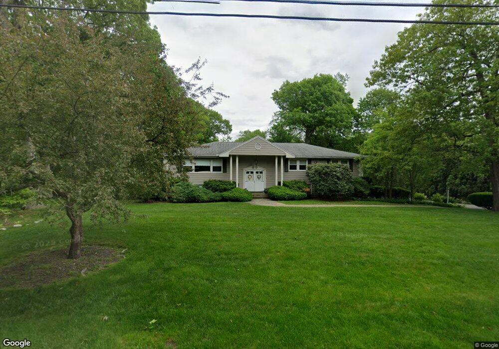
96 Alfred Rd Milton, MA 02186
Brush Hill NeighborhoodEstimated Value: $1,169,000 - $1,602,396
About This Home
This home is located at 96 Alfred Rd, Milton, MA 02186 and is currently estimated at $1,460,849, approximately $418 per square foot. 96 Alfred Rd is a home located in Norfolk County with nearby schools including Milton High School, Delphi Academy, and Thacher Montessori School.
Ownership History
We collect this data history from publicly available records. To have your information removed, we recommend requesting removal directly through your county’s website.
Purchase Details
Purchase Details
Home Values in the Area
Average Home Value in this Area
Purchase History
We collect this data history from publicly available records. To have your information removed, we recommend requesting removal directly through your county’s website.
| Date | Buyer | Sale Price | Title Company |
|---|---|---|---|
| -- | None Available | ||
| -- | None Available | ||
| $270,000 | -- | ||
| $270,000 | -- |
Mortgage History
We collect this data history from publicly available records. To have your information removed, we recommend requesting removal directly through your county’s website.
| Date | Status | Borrower | Loan Amount |
|---|---|---|---|
| Previous Owner | $417,000 | ||
| Previous Owner | $50,000 | ||
| Previous Owner | $200,000 |
Tax History
We collect this data history from publicly available records. To have your information removed, we recommend requesting removal directly through your county’s website.
| Year | Tax Paid | Tax Assessment Tax Assessment Total Assessment is a certain percentage of the fair market value that is determined by local assessors to be the total taxable value of land and additions on the property. | Land | Improvement |
|---|---|---|---|---|
| 2025 | $11,469 | $1,034,200 | $584,400 | $449,800 |
| 2024 | $10,990 | $1,006,400 | $556,600 | $449,800 |
| 2023 | $10,379 | $910,400 | $530,200 | $380,200 |
| 2022 | $10,299 | $825,900 | $530,200 | $295,700 |
| 2021 | $10,455 | $796,300 | $514,700 | $281,600 |
| 2020 | $10,562 | $805,000 | $505,100 | $299,900 |
| 2019 | $10,301 | $781,600 | $490,400 | $291,200 |
| 2018 | $10,015 | $725,200 | $434,800 | $290,400 |
| 2017 | $9,369 | $690,900 | $414,000 | $276,900 |
| 2016 | $9,281 | $687,500 | $414,000 | $273,500 |
| 2015 | $9,251 | $663,600 | $381,400 | $282,200 |
Map
- 17 Landon Rd
- 35 Craig St
- 375 Atherton St
- 45 Adanac Rd
- 485 Blue Hills Pkwy Unit 39
- 485 Blue Hills Pkwy Unit 12
- 485 Blue Hills Pkwy Unit 13
- 485 Blue Hills Pkwy Unit 2
- 485 Blue Hills Pkwy Unit 21
- 6 Kinsale Ln
- 3 Stone Bridge Ln
- 90 Countryside Ln
- 34 Spring Hill Rd
- 23 Woodmere Dr Unit 23
- 29 Woodmere Dr Unit 29
- 86 Milton Ave
- 9 Spring Hill Rd
- 7 Parkway Crescent
- 101 Pagoda St
- 71 Neponset Ave Unit 1
Ask me questions while you tour the home.