Estimated Value: $666,026 - $828,000
7
Beds
2
Baths
2,736
Sq Ft
$266/Sq Ft
Est. Value
About This Home
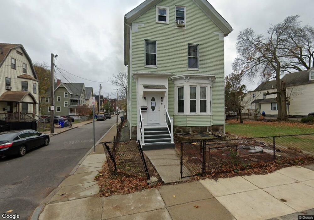
This home is located at 96 Bird St, Dorchester, MA 02125 and is currently estimated at $729,007, approximately $266 per square foot. 96 Bird St is a home located in Suffolk County with nearby schools including Uncommon Schools Roxbury Prep Dorchester Campus.
Ownership History
Date
Name
Owned For
Owner Type
Purchase Details
Closed on
Nov 24, 1998
Sold by
Lemar Carl
Bought by
Zayas Sylvia M
Current Estimated Value
Home Financials for this Owner
Home Financials are based on the most recent Mortgage that was taken out on this home.
Original Mortgage
$86,250
Outstanding Balance
$19,102
Interest Rate
6.49%
Mortgage Type
Purchase Money Mortgage
Estimated Equity
$709,905
Create a Home Valuation Report for This Property
The Home Valuation Report is an in-depth analysis detailing your home's value as well as a comparison with similar homes in the area
Home Values in the Area
Average Home Value in this Area
Purchase History
| Date | Buyer | Sale Price | Title Company |
|---|---|---|---|
| Zayas Sylvia M | $115,000 | -- |
Source: Public Records
Mortgage History
| Date | Status | Borrower | Loan Amount |
|---|---|---|---|
| Open | Zayas Sylvia M | $86,250 | |
| Previous Owner | Zayas Sylvia M | $50,000 | |
| Closed | Zayas Sylvia M | $23,000 |
Source: Public Records
Tax History Compared to Growth
Tax History
| Year | Tax Paid | Tax Assessment Tax Assessment Total Assessment is a certain percentage of the fair market value that is determined by local assessors to be the total taxable value of land and additions on the property. | Land | Improvement |
|---|---|---|---|---|
| 2025 | $5,561 | $480,200 | $190,600 | $289,600 |
| 2024 | $5,080 | $466,100 | $194,000 | $272,100 |
| 2023 | $4,634 | $431,500 | $179,600 | $251,900 |
| 2022 | $4,559 | $419,000 | $174,400 | $244,600 |
| 2021 | $4,165 | $390,300 | $169,300 | $221,000 |
| 2020 | $3,887 | $368,100 | $153,000 | $215,100 |
| 2019 | $3,674 | $348,600 | $128,600 | $220,000 |
| 2018 | $3,414 | $325,800 | $128,600 | $197,200 |
| 2017 | $3,137 | $296,200 | $128,600 | $167,600 |
| 2016 | $3,164 | $287,600 | $128,600 | $159,000 |
| 2015 | $3,170 | $261,800 | $130,700 | $131,100 |
| 2014 | $3,220 | $256,000 | $124,900 | $131,100 |
Source: Public Records
Map
Nearby Homes
- 173 Magnolia St Unit 5
- 47 Sargent St Unit 3
- 96-98 Woodledge St
- 35 Cunningham St
- 42 Monadnock St
- 18 Sargent St Unit B
- 130 Howard Ave
- 5 Wheelock Ave
- 3 Ware St
- 163 Howard Ave
- 252-254 Magnolia St
- 60 Stanley St Unit 301
- 60 Stanley St Unit 302
- 60 Stanley St
- 60 Stanley St Unit 101
- 22 Ronan St
- 91 Howard Ave
- 53 Woodford St
- 52 Bellevue St Unit 1
- 52 Bellevue St Unit 2
- 102 Bird St
- 25 Bodwell St
- 25 Bodwell St Unit 1
- 92 Bird St
- 22 Bodwell St
- 22 Baker Ave
- 97 Bird St
- 21 Bodwell St
- 91 Bird St
- 89 Bird St
- 80 Glendale St
- 78 Glendale St
- 20 Baker Ct
- 19 Bodwell St
- 72 Glendale St Unit 74
- 18 Bodwell St
- 18 Bodwell St Unit 2
- 18 Bodwell St Unit 3
- 18 Bodwell St Unit 1
- 30 Drayton Ave Unit 32