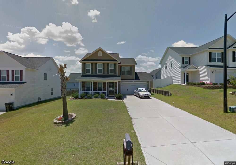
96 Boston Harbor (L17) Dr Cameron, NC 28326
Estimated Value: $257,000 - $276,000
3
Beds
3
Baths
1,724
Sq Ft
$154/Sq Ft
Est. Value
About This Home
This home is located at 96 Boston Harbor (L17) Dr, Cameron, NC 28326 and is currently estimated at $265,531, approximately $154 per square foot. 96 Boston Harbor (L17) Dr is a home located in Harnett County with nearby schools including Benhaven Elementary School, Overhills Middle School, and Overhills High School.
Ownership History
Date
Name
Owned For
Owner Type
Purchase Details
Closed on
Mar 14, 2025
Sold by
Mcknight Gloria J
Bought by
Persico Dionysios and Persico Lauren
Current Estimated Value
Home Financials for this Owner
Home Financials are based on the most recent Mortgage that was taken out on this home.
Original Mortgage
$259,461
Outstanding Balance
$258,138
Interest Rate
6.89%
Mortgage Type
VA
Estimated Equity
$7,393
Purchase Details
Closed on
Jul 31, 2008
Sold by
Caviness & Cates Bldg And Development Co
Bought by
Mcknight Gloria J
Home Financials for this Owner
Home Financials are based on the most recent Mortgage that was taken out on this home.
Original Mortgage
$159,200
Interest Rate
6.37%
Mortgage Type
VA
Create a Home Valuation Report for This Property
The Home Valuation Report is an in-depth analysis detailing your home's value as well as a comparison with similar homes in the area
Home Values in the Area
Average Home Value in this Area
Purchase History
| Date | Buyer | Sale Price | Title Company |
|---|---|---|---|
| Persico Dionysios | $254,000 | None Listed On Document | |
| Persico Dionysios | $254,000 | None Listed On Document | |
| Mcknight Gloria J | $156,000 | -- |
Source: Public Records
Mortgage History
| Date | Status | Borrower | Loan Amount |
|---|---|---|---|
| Open | Persico Dionysios | $259,461 | |
| Closed | Persico Dionysios | $259,461 | |
| Previous Owner | Mcknight Gloria J | $159,200 |
Source: Public Records
Tax History
| Year | Tax Paid | Tax Assessment Tax Assessment Total Assessment is a certain percentage of the fair market value that is determined by local assessors to be the total taxable value of land and additions on the property. | Land | Improvement |
|---|---|---|---|---|
| 2025 | $1,282 | $168,288 | $0 | $0 |
| 2024 | $1,282 | $168,288 | $0 | $0 |
| 2023 | $1,282 | $168,288 | $0 | $0 |
| 2022 | $1,413 | $168,288 | $0 | $0 |
| 2021 | $1,413 | $152,640 | $0 | $0 |
| 2020 | $1,413 | $152,640 | $0 | $0 |
| 2019 | $1,398 | $152,640 | $0 | $0 |
| 2018 | $1,367 | $152,640 | $0 | $0 |
| 2017 | $1,367 | $152,640 | $0 | $0 |
| 2016 | $1,371 | $153,050 | $0 | $0 |
| 2015 | $1,371 | $153,050 | $0 | $0 |
| 2014 | $1,371 | $153,050 | $0 | $0 |
Source: Public Records
Map
Nearby Homes
- 86 Boston Harbor
- 61 Bicentennial Way
- 51 Candler Ct
- 420 Crutchfield Dr
- 437 Crutchfield Dr
- 154 Blue Bay Ln
- 12 Agdon Landing
- 88 Loyalist Rd
- 25 Trenton Place
- 70 Ramsey Ct
- 154 Declaration Dr
- 0 Nc Hwy 87
- 65 Pedley Place
- 445 Hayden Ln
- 316 Hayden Ln
- 255 Trenton Place
- 173 Old Montague Way
- 121 Colonist Place
- 70 Garland Dr
- 236 Pittfield Run
- 106 Boston Harbor
- 37 Abigail (L22) Way
- 45 Abigail Way
- 116 Boston Harbor
- 117 Scranton Ct
- 37 Abigail Way
- 68 Boston Harbor
- 55 Abigail Way
- 129 Scranton Ct
- 129 Scranton (L20) Ct
- 105 Boston Harbor
- 19 Abigail Way
- 67 Abigail Way
- 141 Scranton (L21) Ct
- 141 Scranton Ct
- 75 Boston Harbor
- 132 Boston Harbor
- 115 Boston Harbor
- 61 Boston Harbor
- 125 Boston Harbor
Your Personal Tour Guide
Ask me questions while you tour the home.