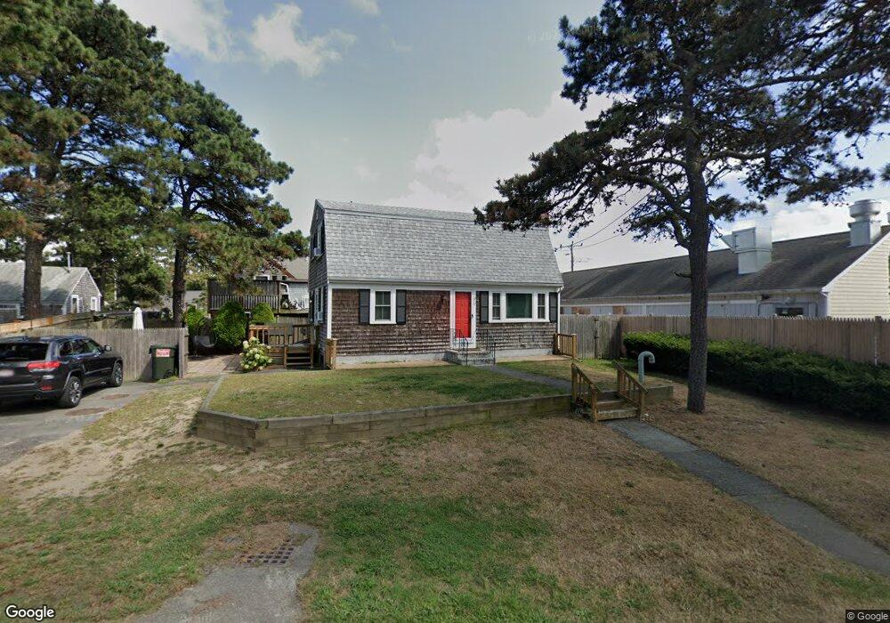
96 Captain Chase Rd Dennis Port, MA 02639
Dennis Port NeighborhoodEstimated Value: $550,000 - $668,000
3
Beds
2
Baths
1,287
Sq Ft
$486/Sq Ft
Est. Value
About This Home
This home is located at 96 Captain Chase Rd, Dennis Port, MA 02639 and is currently estimated at $625,229, approximately $485 per square foot. 96 Captain Chase Rd is a home located in Barnstable County with nearby schools including Dennis-Yarmouth Regional High School and St. Pius X. School.
Ownership History
Date
Name
Owned For
Owner Type
Purchase Details
Closed on
Jan 17, 2020
Sold by
Moran William R and Moran Nellie G
Bought by
House Krishana R
Current Estimated Value
Home Financials for this Owner
Home Financials are based on the most recent Mortgage that was taken out on this home.
Original Mortgage
$263,200
Outstanding Balance
$231,548
Interest Rate
3.6%
Mortgage Type
New Conventional
Estimated Equity
$393,681
Purchase Details
Closed on
May 23, 2013
Sold by
Moran Nellie G
Bought by
Moran William R and Moran Nellie G
Home Financials for this Owner
Home Financials are based on the most recent Mortgage that was taken out on this home.
Original Mortgage
$105,000
Interest Rate
3.45%
Mortgage Type
New Conventional
Purchase Details
Closed on
Mar 18, 2009
Sold by
Moran William R
Bought by
Moran Nellie G
Purchase Details
Closed on
Dec 19, 1995
Sold by
Wrobleski Maureen
Bought by
Moran William R
Create a Home Valuation Report for This Property
The Home Valuation Report is an in-depth analysis detailing your home's value as well as a comparison with similar homes in the area
Home Values in the Area
Average Home Value in this Area
Purchase History
| Date | Buyer | Sale Price | Title Company |
|---|---|---|---|
| House Krishana R | $329,000 | None Available | |
| House Krishana R | $329,000 | None Available | |
| Moran William R | -- | -- | |
| Moran William R | -- | -- | |
| Moran William R | -- | -- | |
| Moran Nellie G | -- | -- | |
| Moran Nellie G | -- | -- | |
| Moran William R | $84,000 | -- | |
| Moran William R | $84,000 | -- |
Source: Public Records
Mortgage History
| Date | Status | Borrower | Loan Amount |
|---|---|---|---|
| Open | House Krishana R | $263,200 | |
| Closed | House Krishana R | $263,200 | |
| Previous Owner | Moran William R | $105,000 |
Source: Public Records
Tax History Compared to Growth
Tax History
| Year | Tax Paid | Tax Assessment Tax Assessment Total Assessment is a certain percentage of the fair market value that is determined by local assessors to be the total taxable value of land and additions on the property. | Land | Improvement |
|---|---|---|---|---|
| 2025 | $2,162 | $499,300 | $190,100 | $309,200 |
| 2024 | $2,072 | $471,900 | $182,800 | $289,100 |
| 2023 | $1,872 | $400,900 | $166,200 | $234,700 |
| 2022 | $1,818 | $324,600 | $149,700 | $174,900 |
| 2021 | $1,891 | $313,600 | $167,700 | $145,900 |
| 2020 | $1,690 | $277,000 | $146,700 | $130,300 |
| 2019 | $1,672 | $271,000 | $143,900 | $127,100 |
| 2018 | $1,564 | $246,700 | $137,000 | $109,700 |
| 2017 | $1,457 | $236,900 | $127,200 | $109,700 |
| 2016 | $1,492 | $228,500 | $137,000 | $91,500 |
| 2015 | $1,462 | $228,500 | $137,000 | $91,500 |
| 2014 | $1,393 | $219,300 | $117,400 | $101,900 |
Source: Public Records
Map
Nearby Homes
- 31 Easy St
- 80 Michaels Ave
- 22 Wixon Rd
- 64 Beaten Rd
- 37 Ocean Dr Unit 2
- 19 Standish Way
- 37 Beach Hills Rd
- 262 Old Wharf Rd Unit 67
- 262 Old Wharf Rd Unit 5
- 262 Old Wharf Rd Unit 5
- 262 Old Wharf Rd Unit 20
- 262 Old Wharf Rd Unit 87
- 37-A Beach Hills Rd
- 154 Old Wharf Rd Unit 26
- 154 Old Wharf Rd Unit 14
- 22 Ferncliff Rd
- 217 Old Wharf Rd Unit 64
- 241 Old Wharf Rd Unit 82
- 241 Old Wharf Rd Unit 127
- 241 Old Wharf Rd Unit 90
- 168 Lower County Rd Unit 1
- 19 Uncle Ezras Path
- 17 Uncle Ezras Path
- 97 Captain Chase Rd
- 99 Captain Chase Rd
- 174 Lower County Rd
- 99 Captain Chase Rd
- 93 Captain Chase Rd
- 13 Uncle Ezras Path
- 91 Captain Chase Rd
- 5 Lorree Ln
- 101 Captain Chase Rd
- 16 Uncle Ezras Path
- 9 Uncle Ezras Path
- 87 Captain Chase Rd
- 0 Captain Chase Rd Unit 2008408
- 0 Captain Chase Rd Unit 2011643
- 0 Captain Chase Rd Unit 5011178
- 0 Captain Chase Rd Unit 23 5009259
- 0 Captain Chase Rd Unit 16 2016692