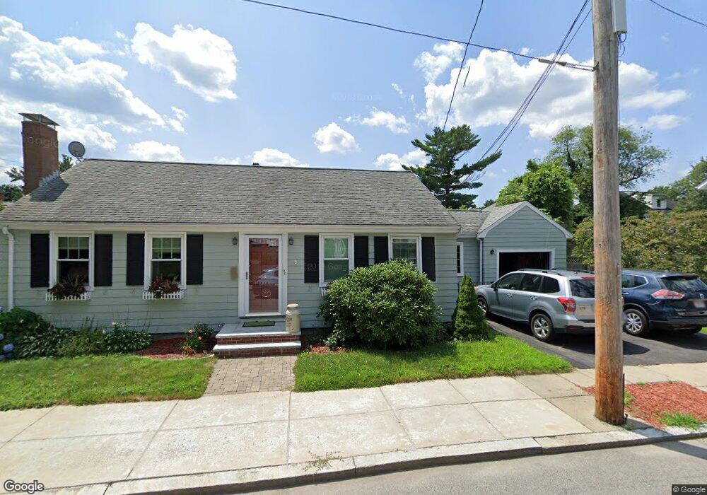
96 Chesbrough Rd West Roxbury, MA 02132
West Roxbury NeighborhoodEstimated Value: $884,000 - $1,064,646
4
Beds
3
Baths
1,865
Sq Ft
$525/Sq Ft
Est. Value
About This Home
This home is located at 96 Chesbrough Rd, West Roxbury, MA 02132 and is currently estimated at $979,412, approximately $525 per square foot. 96 Chesbrough Rd is a home located in Suffolk County with nearby schools including St Theresa School, Catholic Memorial School, and The Roxbury Latin School.
Ownership History
Date
Name
Owned For
Owner Type
Purchase Details
Closed on
Sep 22, 2020
Sold by
Nee Joanne M
Bought by
Nee Robert M and Nee Joanne M
Current Estimated Value
Home Financials for this Owner
Home Financials are based on the most recent Mortgage that was taken out on this home.
Original Mortgage
$570,000
Outstanding Balance
$504,687
Interest Rate
2.9%
Mortgage Type
New Conventional
Estimated Equity
$474,725
Purchase Details
Closed on
Mar 16, 2010
Sold by
Flynn Michael A and Flynn-Mcnamara Carol
Bought by
Dalton Joanne
Home Financials for this Owner
Home Financials are based on the most recent Mortgage that was taken out on this home.
Original Mortgage
$289,350
Interest Rate
5.02%
Mortgage Type
Purchase Money Mortgage
Create a Home Valuation Report for This Property
The Home Valuation Report is an in-depth analysis detailing your home's value as well as a comparison with similar homes in the area
Home Values in the Area
Average Home Value in this Area
Purchase History
| Date | Buyer | Sale Price | Title Company |
|---|---|---|---|
| Nee Robert M | -- | None Available | |
| Dalton Joanne | $321,500 | -- | |
| Dalton Joanne | $321,500 | -- |
Source: Public Records
Mortgage History
| Date | Status | Borrower | Loan Amount |
|---|---|---|---|
| Open | Nee Robert M | $570,000 | |
| Previous Owner | Dalton Joanne | $289,350 | |
| Previous Owner | Dalton Joanne | $100,000 |
Source: Public Records
Tax History Compared to Growth
Tax History
| Year | Tax Paid | Tax Assessment Tax Assessment Total Assessment is a certain percentage of the fair market value that is determined by local assessors to be the total taxable value of land and additions on the property. | Land | Improvement |
|---|---|---|---|---|
| 2025 | $11,218 | $968,700 | $189,300 | $779,400 |
| 2024 | $10,937 | $1,003,400 | $201,300 | $802,100 |
| 2023 | $10,264 | $955,700 | $191,700 | $764,000 |
| 2022 | $6,563 | $603,200 | $122,000 | $481,200 |
| 2021 | $4,828 | $452,500 | $170,900 | $281,600 |
| 2020 | $4,107 | $388,900 | $154,700 | $234,200 |
| 2019 | $3,903 | $370,300 | $129,800 | $240,500 |
| 2018 | $3,594 | $342,900 | $129,800 | $213,100 |
| 2017 | $3,559 | $336,100 | $129,800 | $206,300 |
| 2016 | $3,589 | $326,300 | $129,800 | $196,500 |
| 2015 | $3,810 | $314,600 | $147,600 | $167,000 |
| 2014 | $3,734 | $296,800 | $147,600 | $149,200 |
Source: Public Records
Map
Nearby Homes
- 105 Chesbrough Rd
- 28 Dow Rd
- 59 Chesbrough Rd
- 340 Baker St Unit 1
- 183 Temple St
- 331 Vermont St
- 1216 Vfw Pkwy Unit 40
- 1214 Vfw Pkwy Unit 30
- 1214 Vfw Pkwy Unit 37
- 9 Carroll St
- 14 Sanborn Ave
- 73 Dent St Unit 1
- 539 Lagrange St
- 577 Baker St Unit 577
- 76 Potomac St
- 7 Cass St Unit 6
- 27-29 Temple St
- 76 Vermont St
- 425 Lagrange St Unit 203
- 89 Dwinell St
- 10 Rumford Rd
- 100 Chesbrough Rd
- 377 Baker St
- 99 Chesbrough Rd
- 99 Chesbrough Rd Unit 99
- 97 Chesbrough Rd Unit 99
- 97 Chesbrough Rd Unit 2
- 379 Baker St
- 93 Chesbrough Rd
- 375 Baker St
- 19 Rumford Rd
- 15 Rumford Rd
- 104 Chesbrough Rd
- 11 Rumford Rd
- 89 Chesbrough Rd
- 87 Chesbrough Rd
- 107 Chesbrough Rd
- 367 Baker St
- 367 Baker St Unit 1
- 88 Chesbrough Rd