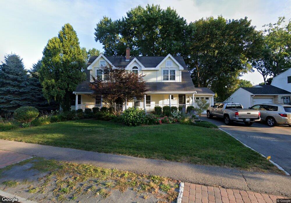
96 Common St Braintree, MA 02184
North Braintree NeighborhoodEstimated Value: $706,507 - $904,000
4
Beds
2
Baths
2,477
Sq Ft
$320/Sq Ft
Est. Value
About This Home
This home is located at 96 Common St, Braintree, MA 02184 and is currently estimated at $793,127, approximately $320 per square foot. 96 Common St is a home located in Norfolk County with nearby schools including Braintree High School, Step Ahead Kindergarten, and Meeting House Montessori School.
Create a Home Valuation Report for This Property
The Home Valuation Report is an in-depth analysis detailing your home's value as well as a comparison with similar homes in the area
Home Values in the Area
Average Home Value in this Area
Tax History
| Year | Tax Paid | Tax Assessment Tax Assessment Total Assessment is a certain percentage of the fair market value that is determined by local assessors to be the total taxable value of land and additions on the property. | Land | Improvement |
|---|---|---|---|---|
| 2025 | $5,709 | $572,000 | $261,700 | $310,300 |
| 2024 | $5,170 | $545,400 | $248,400 | $297,000 |
| 2023 | $4,908 | $502,900 | $221,800 | $281,100 |
| 2022 | $4,915 | $494,000 | $212,900 | $281,100 |
| 2021 | $4,492 | $451,500 | $186,300 | $265,200 |
| 2020 | $4,452 | $451,500 | $186,300 | $265,200 |
| 2019 | $4,178 | $414,100 | $177,400 | $236,700 |
| 2018 | $4,078 | $386,900 | $159,700 | $227,200 |
| 2017 | $3,862 | $359,600 | $142,000 | $217,600 |
| 2016 | $3,711 | $338,000 | $133,100 | $204,900 |
| 2015 | $3,594 | $324,700 | $127,800 | $196,900 |
| 2014 | $3,402 | $297,900 | $115,300 | $182,600 |
Source: Public Records
Map
Nearby Homes
- 63 Dickerman Ln
- 29 Joseph Rd
- 9 Independence Ave Unit 307
- 87 Walnut St
- 17 White Rd
- 20 Vine St
- 99 Verchild St
- 469-471 Washington St
- 192 Federal Ave Unit B
- 491 Washington St Unit 1
- 342 Elm St
- 21 Totman St Unit 205
- 21 Totman St Unit 404
- 21 Totman St Unit 309
- 21 Totman St Unit 409
- 21 Totman St Unit 203
- 21 Totman St Unit 301
- 21 Totman St Unit PH-405
- 21 Totman St Unit PH-401
- 21 Totman St Unit 407
Your Personal Tour Guide
Ask me questions while you tour the home.