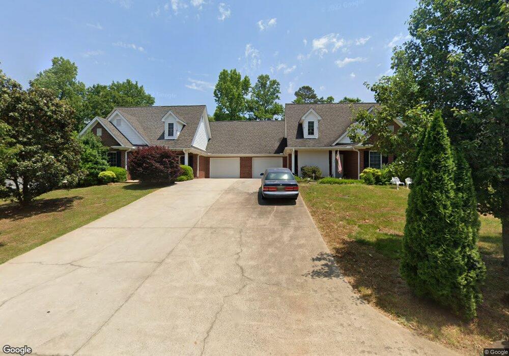
96 Fern Point Dr Toccoa, GA 30577
Estimated Value: $239,279 - $294,000
3
Beds
2
Baths
1,596
Sq Ft
$167/Sq Ft
Est. Value
About This Home
This home is located at 96 Fern Point Dr, Toccoa, GA 30577 and is currently estimated at $267,320, approximately $167 per square foot. 96 Fern Point Dr is a home located in Stephens County with nearby schools including Stephens County High School.
Ownership History
Date
Name
Owned For
Owner Type
Purchase Details
Closed on
Feb 13, 2008
Sold by
Caudell Inc
Bought by
Roberts Stanley W and Roberts Elizabeth
Current Estimated Value
Purchase Details
Closed on
Jan 11, 2008
Sold by
Not Provided
Bought by
Thompson John C
Purchase Details
Closed on
Jun 2, 2006
Sold by
Kiser Tomi Jean Hill
Bought by
Thompson John C and Thompson Sager Patricia G
Create a Home Valuation Report for This Property
The Home Valuation Report is an in-depth analysis detailing your home's value as well as a comparison with similar homes in the area
Home Values in the Area
Average Home Value in this Area
Purchase History
| Date | Buyer | Sale Price | Title Company |
|---|---|---|---|
| Roberts Stanley W | $12,500 | -- | |
| Caudell Inc | -- | -- | |
| Thompson John C | -- | -- | |
| Thompson John C | -- | -- | |
| Thompson John C | $145,000 | -- |
Source: Public Records
Tax History Compared to Growth
Tax History
| Year | Tax Paid | Tax Assessment Tax Assessment Total Assessment is a certain percentage of the fair market value that is determined by local assessors to be the total taxable value of land and additions on the property. | Land | Improvement |
|---|---|---|---|---|
| 2024 | $773 | $60,455 | $2,333 | $58,122 |
| 2023 | $631 | $56,073 | $2,333 | $53,740 |
| 2022 | $75 | $37,400 | $555 | $36,845 |
| 2021 | $79 | $37,400 | $555 | $36,845 |
| 2020 | $79 | $37,400 | $555 | $36,845 |
| 2019 | $80 | $37,400 | $555 | $36,845 |
| 2018 | $80 | $37,400 | $555 | $36,845 |
| 2017 | $82 | $56,695 | $920 | $55,775 |
| 2016 | $698 | $56,695 | $920 | $55,775 |
| 2015 | $722 | $56,400 | $920 | $55,480 |
| 2014 | $733 | $56,400 | $920 | $55,480 |
| 2013 | -- | $56,400 | $920 | $55,480 |
Source: Public Records
Map
Nearby Homes
- 297 Ayers Creek Dr
- 327 Ayers Creek Dr
- 405 Ayers Creek Dr
- 110 Valley Rd
- 490 Addington Dr
- 0 Brookhaven Cir Unit 10616964
- 151 Rock Creek Rd
- 0 E Currahee St Unit 10544607
- 148 Moreland Dr
- 139 Myrtle St
- 0 Moreland Dr Unit 10565201
- 249 Hillcrest Dr
- 3013 Hwy 17 A
- 0 Hwy 17 Alt Unit 10577119
- 229 Hilltop Ln
- 1222 E Tugalo St
- 45 Hayes St
- 253 Stancil Dr
- 3089 Georgia 17 Alternate
- 278 Stancil Dr
- 98 Fern Point
- 54 Fern Point Dr
- 0 Fern Point Dr
- 1466 Fernside Dr
- 1440 Fernside Dr
- 1502 Fernside Dr
- 1 Fernpoint Dr Unit TRACT 1
- 1422 Fernside Dr
- 1534 Fernside Dr
- 1541 Fernside Dr
- 72 Maka Way
- 1568 Fernside Dr
- 105 Lucille Ln
- 61 Boulder Dr
- 48 Maka Way
- 66 Boulder Dr
- 102 Lucille Ln
- 1610 Fernside Dr
- 18 Maka Way
- 157 E Rountree Rd