Estimated Value: $272,506 - $299,000
3
Beds
2
Baths
1,417
Sq Ft
$201/Sq Ft
Est. Value
About This Home
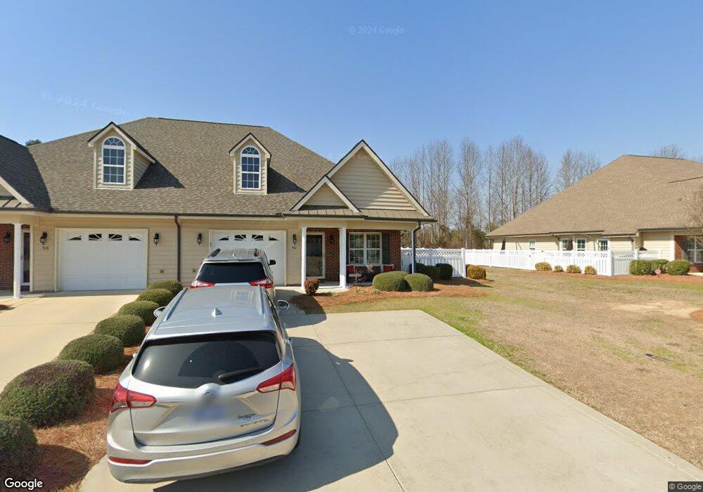
This home is located at 96 Glenfield Dr, Dunn, NC 28334 and is currently estimated at $285,377, approximately $201 per square foot. 96 Glenfield Dr is a home located in Harnett County with nearby schools including Dunn Elementary School, Dunn Middle School, and Triton High School.
Ownership History
Date
Name
Owned For
Owner Type
Purchase Details
Closed on
Nov 4, 2022
Sold by
Spencer Travis R and Spencer Jan P
Bought by
Lewis Perry Austin and Lewis Pamela Hadnott
Current Estimated Value
Purchase Details
Closed on
Oct 27, 2022
Sold by
Wellons Realty Inc
Bought by
Spencer Travis R and Spencer Jan P
Purchase Details
Closed on
May 10, 2013
Sold by
Wellons Realty Inc
Bought by
Spencer Travis R and Spencer Jan P
Home Financials for this Owner
Home Financials are based on the most recent Mortgage that was taken out on this home.
Original Mortgage
$159,976
Interest Rate
3.5%
Mortgage Type
FHA
Create a Home Valuation Report for This Property
The Home Valuation Report is an in-depth analysis detailing your home's value as well as a comparison with similar homes in the area
Home Values in the Area
Average Home Value in this Area
Purchase History
| Date | Buyer | Sale Price | Title Company |
|---|---|---|---|
| Lewis Perry Austin | $226,000 | -- | |
| Spencer Travis R | -- | -- | |
| Spencer Travis R | $165,000 | None Available |
Source: Public Records
Mortgage History
| Date | Status | Borrower | Loan Amount |
|---|---|---|---|
| Previous Owner | Spencer Travis R | $159,976 |
Source: Public Records
Tax History
| Year | Tax Paid | Tax Assessment Tax Assessment Total Assessment is a certain percentage of the fair market value that is determined by local assessors to be the total taxable value of land and additions on the property. | Land | Improvement |
|---|---|---|---|---|
| 2025 | $2,059 | $196,823 | $0 | $0 |
| 2024 | $2,449 | $196,823 | $0 | $0 |
| 2023 | $2,491 | $196,823 | $0 | $0 |
| 2022 | $2,237 | $196,823 | $0 | $0 |
| 2021 | $2,237 | $158,260 | $0 | $0 |
| 2020 | $2,237 | $158,260 | $0 | $0 |
| 2019 | $2,191 | $158,260 | $0 | $0 |
| 2018 | $2,222 | $158,260 | $0 | $0 |
| 2017 | $2,222 | $158,260 | $0 | $0 |
| 2016 | $2,186 | $155,560 | $0 | $0 |
| 2015 | $2,155 | $155,560 | $0 | $0 |
| 2014 | $2,155 | $155,560 | $0 | $0 |
Source: Public Records
Map
Nearby Homes
- 128 Crescent Dr
- 219 Crescent Dr
- 100 Martin St
- 396 Riley Vann Ln
- 311 Marlowe Dr
- 1116 Friendly Rd
- 1208 Red Hill Church Rd
- 1108 Friendly Rd
- 0 W Cumberland St Unit 10097343
- 0 Red Hill Church Rd Unit 10142273
- 130 Jenkins St
- 122 Jenkins St
- 118 Landon Ln
- 103 Byrd Dr
- 105 Cedarbranch Way Unit 183p
- 213 Maye St
- 113 Joy St
- 1492 Erwin Rd
- 51 Stout Landing
- 48 Stout Landing
- 98 Glenfield Dr
- 94 Glenfield Dr
- 99 Glenfield Dr
- 100 Glenfield Dr
- 92 Glenfield Dr
- 89 Glenfield Dr
- 102 Glenfield Dr
- 79 Glenfield Dr
- 88 Glenfield Dr
- 111 Glenfield Dr
- 113 Glenfield Dr
- 104 Glenfield Dr
- 104 Glenfield Dr Unit 104
- 84 Glenfield Dr
- 77 Glenfield Dr
- 106 Glenfield Dr
- 115 Glenfield Dr
- 57 Glenfield Dr
- 78 Glenfield Dr
- 117 Glenfield Dr
Your Personal Tour Guide
Ask me questions while you tour the home.